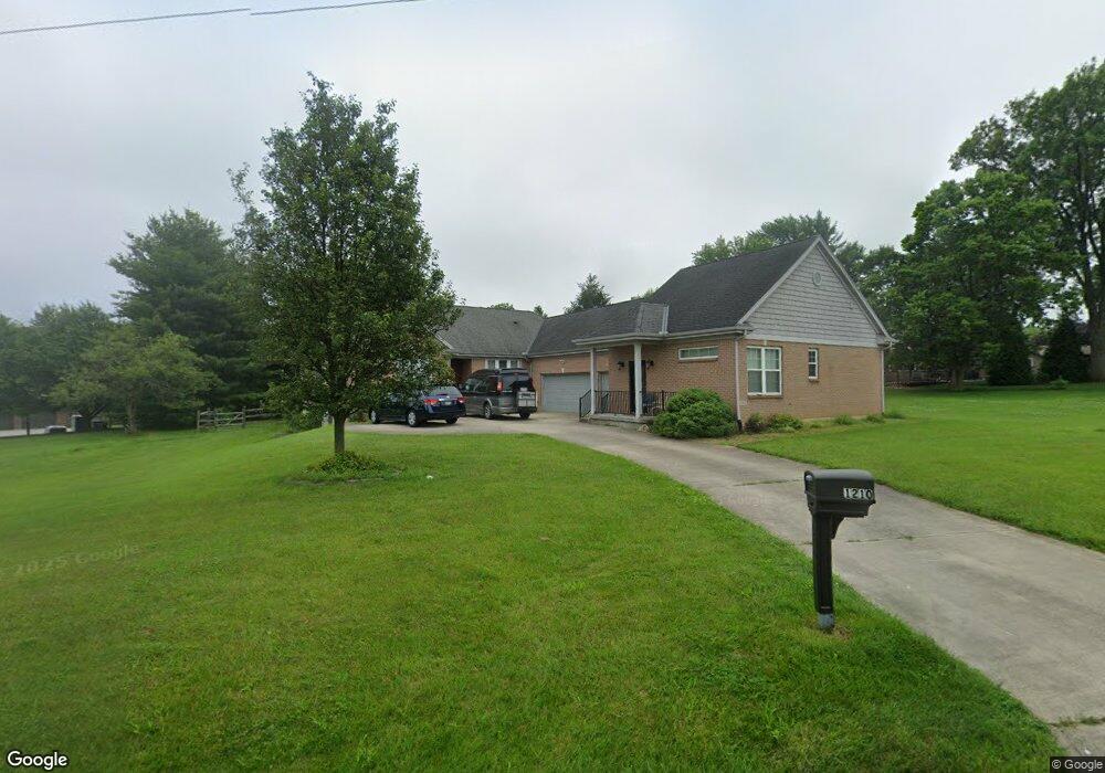
1210 Fuhrman Rd Cincinnati, OH 45215
Estimated Value: $444,000 - $588,000
3
Beds
2
Baths
2,726
Sq Ft
$194/Sq Ft
Est. Value
About This Home
This home is located at 1210 Fuhrman Rd, Cincinnati, OH 45215 and is currently estimated at $529,390, approximately $194 per square foot. 1210 Fuhrman Rd is a home located in Hamilton County with nearby schools including Reading Community High School, Saints Peter and Paul Academy, and Linden Grove School.
Ownership History
Date
Name
Owned For
Owner Type
Purchase Details
Closed on
Jun 23, 2021
Sold by
Menard Jeffrey R
Bought by
Menard Jeffrey R and Menard Graynelle E
Current Estimated Value
Purchase Details
Closed on
Apr 1, 2005
Sold by
Blust James R and Blust Annette
Bought by
Menard Jeffrey R
Purchase Details
Closed on
Mar 14, 2003
Sold by
M & N Properties Ltd
Bought by
Blust James R
Create a Home Valuation Report for This Property
The Home Valuation Report is an in-depth analysis detailing your home's value as well as a comparison with similar homes in the area
Home Values in the Area
Average Home Value in this Area
Purchase History
| Date | Buyer | Sale Price | Title Company |
|---|---|---|---|
| Menard Jeffrey R | -- | None Available | |
| Menard Jeffrey R | -- | None Available | |
| Blust James R | $63,000 | -- |
Source: Public Records
Tax History Compared to Growth
Tax History
| Year | Tax Paid | Tax Assessment Tax Assessment Total Assessment is a certain percentage of the fair market value that is determined by local assessors to be the total taxable value of land and additions on the property. | Land | Improvement |
|---|---|---|---|---|
| 2024 | $8,309 | $160,532 | $14,858 | $145,674 |
| 2023 | $8,434 | $160,532 | $14,858 | $145,674 |
| 2022 | $7,914 | $116,722 | $10,087 | $106,635 |
| 2021 | $6,605 | $116,722 | $10,087 | $106,635 |
| 2020 | $6,678 | $116,722 | $10,087 | $106,635 |
| 2019 | $6,472 | $103,292 | $8,925 | $94,367 |
| 2018 | $6,478 | $103,292 | $8,925 | $94,367 |
| 2017 | $6,105 | $103,292 | $8,925 | $94,367 |
| 2016 | $6,354 | $107,829 | $8,747 | $99,082 |
| 2015 | $6,410 | $107,829 | $8,747 | $99,082 |
| 2014 | $4,901 | $94,235 | $8,747 | $85,488 |
| 2013 | $4,968 | $96,156 | $8,925 | $87,231 |
Source: Public Records
Map
Nearby Homes
- 1194 Fuhrman Rd
- 1246 Thurnridge Dr
- 2451 Hunt Rd
- 2413 Carol Dr
- 1626 Krylon Dr
- 796 Kenray Ct
- 2598 Maple Tree Ct
- 2590 Hunt Rd
- 2127 Longmeadow Ln
- 1684 Sanborn Dr
- 2626 Hunt Rd
- 636 Maple Dr
- 234 Mcguire Ln
- 113 Waxwing Dr
- L Apple Ridge Ln
- 69 Orchard Knoll Dr
- 8907 Eldora Dr
- 3733 Lyndon Center Ct
- 2558 Apple Ridge Ln
- 3843 Blackwood Ct
- 1207 Fuhrman Rd
- 1188 Fuhrman Rd
- 1295 Georgia Ln
- 1191 Becky Ct
- 1187 Becky Ct
- 1218 Fuhrman Rd
- 1215 Fuhrman Rd
- 1195 Becky Ct
- 1184 Fuhrman Rd
- 1223 Fuhrman Rd
- 1183 Becky Ct
- 1199 Fuhrman Rd
- 1199 Becky Ct
- 1289 Alwil Dr
- 1235 Fuhrman Rd
- 1195 Fuhrman Rd
- 1180 Fuhrman Rd
- 1287 Alwil Dr
- 1179 Becky Ct
- 1191 Fuhrman Rd