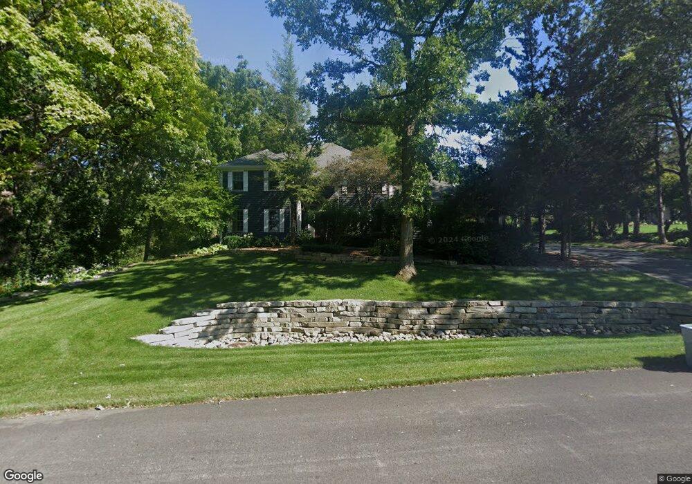
1210 Macintosh Dr Wauconda, IL 60084
Estimated Value: $531,000 - $649,000
4
Beds
3
Baths
3,159
Sq Ft
$185/Sq Ft
Est. Value
About This Home
This home is located at 1210 Macintosh Dr, Wauconda, IL 60084 and is currently estimated at $585,860, approximately $185 per square foot. 1210 Macintosh Dr is a home located in Lake County with nearby schools including Fremont Elementary School, Fremont Intermediate School, and Fremont Jr High/Middle School.
Ownership History
Date
Name
Owned For
Owner Type
Purchase Details
Closed on
Jul 29, 1994
Sold by
Brucato David M and Brucato Cathleen D
Bought by
Mikrut Jerome W and Mikrut Judith A
Current Estimated Value
Home Financials for this Owner
Home Financials are based on the most recent Mortgage that was taken out on this home.
Original Mortgage
$215,000
Interest Rate
8.62%
Create a Home Valuation Report for This Property
The Home Valuation Report is an in-depth analysis detailing your home's value as well as a comparison with similar homes in the area
Home Values in the Area
Average Home Value in this Area
Purchase History
| Date | Buyer | Sale Price | Title Company |
|---|---|---|---|
| Mikrut Jerome W | $325,000 | Chicago Title Insurance Co |
Source: Public Records
Mortgage History
| Date | Status | Borrower | Loan Amount |
|---|---|---|---|
| Closed | Mikrut Jerome W | $215,000 |
Source: Public Records
Tax History
| Year | Tax Paid | Tax Assessment Tax Assessment Total Assessment is a certain percentage of the fair market value that is determined by local assessors to be the total taxable value of land and additions on the property. | Land | Improvement |
|---|---|---|---|---|
| 2024 | $15,533 | $189,920 | $20,704 | $169,216 |
| 2023 | $15,234 | $174,015 | $18,970 | $155,045 |
| 2022 | $15,234 | $166,264 | $20,828 | $145,436 |
| 2021 | $14,605 | $160,440 | $20,098 | $140,342 |
| 2020 | $14,641 | $156,025 | $19,545 | $136,480 |
| 2019 | $14,219 | $150,894 | $18,902 | $131,992 |
| 2018 | $12,552 | $137,323 | $31,562 | $105,761 |
| 2017 | $12,395 | $133,001 | $30,569 | $102,432 |
| 2016 | $11,940 | $126,319 | $29,033 | $97,286 |
| 2015 | $11,493 | $118,421 | $27,218 | $91,203 |
| 2014 | $11,055 | $114,006 | $26,297 | $87,709 |
| 2012 | $11,416 | $115,018 | $26,530 | $88,488 |
Source: Public Records
Map
Nearby Homes
- 1260 Water Stone Cir
- 1017 Grand Blvd
- 905 Grand Blvd
- 1114 Jackson Ave
- 818 Sheridan Dr
- 0 Bonner Rd
- 28722 N Madison Ave
- 701 Lake Shore Dr
- 505 Woodland Ave
- 28855 N Garland Rd
- 29564 N Garland Rd
- 417 Lake Shore Blvd
- 428 Country Lane Ct Unit 301
- 2175 Gossell Rd
- 2190 Braeburn Dr Unit B
- 902 Highland Ave
- 235 Crestview Dr Unit A
- 304 Hill St Unit 1004
- 365 Lake Ave Unit C
- 229 Brett Cir Unit B
- 1208 Jonathon Ct
- 1201 E Bonner Rd
- 1211 Macintosh Dr
- 1206 Jonathon Ct
- 1215 E Bonner Rd
- 1209 Macintosh Dr
- 1203 E Bonner Rd
- 1205 E Bonner Rd
- 1204 Jonathon Ct
- 1221 Cortland Ln
- 1202 Jonathon Ct
- 1219 Cortland Ln
- 1223 Cortland Ln
- 1217 Cortland Ln
- 1215 Cortland Ln
- 1225 Cortland Ln
- 1207 Macintosh Dr
- 1200 Macintosh Dr
- 1213 Cortland Ln
- 1222 Cortland Ln
Your Personal Tour Guide
Ask me questions while you tour the home.