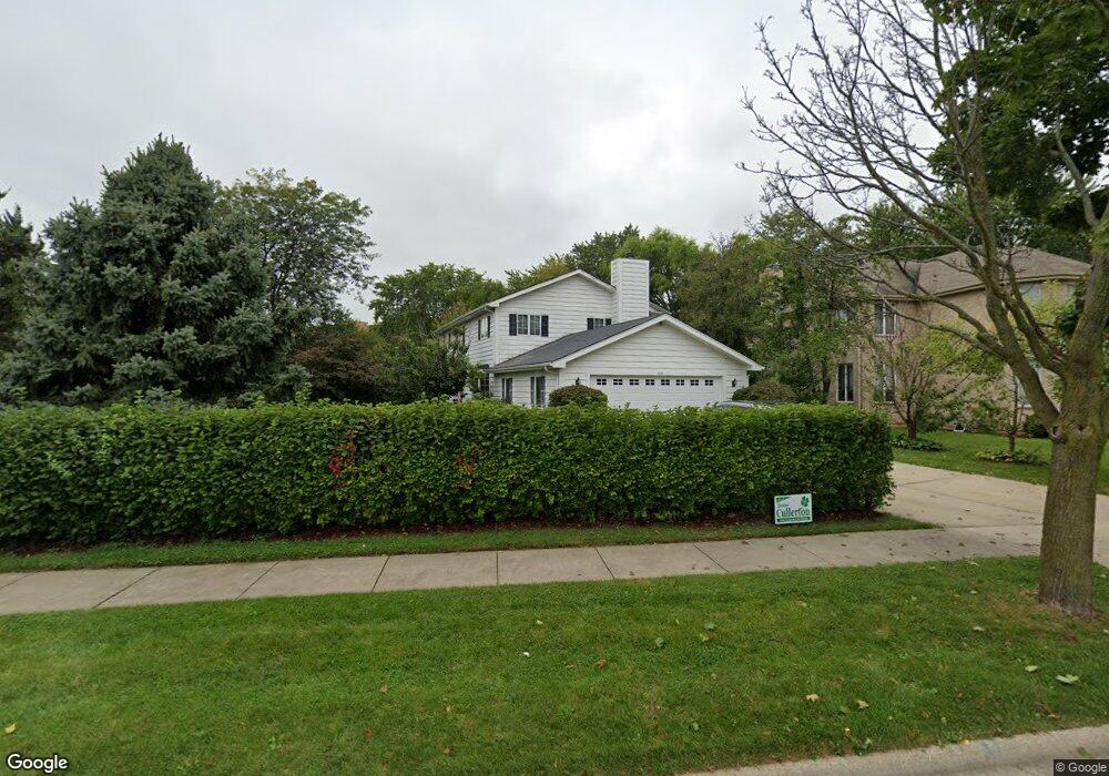
1210 N Aspen Way Addison, IL 60101
Estimated Value: $527,390 - $604,000
--
Bed
1
Bath
2,566
Sq Ft
$221/Sq Ft
Est. Value
About This Home
This home is located at 1210 N Aspen Way, Addison, IL 60101 and is currently estimated at $567,348, approximately $221 per square foot. 1210 N Aspen Way is a home located in DuPage County with nearby schools including Stone Elementary School, Indian Trail Jr High School, and Addison Trail High School.
Ownership History
Date
Name
Owned For
Owner Type
Purchase Details
Closed on
Aug 19, 2003
Sold by
Harris Trust & Savings Bank
Bought by
Lyons Robert P and Lyons Mary Ann C
Current Estimated Value
Home Financials for this Owner
Home Financials are based on the most recent Mortgage that was taken out on this home.
Original Mortgage
$70,000
Interest Rate
6.44%
Mortgage Type
Purchase Money Mortgage
Create a Home Valuation Report for This Property
The Home Valuation Report is an in-depth analysis detailing your home's value as well as a comparison with similar homes in the area
Home Values in the Area
Average Home Value in this Area
Purchase History
| Date | Buyer | Sale Price | Title Company |
|---|---|---|---|
| Lyons Robert P | -- | Atg |
Source: Public Records
Mortgage History
| Date | Status | Borrower | Loan Amount |
|---|---|---|---|
| Closed | Lyons Robert P | $70,000 |
Source: Public Records
Tax History Compared to Growth
Tax History
| Year | Tax Paid | Tax Assessment Tax Assessment Total Assessment is a certain percentage of the fair market value that is determined by local assessors to be the total taxable value of land and additions on the property. | Land | Improvement |
|---|---|---|---|---|
| 2024 | $11,201 | $174,919 | $61,559 | $113,360 |
| 2023 | $10,659 | $160,800 | $56,590 | $104,210 |
| 2022 | $10,974 | $160,000 | $56,310 | $103,690 |
| 2021 | $10,507 | $153,260 | $53,940 | $99,320 |
| 2020 | $10,214 | $146,800 | $51,670 | $95,130 |
| 2019 | $10,135 | $141,150 | $49,680 | $91,470 |
| 2018 | $10,802 | $139,060 | $49,680 | $89,380 |
| 2017 | $10,533 | $132,900 | $47,480 | $85,420 |
| 2016 | $10,272 | $122,710 | $43,840 | $78,870 |
| 2015 | $10,036 | $113,360 | $40,500 | $72,860 |
| 2014 | $10,091 | $113,250 | $40,750 | $72,500 |
| 2013 | $9,880 | $115,560 | $41,580 | $73,980 |
Source: Public Records
Map
Nearby Homes
- 1210 N Foxdale Dr Unit 109
- 1660 W Prescott Place
- 1202 W Surrey Rd
- 1520 W Grove St
- 1275 W Lake St Unit 104
- 5N210 Central Rd
- 1065 N Jamey Ln
- 943 N Rohlwing Rd Unit 101H
- 953 N Rohlwing Rd Unit GB
- 1527 W Holtz Ave
- 4N327 7th Ave
- 1 Itasca Place Unit 107
- 1 Itasca Place Unit 108
- 5N260 Eagle Terrace
- 580 N Highlander Way
- 823 N Harrow Ct
- 19W720 Woodland Ave
- 818 N Rumple Ln
- 1155 W Westwood Trail
- 1750 W Woodland Ave
- 1212 N Aspen Way
- 1207 N Foxdale Dr
- 1213 N Foxdale Dr
- 1337 W Sable Dr
- 1201 N Foxdale Dr
- 1211 N Aspen Way
- 1218 N Aspen Way
- 1213 N Aspen Way
- 1332 W Sable Dr
- 1219 N Foxdale Dr
- 1333 W Sable Dr
- 1219 N Aspen Way
- 1224 N Aspen Way
- 1208 N Ashley Ln
- 1225 N Foxdale Dr
- 1331 W Sable Dr
- 1225 N Aspen Way
- 1330 W Sable Dr
- 1231 N Foxdale Dr
- 1200 N Foxdale Dr Unit 300