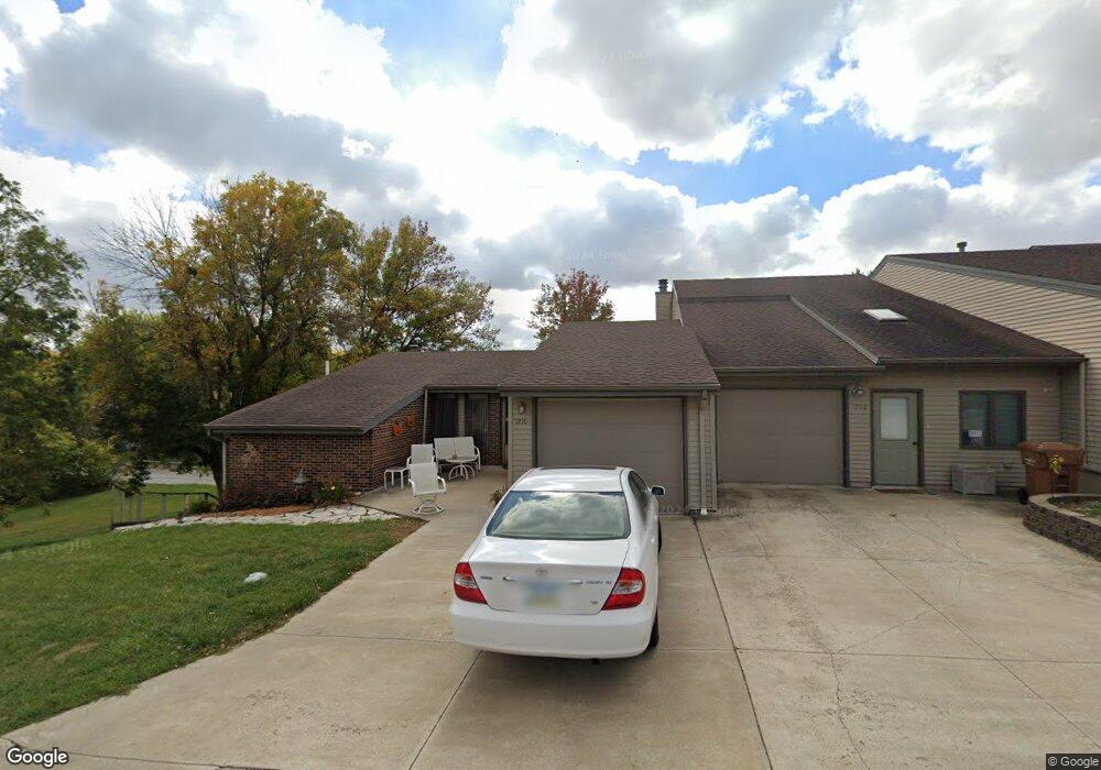
1210 N Clark St Carroll, IA 51401
Estimated Value: $140,000 - $173,000
2
Beds
3
Baths
1,200
Sq Ft
$129/Sq Ft
Est. Value
About This Home
This home is located at 1210 N Clark St, Carroll, IA 51401 and is currently estimated at $154,723, approximately $128 per square foot. 1210 N Clark St is a home with nearby schools including Fairview Elementary School, Adams Elementary School, and Carroll Middle School.
Ownership History
Date
Name
Owned For
Owner Type
Purchase Details
Closed on
Jun 24, 2022
Sold by
Debower Land Trust
Bought by
Schmitz Robert J and Schmitz Linda L
Current Estimated Value
Home Financials for this Owner
Home Financials are based on the most recent Mortgage that was taken out on this home.
Original Mortgage
$93,500
Outstanding Balance
$87,089
Interest Rate
5.3%
Mortgage Type
Construction
Estimated Equity
$67,634
Purchase Details
Closed on
Aug 21, 2012
Sold by
Debower Dona M
Bought by
Debower Dona M and Debower Land Trust
Create a Home Valuation Report for This Property
The Home Valuation Report is an in-depth analysis detailing your home's value as well as a comparison with similar homes in the area
Home Values in the Area
Average Home Value in this Area
Purchase History
| Date | Buyer | Sale Price | Title Company |
|---|---|---|---|
| Schmitz Robert J | $110,000 | None Listed On Document | |
| Debower Dona M | -- | None Available |
Source: Public Records
Mortgage History
| Date | Status | Borrower | Loan Amount |
|---|---|---|---|
| Open | Schmitz Robert J | $93,500 |
Source: Public Records
Tax History Compared to Growth
Tax History
| Year | Tax Paid | Tax Assessment Tax Assessment Total Assessment is a certain percentage of the fair market value that is determined by local assessors to be the total taxable value of land and additions on the property. | Land | Improvement |
|---|---|---|---|---|
| 2025 | $1,902 | $169,160 | $10,190 | $158,970 |
| 2024 | $1,902 | $147,900 | $10,190 | $137,710 |
| 2023 | $2,079 | $147,900 | $10,190 | $137,710 |
| 2022 | $1,840 | $135,940 | $8,500 | $127,440 |
| 2021 | $1,840 | $135,940 | $8,500 | $127,440 |
| 2020 | $1,890 | $135,940 | $8,500 | $127,440 |
| 2019 | $1,864 | $135,940 | $8,500 | $127,440 |
| 2018 | $1,752 | $135,940 | $8,500 | $127,440 |
| 2017 | $1,752 | $131,022 | $5,008 | $126,014 |
| 2016 | $1,628 | $122,450 | $0 | $0 |
| 2015 | $1,628 | $126,430 | $0 | $0 |
| 2014 | $1,666 | $126,430 | $0 | $0 |
Source: Public Records
Map
Nearby Homes
- 1026 N Clark St
- 1108 N Main St
- 1102 N Main St
- 926 N Court St
- 1217 N Main St
- 621 Alta Vista Dr
- 260 Bass St
- 222 Bass St
- 804 N Clark St
- 1015 N Adams St
- 204 W 11th St
- 807 N Court St
- 638 Capistrano Ave
- 1408 N Adams St
- 226 W 13th St
- 1601 Pike Ave
- 1102 Skyline Dr
- 1022 Skyline Dr
- 1137 High Ridge Rd
- 1068 Amy Ave
- 1206 N Clark St
- 1208 N Clark St
- 1204 N Clark St
- 310 E 12th St
- 320 E 12th St
- 1128 N Clark St
- 1205 N Clark St Unit 3C
- 1207 N Clark St
- 1209 N Clark St Unit 3E
- 1219 N Clark St
- 1122 N Clark St
- 1223 N Clark St
- 1205 N Grant Rd
- 1151 N Grant Rd
- 1215 N Grant Rd
- 1225 N Clark St
- 1127 N Clark St
- 1227 N Clark St
- 1225 N Grant Rd
- 1143 N Grant Rd