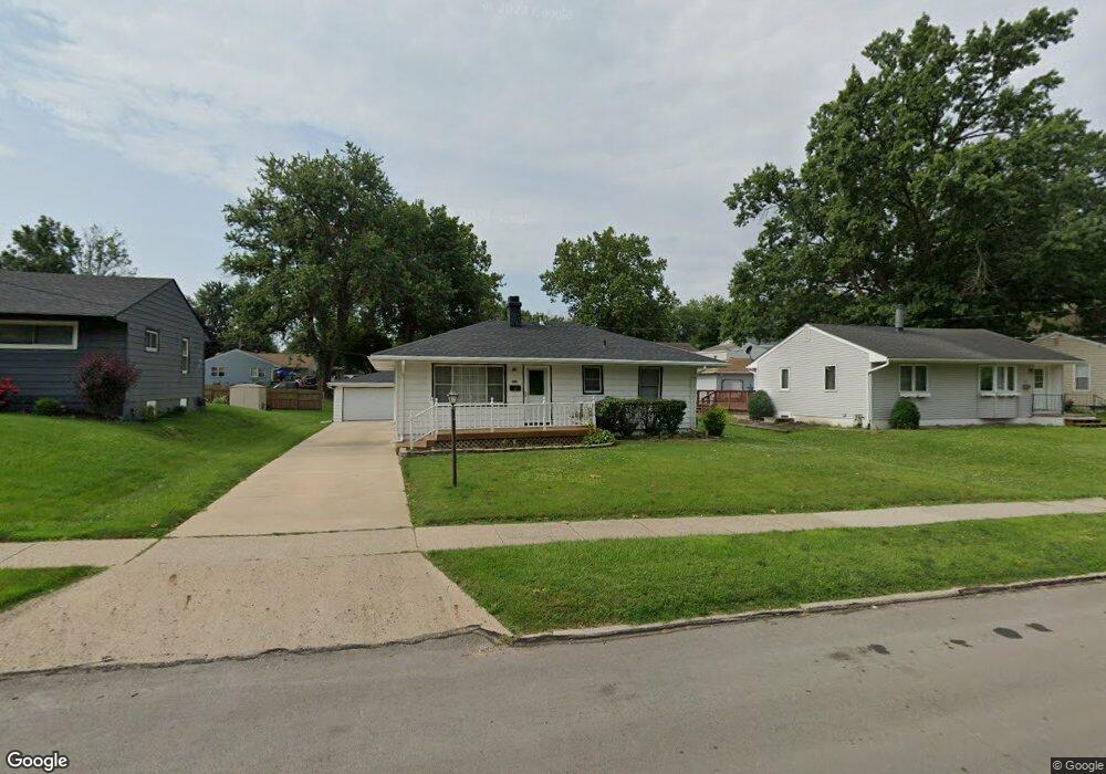
1210 Porter Ave Des Moines, IA 50315
Watrous South NeighborhoodEstimated Value: $185,000 - $205,000
3
Beds
1
Bath
864
Sq Ft
$229/Sq Ft
Est. Value
About This Home
This home is located at 1210 Porter Ave, Des Moines, IA 50315 and is currently estimated at $197,843, approximately $228 per square foot. 1210 Porter Ave is a home located in Polk County with nearby schools including Wright Elementary School, Brody Middle School, and Lincoln High School.
Ownership History
Date
Name
Owned For
Owner Type
Purchase Details
Closed on
Sep 15, 1999
Sold by
Taylor George E and Taylor Frances B
Bought by
Brandsfield Todd A
Current Estimated Value
Home Financials for this Owner
Home Financials are based on the most recent Mortgage that was taken out on this home.
Original Mortgage
$78,800
Outstanding Balance
$23,559
Interest Rate
7.93%
Estimated Equity
$174,284
Create a Home Valuation Report for This Property
The Home Valuation Report is an in-depth analysis detailing your home's value as well as a comparison with similar homes in the area
Home Values in the Area
Average Home Value in this Area
Purchase History
| Date | Buyer | Sale Price | Title Company |
|---|---|---|---|
| Brandsfield Todd A | $97,875 | -- |
Source: Public Records
Mortgage History
| Date | Status | Borrower | Loan Amount |
|---|---|---|---|
| Open | Brandsfield Todd A | $78,800 |
Source: Public Records
Tax History
| Year | Tax Paid | Tax Assessment Tax Assessment Total Assessment is a certain percentage of the fair market value that is determined by local assessors to be the total taxable value of land and additions on the property. | Land | Improvement |
|---|---|---|---|---|
| 2025 | $3,378 | $192,500 | $36,400 | $156,100 |
| 2024 | $3,378 | $171,700 | $31,900 | $139,800 |
| 2023 | $3,340 | $171,700 | $31,900 | $139,800 |
| 2022 | $3,314 | $141,700 | $27,300 | $114,400 |
| 2021 | $3,212 | $141,700 | $27,300 | $114,400 |
| 2020 | $3,336 | $128,700 | $24,600 | $104,100 |
| 2019 | $3,112 | $128,700 | $24,600 | $104,100 |
| 2018 | $3,080 | $115,800 | $21,700 | $94,100 |
| 2017 | $2,908 | $115,800 | $21,700 | $94,100 |
| 2016 | $2,832 | $107,500 | $19,800 | $87,700 |
| 2015 | $2,832 | $107,500 | $19,800 | $87,700 |
| 2014 | $2,774 | $108,300 | $19,700 | $88,600 |
Source: Public Records
Map
Nearby Homes
- 1304 Wall Ave
- 5915 SW 12th St
- 6001 SW 13th Place
- 1515 Highview Dr
- 1512 Highview Dr
- 1243 Hackley Ave
- 1616 Southlawn Dr
- 1310 Leland Ave
- 6006 SW 15th St
- 1014 Leland Ave
- 4916 SW 13th St
- 902 Hackley Ave
- 912 Titus Ave
- 700 Payton Ave
- 1715 Frazier Ave
- 1242 Mckinley Ave
- 1324 Army Post Rd
- 5413 SW 19th St
- 936 Mckinley Ave Unit 14
- 1225 West St
- 1208 Porter Ave
- 1212 Porter Ave
- 1206 Porter Ave
- 1214 Porter Ave
- 1211 Southlawn Dr
- 1213 Southlawn Dr
- 1209 Southlawn Dr
- 1213 Porter Ave
- 1211 Porter Ave
- 1215 Southlawn Dr
- 1204 Porter Ave
- 1216 Porter Ave
- 1207 Southlawn Dr
- 1225 Porter Ave
- 1207 Porter Ave
- 1217 Southlawn Dr
- 1205 Southlawn Dr
- 1215 Porter Ave
- 1218 Porter Ave
- 1202 Porter Ave
Your Personal Tour Guide
Ask me questions while you tour the home.