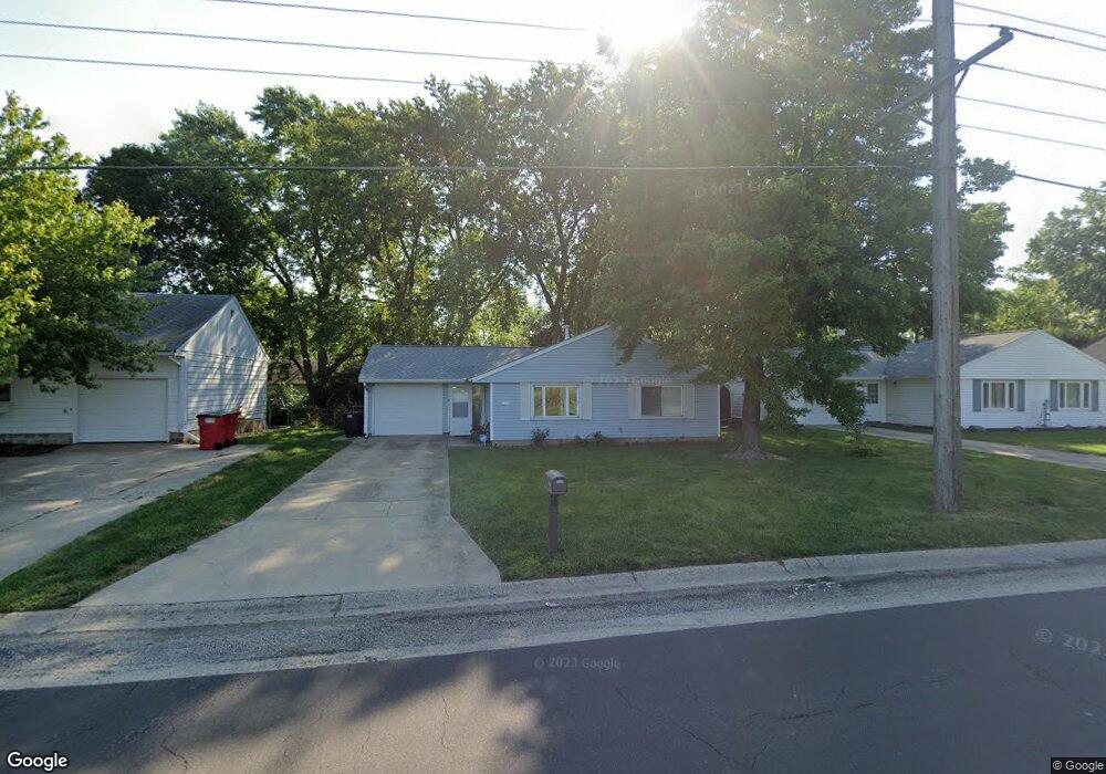
1210 S Duncan Rd Champaign, IL 61821
Estimated Value: $183,000 - $196,656
--
Bed
2
Baths
1,236
Sq Ft
$153/Sq Ft
Est. Value
About This Home
This home is located at 1210 S Duncan Rd, Champaign, IL 61821 and is currently estimated at $189,414, approximately $153 per square foot. 1210 S Duncan Rd is a home located in Champaign County with nearby schools including Centennial High School, Swann Special Care Center-Elem/Secondary School, and Countryside School.
Ownership History
Date
Name
Owned For
Owner Type
Purchase Details
Closed on
Jun 13, 2007
Sold by
Colombe Emily C and Colombe Andrew J
Bought by
Graham Davena M
Current Estimated Value
Home Financials for this Owner
Home Financials are based on the most recent Mortgage that was taken out on this home.
Original Mortgage
$111,304
Outstanding Balance
$68,143
Interest Rate
6.2%
Mortgage Type
FHA
Estimated Equity
$121,271
Purchase Details
Closed on
Dec 3, 2004
Sold by
Watson Jolene U
Bought by
Grant Emily C
Home Financials for this Owner
Home Financials are based on the most recent Mortgage that was taken out on this home.
Original Mortgage
$80,300
Interest Rate
5.82%
Mortgage Type
Purchase Money Mortgage
Create a Home Valuation Report for This Property
The Home Valuation Report is an in-depth analysis detailing your home's value as well as a comparison with similar homes in the area
Home Values in the Area
Average Home Value in this Area
Purchase History
| Date | Buyer | Sale Price | Title Company |
|---|---|---|---|
| Graham Davena M | $112,500 | None Available | |
| Grant Emily C | $94,500 | -- |
Source: Public Records
Mortgage History
| Date | Status | Borrower | Loan Amount |
|---|---|---|---|
| Open | Graham Davena M | $111,304 | |
| Previous Owner | Grant Emily C | $80,300 |
Source: Public Records
Tax History Compared to Growth
Tax History
| Year | Tax Paid | Tax Assessment Tax Assessment Total Assessment is a certain percentage of the fair market value that is determined by local assessors to be the total taxable value of land and additions on the property. | Land | Improvement |
|---|---|---|---|---|
| 2024 | $3,177 | $45,270 | $9,860 | $35,410 |
| 2023 | $3,177 | $41,230 | $8,980 | $32,250 |
| 2022 | $2,945 | $38,030 | $8,280 | $29,750 |
| 2021 | $2,864 | $37,290 | $8,120 | $29,170 |
| 2020 | $2,802 | $36,560 | $7,960 | $28,600 |
| 2019 | $2,701 | $35,810 | $7,800 | $28,010 |
| 2018 | $2,632 | $35,250 | $7,680 | $27,570 |
| 2017 | $2,643 | $35,250 | $7,680 | $27,570 |
| 2016 | $2,359 | $34,520 | $7,520 | $27,000 |
| 2015 | $2,368 | $33,910 | $7,390 | $26,520 |
| 2014 | $2,348 | $33,910 | $7,390 | $26,520 |
| 2013 | $2,327 | $33,910 | $7,390 | $26,520 |
Source: Public Records
Map
Nearby Homes
- 1309 Maplepark Dr
- 2808 Carrelton Dr
- 1508 Centennial Dr
- 901 Dogwood Dr
- 1402 Scottsdale Dr
- 2612 W Kirby Ave
- 2605 Trafalgar Square
- 2501 Sheridan Dr
- 2908 W John St Unit B
- 3311 Brentwood Dr
- 806 Scottsdale Dr
- 610 S Duncan Rd Unit A
- 1407 Kenwood Rd
- 1818 Tahoe Ct
- 1601 Carolyn Dr
- 1012 Waters Edge Rd
- 2203 W Kirby Ave
- 3804 Balmoral Dr
- 3761 Thornhill Cir Unit 3761
- 3334 Ridgewood Dr
- 1208 S Duncan Rd
- 1212 S Duncan Rd
- 1209 Maplepark Dr
- 1207 Maplepark Dr
- 1211 Maplepark Dr
- 1206 S Duncan Rd
- 1214 S Duncan Rd
- 2912 Sangamon Dr
- 1205 Maplepark Dr
- 1213 Maplepark Dr
- 1204 S Duncan Rd
- 2911 Maplewood Dr
- 1203 Maplepark Dr
- 2905 Alton Dr
- 2904 Alton Dr
- 1212 Maplepark Dr
- 1204 Maplepark Dr
- 1302 S Duncan Rd
- 1302 S Duncan Rd Unit 1
- 2904 Sangamon Dr