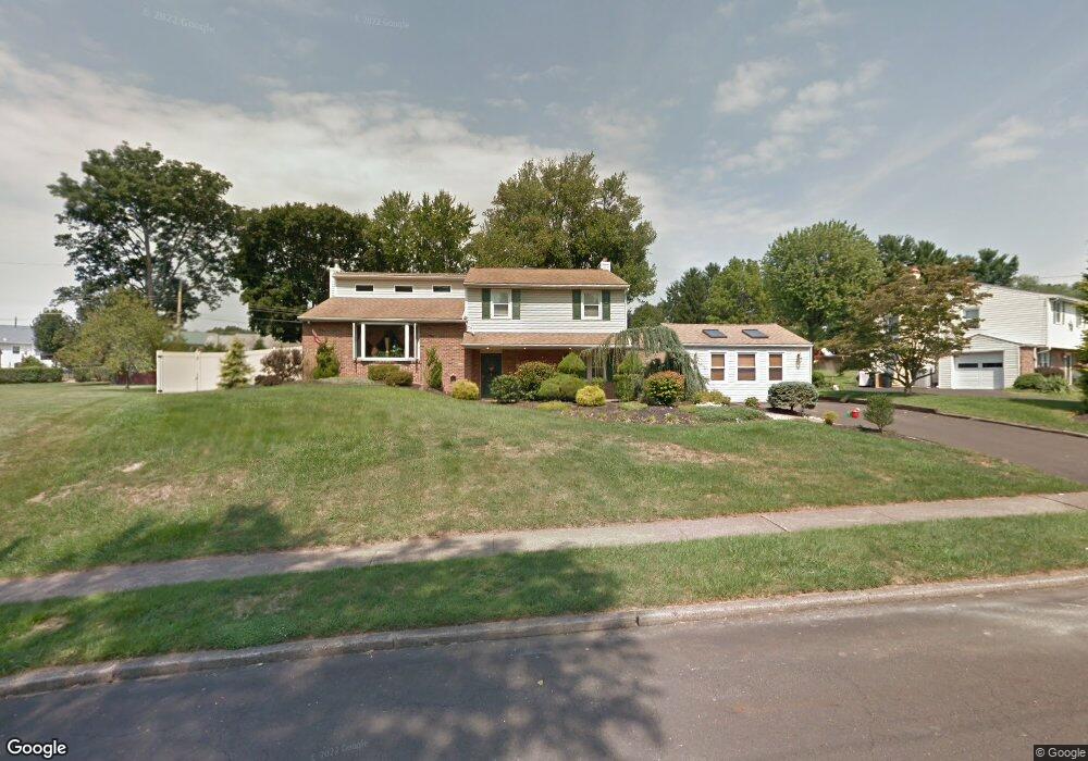
1210 Stuart Ln Southampton, PA 18966
Estimated Value: $524,896 - $609,000
3
Beds
2
Baths
1,886
Sq Ft
$295/Sq Ft
Est. Value
About This Home
This home is located at 1210 Stuart Ln, Southampton, PA 18966 and is currently estimated at $556,724, approximately $295 per square foot. 1210 Stuart Ln is a home located in Bucks County with nearby schools including Davis Elementary School, Klinger Middle School, and William Tennent High School.
Ownership History
Date
Name
Owned For
Owner Type
Purchase Details
Closed on
Jun 16, 2008
Sold by
Klinger David M and Klinger Michele
Bought by
Jablonowski Kenneth J and Jablonowski Dana M
Current Estimated Value
Home Financials for this Owner
Home Financials are based on the most recent Mortgage that was taken out on this home.
Original Mortgage
$333,000
Interest Rate
6.4%
Mortgage Type
Purchase Money Mortgage
Purchase Details
Closed on
Aug 3, 1994
Sold by
Klinger David M
Bought by
Klinger David M and Klinger Michele
Create a Home Valuation Report for This Property
The Home Valuation Report is an in-depth analysis detailing your home's value as well as a comparison with similar homes in the area
Home Values in the Area
Average Home Value in this Area
Purchase History
| Date | Buyer | Sale Price | Title Company |
|---|---|---|---|
| Jablonowski Kenneth J | $370,000 | None Available | |
| Klinger David M | -- | -- |
Source: Public Records
Mortgage History
| Date | Status | Borrower | Loan Amount |
|---|---|---|---|
| Previous Owner | Jablonowski Kenneth J | $333,000 |
Source: Public Records
Tax History Compared to Growth
Tax History
| Year | Tax Paid | Tax Assessment Tax Assessment Total Assessment is a certain percentage of the fair market value that is determined by local assessors to be the total taxable value of land and additions on the property. | Land | Improvement |
|---|---|---|---|---|
| 2025 | $6,502 | $30,400 | $7,040 | $23,360 |
| 2024 | $6,502 | $30,400 | $7,040 | $23,360 |
| 2023 | $6,305 | $30,400 | $7,040 | $23,360 |
| 2022 | $6,172 | $30,400 | $7,040 | $23,360 |
| 2021 | $6,060 | $30,400 | $7,040 | $23,360 |
| 2020 | $5,977 | $30,400 | $7,040 | $23,360 |
| 2019 | $5,757 | $30,400 | $7,040 | $23,360 |
| 2018 | $5,624 | $30,400 | $7,040 | $23,360 |
| 2017 | $5,465 | $30,400 | $7,040 | $23,360 |
| 2016 | $5,465 | $30,400 | $7,040 | $23,360 |
| 2015 | -- | $30,400 | $7,040 | $23,360 |
| 2014 | -- | $30,400 | $7,040 | $23,360 |
Source: Public Records
Map
Nearby Homes
- 559 Maple Ave
- 1310 Dennis Rd
- 1081 Cherry Ln
- 448 W Bristol Rd
- 1020 Pennsylvania Ave
- 215 Surrey Rd
- 955 Bristol Rd
- 1495 Estate Ln
- 225 Green Dr
- 902 Manor Ln
- 909 Carlin Dr
- 29 Devon Rd
- 950 Manor Ln
- 756 Churchville Rd
- 1435 Churchville Rd
- 756 Street Rd Unit 17
- 615 Belmont Ave
- 86 Valley Dr
- 1370 Mill Creek Rd
- 52 Belmont Station