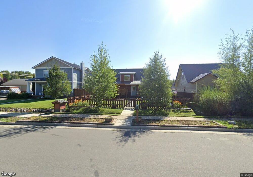
1210 Vulcan St Gunnison, CO 81230
Estimated Value: $578,000 - $727,000
3
Beds
2
Baths
1,280
Sq Ft
$523/Sq Ft
Est. Value
About This Home
This home is located at 1210 Vulcan St, Gunnison, CO 81230 and is currently estimated at $670,053, approximately $523 per square foot. 1210 Vulcan St is a home with nearby schools including Gunnison Elementary School, Gunnison Middle School, and Crested Butte Community School.
Ownership History
Date
Name
Owned For
Owner Type
Purchase Details
Closed on
Feb 28, 2017
Sold by
Dehmlow William A and Dehmlow Tina L
Bought by
Henaghan Leia and Henaghan John
Current Estimated Value
Home Financials for this Owner
Home Financials are based on the most recent Mortgage that was taken out on this home.
Original Mortgage
$222,062
Outstanding Balance
$183,889
Interest Rate
4.12%
Mortgage Type
New Conventional
Estimated Equity
$486,164
Purchase Details
Closed on
Nov 14, 2016
Sold by
West Elk Investments Llc
Bought by
Dehmlow William A and Dehmlow Tina L
Create a Home Valuation Report for This Property
The Home Valuation Report is an in-depth analysis detailing your home's value as well as a comparison with similar homes in the area
Home Values in the Area
Average Home Value in this Area
Purchase History
| Date | Buyer | Sale Price | Title Company |
|---|---|---|---|
| Henaghan Leia | $233,750 | Land Title Escrow | |
| Dehmlow William A | $50,000 | None Available |
Source: Public Records
Mortgage History
| Date | Status | Borrower | Loan Amount |
|---|---|---|---|
| Open | Henaghan Leia | $222,062 |
Source: Public Records
Tax History Compared to Growth
Tax History
| Year | Tax Paid | Tax Assessment Tax Assessment Total Assessment is a certain percentage of the fair market value that is determined by local assessors to be the total taxable value of land and additions on the property. | Land | Improvement |
|---|---|---|---|---|
| 2024 | $1,997 | $42,110 | $13,020 | $29,090 |
| 2023 | $1,997 | $38,420 | $11,880 | $26,540 |
| 2022 | $1,739 | $29,120 | $5,310 | $23,810 |
| 2021 | $1,567 | $29,960 | $5,460 | $24,500 |
| 2020 | $1,361 | $24,530 | $4,560 | $19,970 |
| 2019 | $1,330 | $24,530 | $4,560 | $19,970 |
| 2018 | $1,156 | $12,740 | $12,740 | $0 |
| 2017 | $725 | $12,740 | $12,740 | $0 |
Source: Public Records
Map
Nearby Homes
- 21 Vulcan St
- 316 Van Tuyl Cir
- 302 Van Tuyl Cir Unit E
- TBD Spencer & Pine
- 520 W Elizabeth Ave
- 614 N Pine St
- Lot 3 W Denver Ave
- 510 N Pine St
- 1005 W Denver Ave Unit G-4
- 1021 W Denver Ave Unit 4
- 416 N Main St
- 410 N 11th St
- 404 N Main St
- 306 N 9th St Unit 1B
- 304 N 9th St Unit 3A
- 216 N Taylor St
- 401 N 7th St
- 717 W Virginia Ave
- 240 Crest View Dr
- 0 Rainbow Acres Ln Unit 826591
- 1212 Vulcan St
- 1208 Vulcan St
- 1206 Vulcan St
- 19 Vulcan St
- 0 Hall 4 Hall No 4 Tincup Unit 793865
- 17 Vulcan St
- 186 County Road 13
- 184 County Road 13
- 1202 Vulcan St
- 1205 Van Tuyl Cir
- 178 County Road 13
- 1207 Van Tuyl Cir
- 15 Vulcan St
- 408 Tincup Dr
- 1200 Vulcan St
- 172 County Road 13
- 124 Tincup Dr
- 1203 Van Tuyl Cir
- 122 Floresta St
- 120 Floresta St