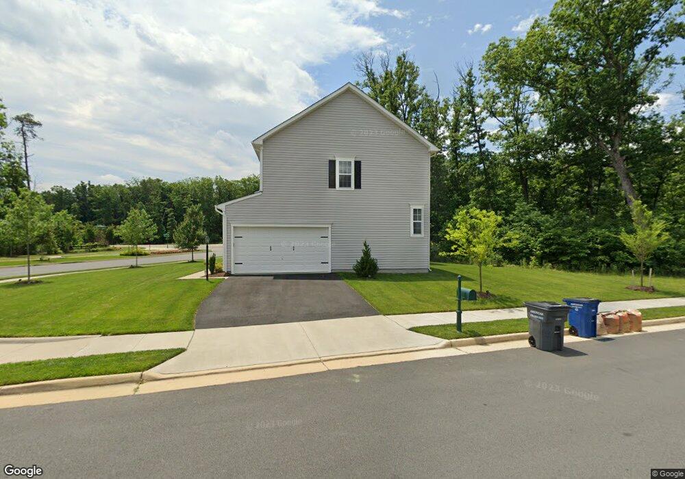
12101 Aster Rd Bristow, VA 20136
Estimated Value: $756,223 - $827,000
4
Beds
4
Baths
2,380
Sq Ft
$330/Sq Ft
Est. Value
About This Home
This home is located at 12101 Aster Rd, Bristow, VA 20136 and is currently estimated at $784,556, approximately $329 per square foot. 12101 Aster Rd is a home located in Prince William County with nearby schools including The Nokesville School, Brentsville District High School, and Linton Hall School.
Ownership History
Date
Name
Owned For
Owner Type
Purchase Details
Closed on
May 27, 2020
Sold by
Brookfield Vint Hill Llc
Bought by
Meyer Troy and Meyer Lauren Frances
Current Estimated Value
Home Financials for this Owner
Home Financials are based on the most recent Mortgage that was taken out on this home.
Original Mortgage
$155,000
Outstanding Balance
$107,968
Interest Rate
2.8%
Mortgage Type
New Conventional
Estimated Equity
$676,588
Create a Home Valuation Report for This Property
The Home Valuation Report is an in-depth analysis detailing your home's value as well as a comparison with similar homes in the area
Home Values in the Area
Average Home Value in this Area
Purchase History
| Date | Buyer | Sale Price | Title Company |
|---|---|---|---|
| Meyer Troy | $605,151 | Premier Title Inc |
Source: Public Records
Mortgage History
| Date | Status | Borrower | Loan Amount |
|---|---|---|---|
| Open | Meyer Troy | $155,000 |
Source: Public Records
Tax History
| Year | Tax Paid | Tax Assessment Tax Assessment Total Assessment is a certain percentage of the fair market value that is determined by local assessors to be the total taxable value of land and additions on the property. | Land | Improvement |
|---|---|---|---|---|
| 2025 | $6,791 | $694,800 | $188,800 | $506,000 |
| 2024 | $6,791 | $682,900 | $186,200 | $496,700 |
| 2023 | $6,884 | $661,600 | $184,100 | $477,500 |
| 2022 | $6,442 | $581,700 | $160,800 | $420,900 |
| 2021 | $6,420 | $527,000 | $145,700 | $381,300 |
| 2020 | $2,224 | $143,500 | $143,500 | $0 |
| 2019 | $2,218 | $143,100 | $143,100 | $0 |
| 2018 | $1,724 | $142,800 | $142,800 | $0 |
| 2017 | $1,723 | $142,800 | $142,800 | $0 |
| 2016 | $681 | $57,000 | $57,000 | $0 |
| 2015 | $696 | $57,000 | $57,000 | $0 |
| 2014 | $696 | $57,000 | $57,000 | $0 |
Source: Public Records
Map
Nearby Homes
- 10351 Spring Iris Dr
- 12172 Aster Rd
- 12021 Spring Beauty Rd
- 12217 Wheat Mill Loop
- 11747 Alexander Hays Rd
- 12458 Hadrians Ct
- 12151 Drum Salute Place
- 12360 Corncrib Ct
- 10410 Kettle Run Rd
- 10021 Hume Ct
- 12142 Millbill Ct
- 9927 Broadsword Dr
- 9568 Tarvie Cir
- 11968 Benton Lake Rd
- 9249 Alvyn Lake Cir
- 10941 Samuel Trexler Dr
- 0 Fitzwater Dr Unit VAPW2089498
- 0 Fitzwater Dr Unit VAPW2089496
- 0 Fitzwater Dr Unit VAPW2089490
- 0 Fitzwater Dr Unit VAPW2089402
- 12115 Aster Rd
- 10410 Twin Leaf Dr
- 13080 Twin Leaf Dr
- 12110 Aster Rd
- 0 Golden Aster Ct Unit VAPW321942
- 10396 Twin Leaf Dr
- 10392 Twin Leaf Dr
- 10403 Twin Leaf Dr
- 10557 Blazing Star Loop
- 10393 Twin Leaf Dr
- 10388 Twin Leaf Dr
- 10389 Twin Leaf Dr
- 10553 Blazing Star Loop
- 10561 Blazing Star Loop
- 10384 Twin Leaf Dr
- 0 Sedge St Unit PW9952341
- 0 Sedge St Unit PW9886128
- 0 Sedge St Unit PW9832382
- 10385 Twin Leaf Dr
- 10565 Blazing Star Loop