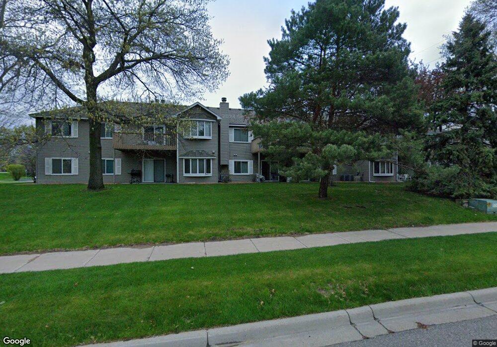
12101 Grouse St NW Unit 103 Coon Rapids, MN 55448
Estimated Value: $189,000 - $227,000
2
Beds
1
Bath
1,008
Sq Ft
$206/Sq Ft
Est. Value
About This Home
This home is located at 12101 Grouse St NW Unit 103, Coon Rapids, MN 55448 and is currently estimated at $207,542, approximately $205 per square foot. 12101 Grouse St NW Unit 103 is a home located in Anoka County with nearby schools including Lucile Bruner Elementary School, Sand Creek Elementary School, and Laughlin Junior/Senior High School.
Ownership History
Date
Name
Owned For
Owner Type
Purchase Details
Closed on
Jul 11, 2017
Sold by
Hampton Sharon C and Hampton Richard P
Bought by
Dupay Kathleen
Current Estimated Value
Purchase Details
Closed on
Feb 4, 2016
Sold by
Hampton Richard P and Hampton Sharon C
Bought by
Sharon C Hampton Revocable Trust
Purchase Details
Closed on
Nov 5, 2015
Sold by
Dunn Amanda A
Bought by
Hampton Richard P
Home Financials for this Owner
Home Financials are based on the most recent Mortgage that was taken out on this home.
Original Mortgage
$88,000
Interest Rate
3.87%
Mortgage Type
New Conventional
Purchase Details
Closed on
Sep 28, 1999
Sold by
Christiansen Joan M
Bought by
Carlson Fridolf H and Carlson Ruth C
Create a Home Valuation Report for This Property
The Home Valuation Report is an in-depth analysis detailing your home's value as well as a comparison with similar homes in the area
Home Values in the Area
Average Home Value in this Area
Purchase History
| Date | Buyer | Sale Price | Title Company |
|---|---|---|---|
| Dupay Kathleen | $121,000 | Alliance Title Llc | |
| Sharon C Hampton Revocable Trust | -- | Attorney | |
| Hampton Richard P | $110,000 | Title Specialists Inc | |
| Carlson Fridolf H | $87,900 | -- |
Source: Public Records
Mortgage History
| Date | Status | Borrower | Loan Amount |
|---|---|---|---|
| Previous Owner | Hampton Richard P | $88,000 |
Source: Public Records
Tax History Compared to Growth
Tax History
| Year | Tax Paid | Tax Assessment Tax Assessment Total Assessment is a certain percentage of the fair market value that is determined by local assessors to be the total taxable value of land and additions on the property. | Land | Improvement |
|---|---|---|---|---|
| 2025 | $1,940 | $167,500 | $36,000 | $131,500 |
| 2024 | $1,940 | $177,600 | $33,300 | $144,300 |
| 2023 | $1,485 | $161,300 | $32,400 | $128,900 |
| 2022 | $1,535 | $149,000 | $31,100 | $117,900 |
| 2021 | $1,458 | $129,200 | $21,600 | $107,600 |
| 2020 | $1,414 | $125,600 | $18,000 | $107,600 |
| 2019 | $1,353 | $116,400 | $18,000 | $98,400 |
| 2018 | $1,239 | $107,900 | $0 | $0 |
| 2017 | $1,047 | $95,300 | $0 | $0 |
| 2016 | $677 | $73,800 | $0 | $0 |
| 2015 | $625 | $73,800 | $4,500 | $69,300 |
| 2014 | -- | $66,900 | $6,000 | $60,900 |
Source: Public Records
Map
Nearby Homes
- 12010 Eagle St NW
- 1727 121st Ln NW
- 1449 119th Ln NW
- 12463 Drake St NW
- 12365 Jay St NW
- 11852 Yellow Pine St NW
- 1660 Northdale Blvd NW
- 11923 Wintergreen St NW
- 12554 Grouse St NW
- 1593 126th Ln NW
- 1450 126th Ln NW
- 2068 124th Ln NW
- 12488 Unity St NW
- 2147 125th Ln NW
- 1930 127th Cir NW
- 11350 Jay St NW
- 899 123rd Ln NW
- 12759 Ibis St NW
- 1234 128th Cir NW
- 11444 Hanson Blvd NW
- 12101 Grouse St NW Unit 108
- 12101 Grouse St NW Unit 107
- 12101 Grouse St NW Unit 106
- 12101 Grouse St NW Unit 105
- 12101 Grouse St NW Unit 104
- 12101 Grouse St NW Unit 102
- 12101 Grouse St NW Unit 101
- 12101 Grouse St NW
- 12101 12101 Grouse St NW
- 12131 12131 Grouse-Street-nw
- 12131 12131 Grouse St NW
- 12131 Grouse St NW Unit 208
- 12131 Grouse St NW Unit 207
- 12131 Grouse St NW Unit 206
- 12131 Grouse St NW Unit 205
- 12131 Grouse St NW Unit 204
- 12131 Grouse St NW Unit 203
- 12131 Grouse St NW Unit 202
- 12131 Grouse St NW Unit 201
- 1600 121st Cir NW