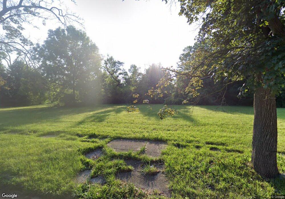
12104 Rutland St Detroit, MI 48227
Plymouth-Detroit NeighborhoodEstimated Value: $61,000 - $78,000
--
Bed
--
Bath
--
Sq Ft
4,356
Sq Ft Lot
About This Home
This home is located at 12104 Rutland St, Detroit, MI 48227 and is currently estimated at $69,500. 12104 Rutland St is a home located in Wayne County with nearby schools including Bates Academy, Charles L. Spain Elementary-Middle School, and Edward 'Duke' Ellington Conservatory of Music and Art.
Ownership History
Date
Name
Owned For
Owner Type
Purchase Details
Closed on
Jan 13, 2016
Sold by
Wayne County Treasurer
Bought by
Detroit Land Bank Authority
Current Estimated Value
Purchase Details
Closed on
Jun 25, 2009
Sold by
Donovan Shaun
Bought by
Walgbow Management Inc
Purchase Details
Closed on
Feb 22, 2008
Sold by
Midfirst Bank
Bought by
Hud
Purchase Details
Closed on
Aug 15, 2007
Sold by
Moore Ronald
Bought by
Midfirst Bank
Purchase Details
Closed on
Dec 22, 2004
Sold by
Ellison Lucille
Bought by
Moore Ronald
Create a Home Valuation Report for This Property
The Home Valuation Report is an in-depth analysis detailing your home's value as well as a comparison with similar homes in the area
Home Values in the Area
Average Home Value in this Area
Purchase History
| Date | Buyer | Sale Price | Title Company |
|---|---|---|---|
| Detroit Land Bank Authority | -- | None Available | |
| Walgbow Management Inc | $180 | None Available | |
| Hud | -- | None Available | |
| Midfirst Bank | $67,678 | None Available | |
| Moore Ronald | $49,000 | Multiple |
Source: Public Records
Tax History Compared to Growth
Tax History
| Year | Tax Paid | Tax Assessment Tax Assessment Total Assessment is a certain percentage of the fair market value that is determined by local assessors to be the total taxable value of land and additions on the property. | Land | Improvement |
|---|---|---|---|---|
| 2025 | -- | $0 | $0 | $0 |
| 2024 | -- | $0 | $0 | $0 |
| 2023 | $0 | $0 | $0 | $0 |
| 2022 | $0 | $0 | $0 | $0 |
| 2021 | $0 | $0 | $0 | $0 |
| 2020 | $48 | $0 | $0 | $0 |
| 2019 | $48 | $0 | $0 | $0 |
| 2018 | $0 | $0 | $0 | $0 |
| 2017 | $30 | $0 | $0 | $0 |
| 2016 | $30 | $300 | $0 | $0 |
| 2015 | $30 | $300 | $0 | $0 |
| 2013 | $62 | $618 | $0 | $0 |
| 2010 | -- | $702 | $561 | $141 |
Source: Public Records
Map
Nearby Homes
- 12251 Grandmont Ave
- 11691 Archdale St
- 11676 Grandmont Ave
- 12094 Asbury Park
- 12651 Abington Ave
- 16530 Fullerton Ave
- 12688 Memorial St
- 12122 Mettetal St
- 11375 Grandmont Ave
- 12729 Grandmont Ave
- 11387 Asbury Park
- 11394 Asbury Park
- 11690 Saint Marys St
- 12039 Faust Ave
- 9996 Archdale St
- 9961 Rutland St
- 12213 Rutherford St
- 12235 Rutherford St
- 11723 Rutherford St
- 12912 Longacre St
- 12110 Rutland St
- 12116 Rutland St
- 12074 Rutland St
- 12103 Memorial St
- 12068 Rutland St
- 12125 Memorial St
- 12089 Rutland St
- 12117 Rutland St
- 12129 Memorial St
- 12066 Rutland St
- 12137 Memorial St
- 12069 Memorial St
- 12073 Rutland St
- 12056 Rutland St
- 12150 Rutland St
- 12067 Rutland St
- 12137 Rutland St
- 12145 Memorial St
- 12061 Rutland St
- 12145 Rutland St
