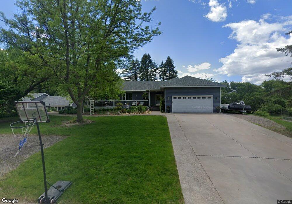
12105 39th St NE Saint Michael, MN 55376
Estimated Value: $392,000 - $474,000
4
Beds
3
Baths
1,171
Sq Ft
$374/Sq Ft
Est. Value
About This Home
This home is located at 12105 39th St NE, Saint Michael, MN 55376 and is currently estimated at $438,267, approximately $374 per square foot. 12105 39th St NE is a home located in Wright County with nearby schools including St. Michael Elementary School, Albertville Primary School, and Middle School East.
Ownership History
Date
Name
Owned For
Owner Type
Purchase Details
Closed on
Mar 6, 2015
Sold by
Kortuem Joyce Joyce
Bought by
Sunram Ryan Ryan
Current Estimated Value
Home Financials for this Owner
Home Financials are based on the most recent Mortgage that was taken out on this home.
Original Mortgage
$205,650
Outstanding Balance
$157,913
Interest Rate
3.75%
Estimated Equity
$280,354
Create a Home Valuation Report for This Property
The Home Valuation Report is an in-depth analysis detailing your home's value as well as a comparison with similar homes in the area
Home Values in the Area
Average Home Value in this Area
Purchase History
| Date | Buyer | Sale Price | Title Company |
|---|---|---|---|
| Sunram Ryan Ryan | $216,500 | -- |
Source: Public Records
Mortgage History
| Date | Status | Borrower | Loan Amount |
|---|---|---|---|
| Open | Sunram Ryan Ryan | $205,650 |
Source: Public Records
Tax History Compared to Growth
Tax History
| Year | Tax Paid | Tax Assessment Tax Assessment Total Assessment is a certain percentage of the fair market value that is determined by local assessors to be the total taxable value of land and additions on the property. | Land | Improvement |
|---|---|---|---|---|
| 2025 | $4,892 | $450,500 | $139,500 | $311,000 |
| 2024 | $4,506 | $432,600 | $130,200 | $302,400 |
| 2023 | $4,610 | $425,300 | $130,200 | $295,100 |
| 2022 | $4,378 | $403,500 | $130,200 | $273,300 |
| 2021 | $4,494 | $330,800 | $88,400 | $242,400 |
| 2020 | $4,246 | $328,300 | $88,400 | $239,900 |
| 2019 | $3,954 | $304,800 | $0 | $0 |
| 2018 | $3,354 | $270,000 | $0 | $0 |
| 2017 | $3,172 | $234,900 | $0 | $0 |
| 2016 | $3,044 | $0 | $0 | $0 |
| 2015 | $3,012 | $0 | $0 | $0 |
| 2014 | -- | $0 | $0 | $0 |
Source: Public Records
Map
Nearby Homes
- 3880 Larabee Ave NE
- 3886 Larabee Ave NE
- 911 Ridge Dr SE
- 3823 Larabee Ave NE
- 3773 Larabee Ave NE
- 4481 Mason Ave NE
- 12608 43rd St NE
- 2464 Jacamar Ave NE
- 9942 14th Cir NE
- 9964 14th Cir NE
- 9976 14th Cir NE
- 3896 Melby Ave NE
- 4149 Orleans Dr NE
- 4206 Orleans Dr NE
- 12763 44th Cir NE
- 4566 Landmark Dr NE
- 307 Lincoln Dr SE
- 12930 44th Place Cir NE
- 11139 Frankfort Pkwy NE
- 4850 Mcallister Ave NE
- 12106 39th St NE
- 12114 39th St NE
- 12100 39th St NE
- 12082 39th St NE
- 12074 39th St NE
- 3900 MacIver Ave NE
- 12042 39th St NE
- 3964 MacIver Ave NE
- XXX MacIver Ave NE
- 3880 MacIver Ave NE
- 4020 MacIver Ave NE
- 0 Unassigned (D) Unit 4461287
- 0 Unassigned (C) Unit 4461262
- 3850 MacIver Ave NE
- 12281 41st St NE
- 12246 42nd St NE
- 4124 Mackenzie Ct NE
- 4124 Mackenzie Ct NE Unit 100
- 3841 MacIver Ave NE
- 3970 Larabee Ave NE