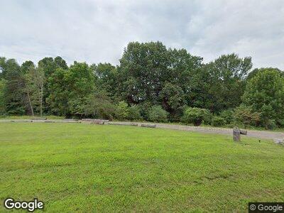
12105 Cantwell Cliffs Rd Rockbridge, OH 43149
Estimated Value: $338,877 - $953,000
--
Bed
1
Bath
2,704
Sq Ft
$239/Sq Ft
Est. Value
About This Home
This home is located at 12105 Cantwell Cliffs Rd, Rockbridge, OH 43149 and is currently estimated at $645,939, approximately $238 per square foot. 12105 Cantwell Cliffs Rd is a home located in Hocking County with nearby schools including Chieftain Elementary School.
Ownership History
Date
Name
Owned For
Owner Type
Purchase Details
Closed on
Nov 29, 2023
Sold by
Ray David L
Bought by
850-852 Wilson Ave Llc
Current Estimated Value
Home Financials for this Owner
Home Financials are based on the most recent Mortgage that was taken out on this home.
Original Mortgage
$292,400
Outstanding Balance
$290,292
Interest Rate
7.79%
Mortgage Type
Credit Line Revolving
Purchase Details
Closed on
Feb 18, 2019
Sold by
Ray David L
Bought by
Rockbridge Management Llc
Create a Home Valuation Report for This Property
The Home Valuation Report is an in-depth analysis detailing your home's value as well as a comparison with similar homes in the area
Home Values in the Area
Average Home Value in this Area
Purchase History
| Date | Buyer | Sale Price | Title Company |
|---|---|---|---|
| 850-852 Wilson Ave Llc | -- | None Listed On Document | |
| Rockbridge Management Llc | $60,000 | Lanco Title Agency |
Source: Public Records
Mortgage History
| Date | Status | Borrower | Loan Amount |
|---|---|---|---|
| Closed | 850-852 Wilson Ave Llc | $0 | |
| Open | 850-852 Wilson Ave Llc | $292,400 | |
| Closed | 850-852 Wilson Ave Llc | $45,000 |
Source: Public Records
Tax History Compared to Growth
Tax History
| Year | Tax Paid | Tax Assessment Tax Assessment Total Assessment is a certain percentage of the fair market value that is determined by local assessors to be the total taxable value of land and additions on the property. | Land | Improvement |
|---|---|---|---|---|
| 2024 | $2,372 | $60,960 | $18,250 | $42,710 |
| 2023 | $2,372 | $60,960 | $18,250 | $42,710 |
| 2022 | $2,321 | $60,960 | $18,250 | $42,710 |
| 2021 | $2,019 | $49,630 | $12,290 | $37,340 |
| 2020 | $2,079 | $51,050 | $12,290 | $38,760 |
| 2019 | $2,305 | $56,430 | $17,670 | $38,760 |
| 2018 | $1,919 | $47,850 | $13,090 | $34,760 |
| 2017 | $1,884 | $47,850 | $13,090 | $34,760 |
| 2016 | $1,871 | $47,850 | $13,090 | $34,760 |
| 2015 | $1,978 | $47,280 | $15,320 | $31,960 |
| 2014 | $1,978 | $47,280 | $15,320 | $31,960 |
| 2013 | $1,986 | $47,280 | $15,320 | $31,960 |
Source: Public Records
Map
Nearby Homes
- 23402 Bigham Rd
- 13427 Ohio 374
- 14091 Jack Run Rd
- 20358 Buena Vista Rd
- 14485 Jack Run Rd
- 14635 Little Cola Rd
- 10643 Opossum Hollow Rd
- 0 Clapper Hollow Rd
- 13032 E Buck Run Rd
- 9385 Rich Hollow Rd SW
- 14212 Long Run Rd
- 26063 Twin Falls
- 18811 Indigo Ln
- 10295 Lookout Rd SW
- 14650 State Route 678
- 22037 Ohio 180
- 15586 Stump Run
- 7805 Revenge Rd SW
- 14081 Middlefork Rd
- 0 Ohio 374
- 12105 Cantwell Cliffs Rd
- 12089 Cantwell Cliffs Rd
- 22625 Buena Vista Rd
- 22701 Buena Vista Rd
- 12133 Cantwell Cliffs Rd
- 22597 Buena Vista Rd
- 11979 Cantwell Cliffs Rd
- 22624 Buena Vista Rd
- 22745 Buena Vista Rd
- 22590 Buena Vista Rd
- 22562 Buena Vista Rd
- 12200 Cantwell Cliffs Rd
- 11921 Woodland Ridge Rd
- 0 Cantwell Cliffs Rd
- 22779 Buena Vista Rd
- 0 Big Cola Rd Unit LOT A 2552390
- 0 Big Cola Rd Unit LOT C 2627990
- 0 Big Cola Rd Unit LOT B 2627989
- 0 Big Cola Rd Unit 2552397
- 0 Big Cola Rd Unit LOT B 2552392
