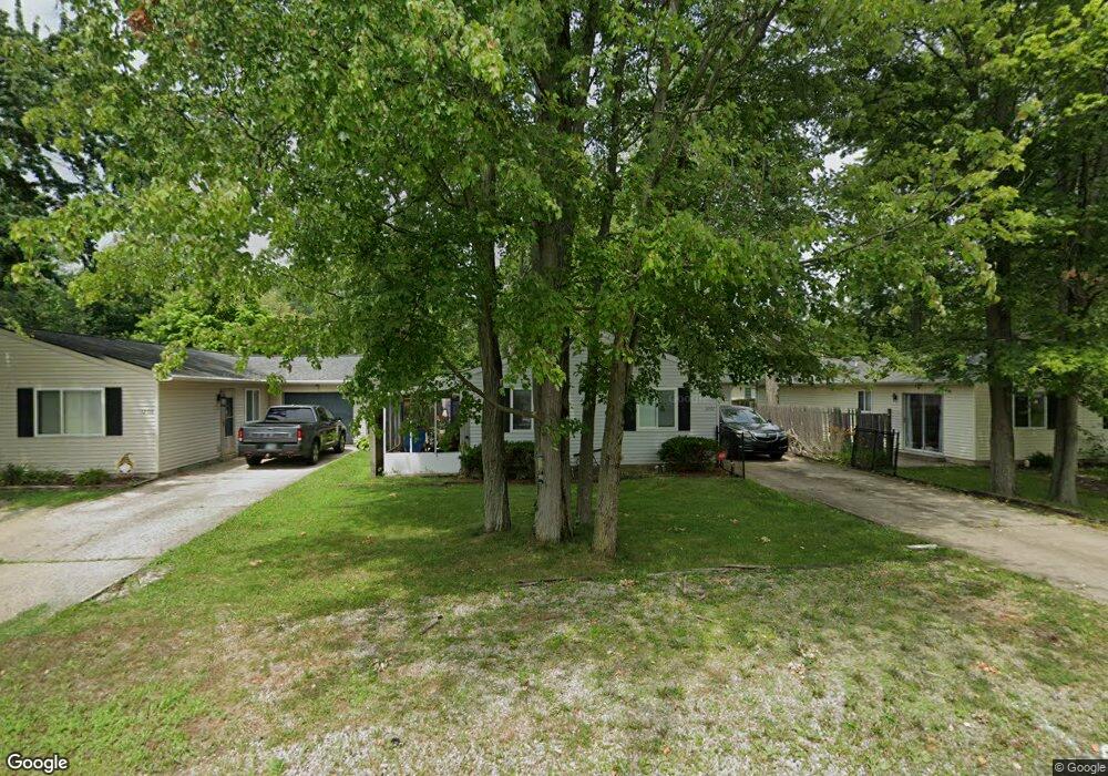
12107 7th Ave Cincinnati, OH 45249
Highpoint NeighborhoodEstimated Value: $179,000 - $200,000
3
Beds
2
Baths
1,056
Sq Ft
$180/Sq Ft
Est. Value
About This Home
This home is located at 12107 7th Ave, Cincinnati, OH 45249 and is currently estimated at $190,166, approximately $180 per square foot. 12107 7th Ave is a home located in Hamilton County with nearby schools including Stewart Elementary School, Princeton Community Middle School, and Princeton High School.
Ownership History
Date
Name
Owned For
Owner Type
Purchase Details
Closed on
Dec 11, 2018
Sold by
Hartzler Jeffrey S and Hartzler Lydia
Bought by
Gilliam Melisa L
Current Estimated Value
Purchase Details
Closed on
Oct 23, 2018
Sold by
Overbey Nathan B and Overbey Megan L
Bought by
Hartzler Jeffrey S and Hartzler Lydia
Purchase Details
Closed on
Dec 2, 2013
Sold by
Vogelsang Andrea and Vogelsang Andrea J
Bought by
Wells Fargo Bank Na
Purchase Details
Closed on
Sep 4, 2001
Sold by
Davis Dennis P and Davis Sherrie
Bought by
Vogelsang Andrea J
Home Financials for this Owner
Home Financials are based on the most recent Mortgage that was taken out on this home.
Original Mortgage
$77,400
Interest Rate
7.03%
Create a Home Valuation Report for This Property
The Home Valuation Report is an in-depth analysis detailing your home's value as well as a comparison with similar homes in the area
Home Values in the Area
Average Home Value in this Area
Purchase History
| Date | Buyer | Sale Price | Title Company |
|---|---|---|---|
| Gilliam Melisa L | -- | Agility Closing & Title Serv | |
| Hartzler Jeffrey S | $125,995 | Agility Closing & Title Svcs | |
| Wells Fargo Bank Na | $44,000 | None Available | |
| Vogelsang Andrea J | $86,000 | Superior Title Agency Inc |
Source: Public Records
Mortgage History
| Date | Status | Borrower | Loan Amount |
|---|---|---|---|
| Previous Owner | Vogelsang Andrea J | $77,400 |
Source: Public Records
Tax History
| Year | Tax Paid | Tax Assessment Tax Assessment Total Assessment is a certain percentage of the fair market value that is determined by local assessors to be the total taxable value of land and additions on the property. | Land | Improvement |
|---|---|---|---|---|
| 2025 | $2,275 | $42,560 | $6,300 | $36,260 |
| 2023 | $1,994 | $42,560 | $6,300 | $36,260 |
| 2022 | $2,561 | $44,100 | $6,286 | $37,814 |
| 2021 | $2,545 | $44,100 | $6,286 | $37,814 |
| 2020 | $2,512 | $44,100 | $6,286 | $37,814 |
| 2019 | $1,710 | $27,392 | $5,513 | $21,879 |
| 2018 | $1,618 | $27,392 | $5,513 | $21,879 |
| 2017 | $1,548 | $27,392 | $5,513 | $21,879 |
| 2016 | $1,457 | $25,137 | $5,355 | $19,782 |
| 2015 | $1,449 | $25,137 | $5,355 | $19,782 |
| 2014 | $1,451 | $25,137 | $5,355 | $19,782 |
| 2013 | $1,332 | $24,644 | $5,250 | $19,394 |
Source: Public Records
Map
Nearby Homes
- 12152 7th Ave
- 7812 Cincinnati Ave
- 12152 3rd Ave
- 12121 3rd Ave
- 11928 2nd Ave
- 9729 Old Stable Ct
- 9720 Cedar Knoll Dr
- 9665 New Castle Ct
- 9548 Butler Warren Rd
- 9917 Shorewood Ln
- 9450 Lark Meadow Ct
- 9891 McCauly Woods Dr
- 12102 Paulmeadows Dr
- 9907 Kensington Ln
- 8469 Fields Ertel Rd
- 9867 Kensington Ln
- 9671 Fox Run Dr
- 12173 Crestfield Ct
- 9509 Butler Warren Rd
- 7883 Chestershire Dr
Your Personal Tour Guide
Ask me questions while you tour the home.