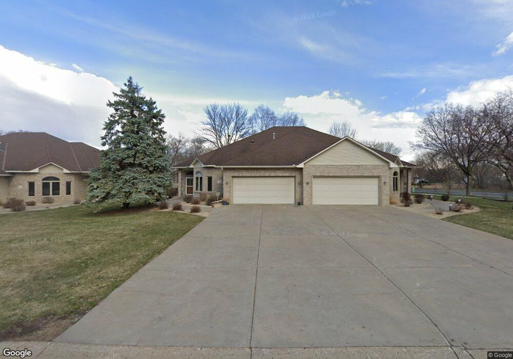
12109 Bluebird Cir NW Coon Rapids, MN 55448
Estimated Value: $417,000 - $464,000
2
Beds
2
Baths
1,960
Sq Ft
$229/Sq Ft
Est. Value
About This Home
This home is located at 12109 Bluebird Cir NW, Coon Rapids, MN 55448 and is currently estimated at $447,915, approximately $228 per square foot. 12109 Bluebird Cir NW is a home located in Anoka County with nearby schools including Lucile Bruner Elementary School, Sand Creek Elementary School, and Laughlin Junior/Senior High School.
Ownership History
Date
Name
Owned For
Owner Type
Purchase Details
Closed on
Jun 24, 2022
Sold by
Peterson Richard and Peterson Marlene
Bought by
Fan Zhu and Shi Ke
Current Estimated Value
Purchase Details
Closed on
Dec 1, 2017
Sold by
Kaiser Kenneth and Kaiser Vella
Bought by
Peterson Richard and Peterson Marlene P
Purchase Details
Closed on
Sep 28, 2017
Sold by
Stringer Barbara L
Bought by
Kaiser Kenneth and Kaiser Vella
Purchase Details
Closed on
Jun 28, 2000
Sold by
Whaley Bennie M and Whaley Janice
Bought by
Stringer Barbara L
Purchase Details
Closed on
Oct 9, 1998
Sold by
Ewing William and Ewing Laraine
Bought by
Whaley Bennie and Whaley Janice
Create a Home Valuation Report for This Property
The Home Valuation Report is an in-depth analysis detailing your home's value as well as a comparison with similar homes in the area
Home Values in the Area
Average Home Value in this Area
Purchase History
| Date | Buyer | Sale Price | Title Company |
|---|---|---|---|
| Fan Zhu | $435,000 | -- | |
| Peterson Richard | $278,000 | Titlesmart Inc | |
| Kaiser Kenneth | $285,000 | None Available | |
| Stringer Barbara L | $204,900 | -- | |
| Whaley Bennie | $178,500 | -- |
Source: Public Records
Tax History Compared to Growth
Tax History
| Year | Tax Paid | Tax Assessment Tax Assessment Total Assessment is a certain percentage of the fair market value that is determined by local assessors to be the total taxable value of land and additions on the property. | Land | Improvement |
|---|---|---|---|---|
| 2025 | $4,469 | $413,900 | $93,500 | $320,400 |
| 2024 | $4,469 | $419,200 | $88,000 | $331,200 |
| 2023 | $3,559 | $370,300 | $71,500 | $298,800 |
| 2022 | $3,327 | $362,100 | $72,600 | $289,500 |
| 2021 | $3,455 | $303,000 | $52,800 | $250,200 |
| 2020 | $3,524 | $306,500 | $44,000 | $262,500 |
| 2019 | $3,256 | $299,700 | $44,000 | $255,700 |
| 2018 | $3,174 | $270,900 | $0 | $0 |
| 2017 | $2,888 | $256,700 | $0 | $0 |
| 2016 | $2,956 | $231,700 | $0 | $0 |
| 2015 | $2,851 | $231,700 | $48,800 | $182,900 |
| 2014 | -- | $191,300 | $33,200 | $158,100 |
Source: Public Records
Map
Nearby Homes
- 12010 Eagle St NW
- 1449 119th Ln NW
- 11852 Yellow Pine St NW
- 11923 Wintergreen St NW
- 12463 Drake St NW
- 1727 121st Ln NW
- 1625 124th Ave NW
- 12488 Unity St NW
- 12365 Jay St NW
- 1450 126th Ln NW
- 899 123rd Ln NW
- 1660 Northdale Blvd NW
- 1593 126th Ln NW
- 12554 Grouse St NW
- 12796 Bluebird St NW
- 1234 128th Cir NW
- 633 Sand Creek Dr NW
- 12357 Magnolia St NW
- 2068 124th Ln NW
- 1520 129th Ave NW
- 12103 Bluebird Cir NW
- 12115 Bluebird Cir NW
- 12121 Bluebird Cir NW
- 12133 Bluebird Cir NW
- 12100 Bluebird Cir NW
- 12106 Bluebird Cir NW
- 12112 Bluebird Cir NW
- 12147 Bluebird Cir NW
- 12118 Bluebird Cir NW
- 12179 Bluebird Cir NW
- 12175 Bluebird Cir NW
- 1354 121st Ave NW
- 12183 Bluebird Cir NW
- 12130 Bluebird Cir NW
- 12187 Bluebird Cir NW
- 12134 Bluebird Cir NW
- 12138 Bluebird Cir NW
- 1408 121st Ave NW
- 12189 Bluebird Cir NW
- 12103 Drake St NW