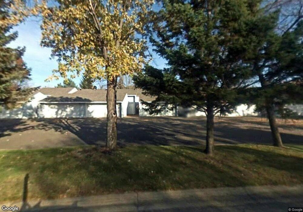
12109 Drake St NW Coon Rapids, MN 55448
Estimated Value: $232,000 - $282,000
3
Beds
2
Baths
1,392
Sq Ft
$181/Sq Ft
Est. Value
About This Home
This home is located at 12109 Drake St NW, Coon Rapids, MN 55448 and is currently estimated at $251,429, approximately $180 per square foot. 12109 Drake St NW is a home located in Anoka County with nearby schools including Lucile Bruner Elementary School, Sand Creek Elementary School, and Laughlin Junior/Senior High School.
Ownership History
Date
Name
Owned For
Owner Type
Purchase Details
Closed on
Dec 10, 2021
Sold by
Netko Daniel and Netko Jean
Bought by
Fronsoe Samantha
Current Estimated Value
Home Financials for this Owner
Home Financials are based on the most recent Mortgage that was taken out on this home.
Original Mortgage
$211,105
Outstanding Balance
$194,239
Interest Rate
3.14%
Mortgage Type
FHA
Estimated Equity
$57,190
Purchase Details
Closed on
Jun 12, 2017
Sold by
Chandler Jessica J and Chandler Betty A
Bought by
Netko Daniel
Home Financials for this Owner
Home Financials are based on the most recent Mortgage that was taken out on this home.
Original Mortgage
$103,875
Interest Rate
4.02%
Mortgage Type
New Conventional
Create a Home Valuation Report for This Property
The Home Valuation Report is an in-depth analysis detailing your home's value as well as a comparison with similar homes in the area
Home Values in the Area
Average Home Value in this Area
Purchase History
| Date | Buyer | Sale Price | Title Company |
|---|---|---|---|
| Fronsoe Samantha | $215,000 | Legacy Title | |
| Netko Daniel | $138,500 | Liberty Title Inc |
Source: Public Records
Mortgage History
| Date | Status | Borrower | Loan Amount |
|---|---|---|---|
| Open | Fronsoe Samantha | $211,105 | |
| Previous Owner | Netko Daniel | $103,875 |
Source: Public Records
Tax History Compared to Growth
Tax History
| Year | Tax Paid | Tax Assessment Tax Assessment Total Assessment is a certain percentage of the fair market value that is determined by local assessors to be the total taxable value of land and additions on the property. | Land | Improvement |
|---|---|---|---|---|
| 2025 | $3,169 | $224,400 | $40,000 | $184,400 |
| 2024 | $3,169 | $221,700 | $40,000 | $181,700 |
| 2023 | $2,204 | $217,400 | $40,000 | $177,400 |
| 2022 | $1,865 | $199,700 | $35,000 | $164,700 |
| 2021 | $1,918 | $164,400 | $38,000 | $126,400 |
| 2020 | $1,794 | $164,900 | $25,000 | $139,900 |
| 2019 | $1,663 | $147,400 | $25,000 | $122,400 |
| 2018 | $1,663 | $132,200 | $0 | $0 |
| 2017 | $1,179 | $127,700 | $0 | $0 |
| 2016 | $1,177 | $102,600 | $0 | $0 |
| 2015 | -- | $102,600 | $16,200 | $86,400 |
| 2014 | -- | $83,800 | $6,000 | $77,800 |
Source: Public Records
Map
Nearby Homes
- 12010 Eagle St NW
- 11852 Yellow Pine St NW
- 12463 Drake St NW
- 1727 121st Ln NW
- 11923 Wintergreen St NW
- 1625 124th Ave NW
- 12365 Jay St NW
- 12488 Unity St NW
- 1450 126th Ln NW
- 1660 Northdale Blvd NW
- 1593 126th Ln NW
- 12554 Grouse St NW
- 899 123rd Ln NW
- 12796 Bluebird St NW
- 1234 128th Cir NW
- 2068 124th Ln NW
- 12357 Magnolia St NW
- 633 Sand Creek Dr NW
- 1520 129th Ave NW
- 1930 127th Cir NW
- 12107 Drake St NW
- 12113 Drake St NW
- 12115 Drake St NW
- 12105 Drake St NW
- 12103 Drake St NW
- 12119 Drake St NW
- 12121 Drake St NW
- 12123 Drake St NW
- 12125 Drake St NW
- 12112 Drake St NW
- 12110 Drake St NW
- 12106 Drake St NW
- 12108 Drake St NW
- 12127 Drake St NW
- 12106 Bluebird Cir NW
- 12100 Bluebird Cir NW
- 12114 Drake St NW
- 12112 Bluebird Cir NW
- 12118 Bluebird Cir NW
- 1420 121st Ave NW