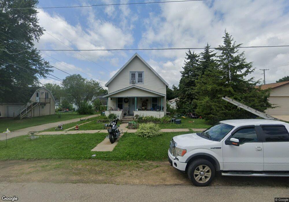
1211 5th Ave de Witt, IA 52742
Estimated Value: $133,047 - $209,000
3
Beds
1
Bath
1,238
Sq Ft
$130/Sq Ft
Est. Value
About This Home
This home is located at 1211 5th Ave, de Witt, IA 52742 and is currently estimated at $161,512, approximately $130 per square foot. 1211 5th Ave is a home located in Clinton County with nearby schools including Ekstrand Elementary School, Central Dewitt Intermediate School, and Central Dewitt Middle School.
Ownership History
Date
Name
Owned For
Owner Type
Purchase Details
Closed on
Mar 30, 2021
Sold by
Shontz Trust
Bought by
Peterson Cheyenne and Olson Nicole
Current Estimated Value
Purchase Details
Closed on
Apr 23, 2010
Sold by
Chambers J Drew
Bought by
Shontz Sandra J
Purchase Details
Closed on
Apr 7, 2010
Sold by
Shontz Austin W and Shontz Gloria A
Bought by
Shontz Sandra J
Purchase Details
Closed on
Feb 26, 2010
Sold by
Stitt Holly M and Stitt Nathan A
Bought by
Shontz Sandra J
Create a Home Valuation Report for This Property
The Home Valuation Report is an in-depth analysis detailing your home's value as well as a comparison with similar homes in the area
Home Values in the Area
Average Home Value in this Area
Purchase History
| Date | Buyer | Sale Price | Title Company |
|---|---|---|---|
| Peterson Cheyenne | -- | None Available | |
| Shontz Sandra J | -- | None Available | |
| Shontz Sandra J | -- | None Available | |
| Shontz Sandra J | -- | None Available |
Source: Public Records
Tax History Compared to Growth
Tax History
| Year | Tax Paid | Tax Assessment Tax Assessment Total Assessment is a certain percentage of the fair market value that is determined by local assessors to be the total taxable value of land and additions on the property. | Land | Improvement |
|---|---|---|---|---|
| 2025 | $1,668 | $95,700 | $12,480 | $83,220 |
| 2024 | $1,668 | $90,650 | $12,480 | $78,170 |
| 2023 | $1,568 | $90,650 | $12,480 | $78,170 |
| 2022 | $1,570 | $80,400 | $12,480 | $67,920 |
| 2021 | $1,350 | $77,310 | $15,360 | $61,950 |
| 2020 | $1,350 | $71,930 | $15,360 | $56,570 |
| 2019 | $1,294 | $69,230 | $0 | $0 |
| 2018 | $1,260 | $69,230 | $0 | $0 |
| 2017 | $1,260 | $69,230 | $0 | $0 |
| 2016 | $1,322 | $0 | $0 | $0 |
| 2015 | $1,322 | $72,200 | $0 | $0 |
| 2014 | $1,340 | $72,200 | $0 | $0 |
| 2013 | $1,314 | $0 | $0 | $0 |
Source: Public Records
Map
Nearby Homes
- 1323 5th Ave
- 407 E 10th St
- 401 10th St
- 709 11th St
- 910 4th Ave
- 0 9th St
- 0 285th St Old Highway 61 Unit parcel 1808590000
- 285th Ave Old Hwy 61 Unit Parcels 1808590000/
- 285th Ave Old Hwy 61 Unit Parcel-1808600000/1
- 824 7th St
- 1104 15th St
- 715 5th St
- 1012 6th St
- 401 3rd Ave
- 1217 7th St
- 1144 Brookview Dr
- 510 2nd St
- 00 3rd St
- 911 3rd St
- 503 1st St