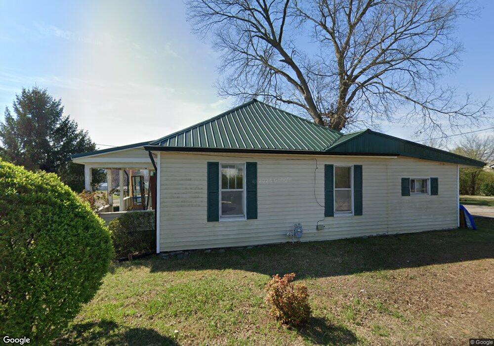
1211 Broad St Sweetwater, TN 37874
Estimated Value: $84,000 - $232,000
--
Bed
1
Bath
1,110
Sq Ft
$152/Sq Ft
Est. Value
About This Home
This home is located at 1211 Broad St, Sweetwater, TN 37874 and is currently estimated at $168,300, approximately $151 per square foot. 1211 Broad St is a home located in Monroe County with nearby schools including Sweetwater Primary School, Sweetwater Elementary School, and Sweetwater Junior High School.
Ownership History
Date
Name
Owned For
Owner Type
Purchase Details
Closed on
Oct 23, 2023
Sold by
Smith Peggy and Smith Harry
Bought by
Camren Roe Llc
Current Estimated Value
Home Financials for this Owner
Home Financials are based on the most recent Mortgage that was taken out on this home.
Original Mortgage
$100,000
Interest Rate
7.19%
Mortgage Type
New Conventional
Purchase Details
Closed on
Dec 16, 1995
Bought by
Smith Peggy
Purchase Details
Closed on
Sep 13, 1995
Sold by
Brewster Walter
Bought by
Smith Peggy
Purchase Details
Closed on
Aug 27, 1987
Bought by
Brewster Walter
Purchase Details
Closed on
Dec 31, 1979
Create a Home Valuation Report for This Property
The Home Valuation Report is an in-depth analysis detailing your home's value as well as a comparison with similar homes in the area
Home Values in the Area
Average Home Value in this Area
Purchase History
| Date | Buyer | Sale Price | Title Company |
|---|---|---|---|
| Camren Roe Llc | $60,000 | Unity Title | |
| Smith Peggy | $8,000 | -- | |
| Smith Peggy | $8,000 | -- | |
| Brewster Walter | -- | -- | |
| -- | -- | -- |
Source: Public Records
Mortgage History
| Date | Status | Borrower | Loan Amount |
|---|---|---|---|
| Closed | Camren Roe Llc | $100,000 |
Source: Public Records
Tax History Compared to Growth
Tax History
| Year | Tax Paid | Tax Assessment Tax Assessment Total Assessment is a certain percentage of the fair market value that is determined by local assessors to be the total taxable value of land and additions on the property. | Land | Improvement |
|---|---|---|---|---|
| 2025 | -- | $22,200 | $0 | $0 |
| 2024 | $453 | $22,200 | $4,075 | $18,125 |
| 2023 | $453 | $18,425 | $4,075 | $14,350 |
| 2022 | $407 | $11,250 | $2,725 | $8,525 |
| 2021 | $407 | $11,250 | $2,725 | $8,525 |
| 2020 | $407 | $11,250 | $2,725 | $8,525 |
| 2019 | $378 | $11,250 | $2,725 | $8,525 |
| 2018 | $378 | $11,250 | $2,725 | $8,525 |
| 2017 | $297 | $9,025 | $2,475 | $6,550 |
| 2016 | $297 | $9,025 | $2,475 | $6,550 |
| 2015 | $297 | $9,025 | $2,475 | $6,550 |
| 2014 | $297 | $9,020 | $0 | $0 |
Source: Public Records
Map
Nearby Homes
- 1203 W Morris St
- 1113 McCaslin Ave
- 1011 Morris St
- 169 Dode St
- 829 Childress Ave
- 173 Dode St
- 307 Browder St
- 201 Browder St
- 706 Broad St
- 806 Bennett St
- 114 Anderson St
- 1502 Monroe St
- 816 Fair St
- 210 Clark St N
- 509 Williams St
- 1023 Wentford Ave
- 1021 Wentford Ave
- 703 Monroe St
- 1019 Wentford Ave
- 117 Cedar Valley Rd
- 1306 Morris St
- 1215 Broad St
- 1210 Broad St
- 1210 Broad St
- Lot 7 Chestnut Ln
- Lot 6 Chestnut Ln
- lot 5 Chestnut Ln
- 7 Chestnut Ln
- 0 Chestnut Ln Unit 1175939
- 0 Chestnut Ln Unit 799221
- 0 Chestnut Ln Unit 799219
- 1307 Morris St
- 1303 Morris St
- 1303 W Morris St
- 1402 Broad St
- 1406 Chestnut St
- 1205 Broad St
- 285 Fair St N
- 1202 Chestnut St
- 1402 W Morris St