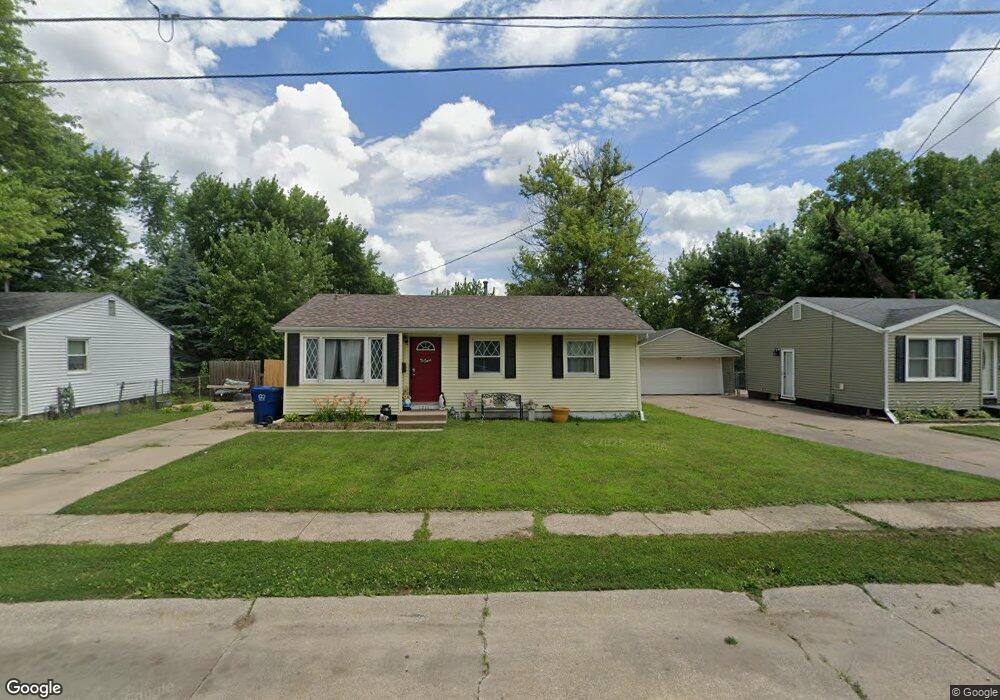
1211 Hillandale Rd Davenport, IA 52804
West End NeighborhoodEstimated Value: $143,268 - $182,000
3
Beds
1
Bath
1,006
Sq Ft
$157/Sq Ft
Est. Value
About This Home
This home is located at 1211 Hillandale Rd, Davenport, IA 52804 and is currently estimated at $158,067, approximately $157 per square foot. 1211 Hillandale Rd is a home located in Scott County with nearby schools including Walnut Hill Elementary School, South Christian Elementary School, and Wilson Elementary School.
Ownership History
Date
Name
Owned For
Owner Type
Purchase Details
Closed on
Mar 25, 2021
Sold by
Mcclimon Judith A
Bought by
Mcclimon Jodee L
Current Estimated Value
Home Financials for this Owner
Home Financials are based on the most recent Mortgage that was taken out on this home.
Original Mortgage
$52,000
Outstanding Balance
$46,588
Interest Rate
2.8%
Mortgage Type
New Conventional
Estimated Equity
$111,479
Purchase Details
Closed on
Dec 6, 2010
Sold by
Walker Deborah
Bought by
Mcclimon Judith A
Purchase Details
Closed on
Aug 4, 2006
Sold by
Rogers Loretta M
Bought by
England Helen L
Create a Home Valuation Report for This Property
The Home Valuation Report is an in-depth analysis detailing your home's value as well as a comparison with similar homes in the area
Home Values in the Area
Average Home Value in this Area
Purchase History
| Date | Buyer | Sale Price | Title Company |
|---|---|---|---|
| Mcclimon Jodee L | -- | None Listed On Document | |
| Mcclimon Judith A | $56,000 | None Available | |
| England Helen L | $31,000 | None Available |
Source: Public Records
Mortgage History
| Date | Status | Borrower | Loan Amount |
|---|---|---|---|
| Open | Mcclimon Jodee L | $52,000 |
Source: Public Records
Tax History Compared to Growth
Tax History
| Year | Tax Paid | Tax Assessment Tax Assessment Total Assessment is a certain percentage of the fair market value that is determined by local assessors to be the total taxable value of land and additions on the property. | Land | Improvement |
|---|---|---|---|---|
| 2025 | $2,098 | $144,870 | $27,300 | $117,570 |
| 2024 | $2,092 | $127,670 | $27,300 | $100,370 |
| 2023 | $2,537 | $130,440 | $27,300 | $103,140 |
| 2022 | $2,372 | $119,490 | $24,270 | $95,220 |
| 2021 | $2,372 | $119,490 | $24,270 | $95,220 |
| 2020 | $2,786 | $109,290 | $24,270 | $85,020 |
| 2019 | $2,752 | $105,040 | $24,270 | $80,770 |
| 2018 | $248 | $105,040 | $24,270 | $80,770 |
| 2017 | $579 | $104,080 | $24,270 | $79,810 |
| 2016 | $2,188 | $99,880 | $0 | $0 |
| 2015 | $2,188 | $102,020 | $0 | $0 |
| 2014 | $2,266 | $102,020 | $0 | $0 |
| 2013 | $2,226 | $0 | $0 | $0 |
| 2012 | -- | $92,100 | $22,900 | $69,200 |
Source: Public Records
Map
Nearby Homes
- 1203 N Thornwood Ave
- 1119 N Thornwood Ave
- 1107 N Thornwood Ave
- 1230 N Elmwood Ave
- 2449 W 13th St
- 1145 Waverly Rd
- 1215 Waverly Rd
- 3117 Schuetzen Ln
- 926 Cimarron Dr
- 2417 W 18th St
- 3430 W Locust St
- 511 Waverly Rd
- 1925 N Michigan Ave
- 2012 N Ohio Ave
- 3920 W 13th St
- 0 W Locust St Unit Utah
- 0 W Locust St Unit 23235762
- 0 W Locust St Unit NOC6326699
- 1922 N Pine St
- 2926 W Lombard St
- 1217 Hillandale Rd
- 1111 Hillandale Rd
- 1225 Hillandale Rd
- 2915 W 13th St
- 1105 Hillandale Rd
- 2909 W 13th St
- 1212 Hillandale Rd
- 1204 Hillandale Rd
- 1218 Hillandale Rd
- 2905 W 13th St
- 1110 Hillandale Rd
- 1224 Hillandale Rd
- 1031 Hillandale Rd
- 1234 Hillandale Rd
- 2827 W 13th St
- 3006 W 11th St
- 1027 Hillandale Rd
- 2821 W 13th St
- 3011 W 13th St
- 3018 W 11th St