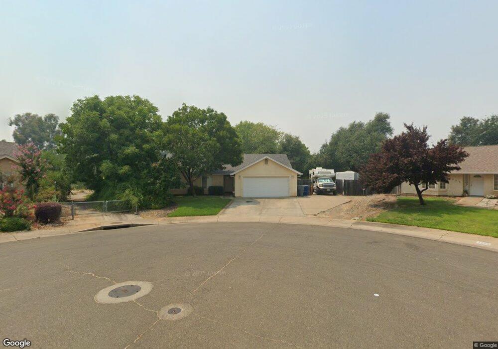
1211 Manatowa Ct Redding, CA 96002
Enterprise NeighborhoodEstimated Value: $347,886 - $409,000
3
Beds
2
Baths
1,400
Sq Ft
$266/Sq Ft
Est. Value
About This Home
This home is located at 1211 Manatowa Ct, Redding, CA 96002 and is currently estimated at $372,972, approximately $266 per square foot. 1211 Manatowa Ct is a home located in Shasta County with nearby schools including Rother Elementary School, Parsons Junior High School, and Enterprise High School.
Ownership History
Date
Name
Owned For
Owner Type
Purchase Details
Closed on
Jul 14, 2020
Sold by
Valasek Darrell C
Bought by
Pickens Robert D
Current Estimated Value
Home Financials for this Owner
Home Financials are based on the most recent Mortgage that was taken out on this home.
Original Mortgage
$252,500
Outstanding Balance
$223,900
Interest Rate
3.1%
Mortgage Type
New Conventional
Estimated Equity
$149,072
Purchase Details
Closed on
Sep 23, 2002
Sold by
Isitt Robert Carl and Isitt Mary L
Bought by
Valasek Darrell C
Home Financials for this Owner
Home Financials are based on the most recent Mortgage that was taken out on this home.
Original Mortgage
$130,500
Interest Rate
6.16%
Mortgage Type
Purchase Money Mortgage
Purchase Details
Closed on
Apr 18, 2002
Sold by
Gray Development Corp
Bought by
Isitt Robert Carl and Isitt Mary L
Create a Home Valuation Report for This Property
The Home Valuation Report is an in-depth analysis detailing your home's value as well as a comparison with similar homes in the area
Home Values in the Area
Average Home Value in this Area
Purchase History
| Date | Buyer | Sale Price | Title Company |
|---|---|---|---|
| Pickens Robert D | $266,000 | Placer Title Company | |
| Valasek Darrell C | $174,500 | Chicago Title Co | |
| Isitt Robert Carl | $143,000 | Chicago Title Co |
Source: Public Records
Mortgage History
| Date | Status | Borrower | Loan Amount |
|---|---|---|---|
| Open | Pickens Robert D | $252,500 | |
| Previous Owner | Valasek Darrell C | $130,500 |
Source: Public Records
Tax History
| Year | Tax Paid | Tax Assessment Tax Assessment Total Assessment is a certain percentage of the fair market value that is determined by local assessors to be the total taxable value of land and additions on the property. | Land | Improvement |
|---|---|---|---|---|
| 2025 | $3,129 | $287,925 | $59,533 | $228,392 |
| 2024 | $3,086 | $282,280 | $58,366 | $223,914 |
| 2023 | $3,086 | $276,746 | $57,222 | $219,524 |
| 2022 | $2,999 | $271,320 | $56,100 | $215,220 |
| 2021 | $2,897 | $266,000 | $55,000 | $211,000 |
| 2020 | $2,460 | $231,076 | $46,342 | $184,734 |
| 2019 | $2,439 | $226,546 | $45,434 | $181,112 |
| 2018 | $2,410 | $222,105 | $44,544 | $177,561 |
| 2017 | $2,451 | $217,751 | $43,671 | $174,080 |
| 2016 | $2,291 | $213,482 | $42,815 | $170,667 |
| 2015 | $2,271 | $210,276 | $42,172 | $168,104 |
| 2014 | $2,230 | $204,000 | $35,000 | $169,000 |
Source: Public Records
Map
Nearby Homes
- 3178 Lawrence Rd
- 1091 Del Sol Place
- 3360 Lawrence Rd
- 1075 Le Brun Ln
- 3293 Middleton Ln
- 3283 Middleton Ln
- 3527 Adams Ln
- 1354 Harpole Rd
- 2893 Alfreda Way
- 3087 Northwoods Way
- 2855 Irwin Rd
- 2906 Regal Ave
- 0 Churn Creek Rd Unit 25-496
- 0 Churn Creek Rd Unit 26-609
- 0 Churn Creek Rd Unit 25-5491
- 2820 Alfreda Way
- 1513 Harpole Rd
- 1209 C St
- 918 Parsons Dr
- 890 Parsons Dr
- 1251 Manatowa Ct
- 1254 Manotowa Ct
- 1254 Manatowa Ct
- 3408 Meridian Dr
- 3390 Meridian Dr
- 3422 Meridian Dr
- 3350 Meridian Dr
- 3436 Meridian Dr
- 3310 Meridian Dr
- 1303 Gehring Ct
- 3395 Meridian Dr
- 3355 Meridian Dr
- 3450 Meridian Dr
- 3315 Meridian Dr
- 3429 Meridian Dr
- 1343 Gehring Ct
- 3464 Meridian Dr
- 1346 Gehring Ct
- 3445 Meridian Dr
- 3247 Lawrence Rd
Your Personal Tour Guide
Ask me questions while you tour the home.