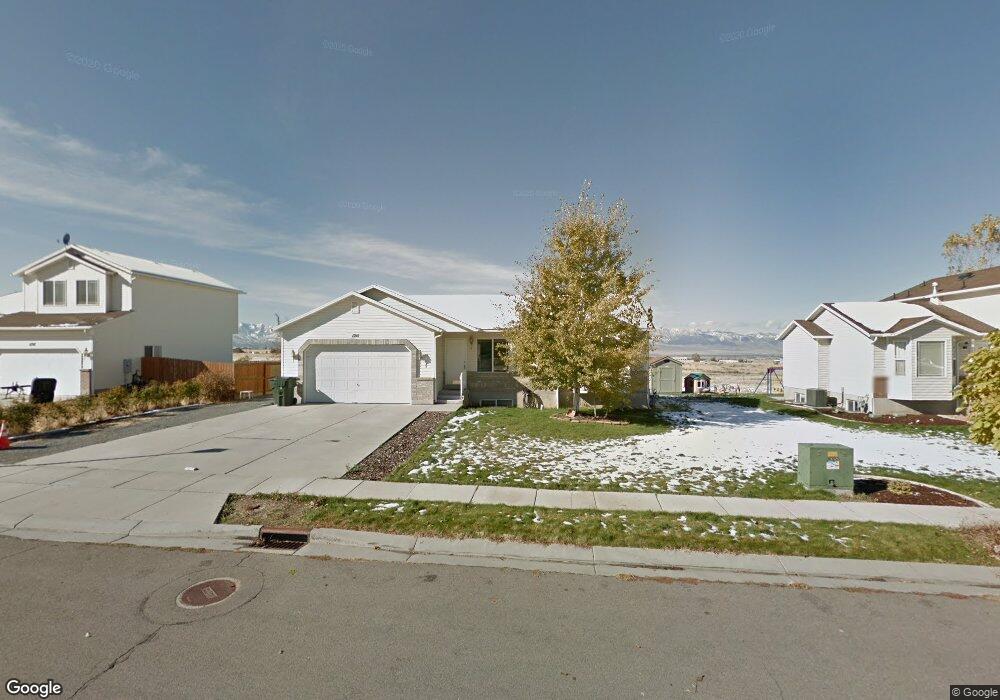
1211 N 380 E Tooele, UT 84074
Estimated Value: $418,000 - $451,000
3
Beds
2
Baths
2,351
Sq Ft
$184/Sq Ft
Est. Value
About This Home
This home is located at 1211 N 380 E, Tooele, UT 84074 and is currently estimated at $433,326, approximately $184 per square foot. 1211 N 380 E is a home located in Tooele County with nearby schools including Copper Canyon Elementary School, Clarke N. Johnsen Junior High School, and Stansbury High School.
Ownership History
Date
Name
Owned For
Owner Type
Purchase Details
Closed on
Sep 21, 2012
Sold by
Johnson Bruce
Bought by
Johnson Bruce and Johnson Lisa L
Current Estimated Value
Home Financials for this Owner
Home Financials are based on the most recent Mortgage that was taken out on this home.
Original Mortgage
$137,000
Outstanding Balance
$95,066
Interest Rate
3.63%
Mortgage Type
New Conventional
Estimated Equity
$338,260
Purchase Details
Closed on
Jan 21, 2009
Sold by
Johnson Bruce and Johnson Lisa
Bought by
Johnson Bruce and Johnson Lisa L
Home Financials for this Owner
Home Financials are based on the most recent Mortgage that was taken out on this home.
Original Mortgage
$138,600
Interest Rate
5.49%
Mortgage Type
New Conventional
Create a Home Valuation Report for This Property
The Home Valuation Report is an in-depth analysis detailing your home's value as well as a comparison with similar homes in the area
Purchase History
| Date | Buyer | Sale Price | Title Company |
|---|---|---|---|
| Johnson Bruce | -- | North American Title | |
| Johnson Bruce | -- | North American Title Ach | |
| Johnson Bruce | -- | First American Title Ins |
Source: Public Records
Mortgage History
| Date | Status | Borrower | Loan Amount |
|---|---|---|---|
| Open | Johnson Bruce | $137,000 | |
| Closed | Johnson Bruce | $137,000 | |
| Closed | Johnson Bruce | $138,600 |
Source: Public Records
Tax History
| Year | Tax Paid | Tax Assessment Tax Assessment Total Assessment is a certain percentage of the fair market value that is determined by local assessors to be the total taxable value of land and additions on the property. | Land | Improvement |
|---|---|---|---|---|
| 2025 | $2,846 | $431,575 | $103,750 | $327,825 |
| 2024 | $3,018 | $230,377 | $57,063 | $173,314 |
| 2023 | $3,018 | $232,219 | $54,342 | $177,877 |
| 2022 | $2,729 | $234,815 | $54,227 | $180,588 |
| 2021 | $2,232 | $160,605 | $21,691 | $138,914 |
| 2020 | $2,139 | $266,979 | $39,438 | $227,541 |
| 2019 | $2,006 | $246,293 | $39,438 | $206,855 |
| 2018 | $1,849 | $215,301 | $40,000 | $175,301 |
| 2017 | $1,598 | $220,771 | $30,000 | $190,771 |
| 2016 | $1,303 | $107,738 | $16,500 | $91,238 |
| 2015 | $1,303 | $94,763 | $0 | $0 |
| 2014 | -- | $94,763 | $0 | $0 |
Source: Public Records
Map
Nearby Homes
- 405 E 1310 N
- 475 E 1310 N
- 180 1000 N
- 472 E 1420 N
- 438 E 1480 N
- 1154 N Berra Blvd
- 332 E 880 N
- 936 N 580 E
- 931 Brook Ave E Unit A
- 647 E 980 N
- 1194 N 690 E
- 1598 N 210 E Unit 107
- 1618 N 210 E
- 516 N Broadway Ave
- 1762 N Broadway Ave Unit 102
- 802 E 1120 N
- 437 E 740 N
- 795 N Brook Ave
- 768 E 980 N
- 1725 180 E Unit D137
Your Personal Tour Guide
Ask me questions while you tour the home.