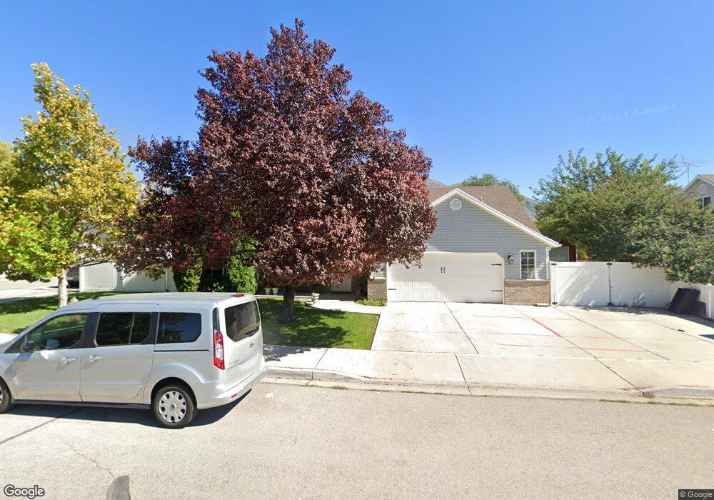
1211 S 980 W Provo, UT 84601
Franklin NeighborhoodEstimated Value: $498,000 - $656,000
5
Beds
3
Baths
2,174
Sq Ft
$252/Sq Ft
Est. Value
About This Home
This home is located at 1211 S 980 W, Provo, UT 84601 and is currently estimated at $548,512, approximately $252 per square foot. 1211 S 980 W is a home located in Utah County with nearby schools including Sunset View Elementary School, Dixon Middle School, and Provo High School.
Ownership History
Date
Name
Owned For
Owner Type
Purchase Details
Closed on
Aug 29, 2012
Sold by
Federal National Mortgage Association
Bought by
Baizabal Raul and Coronado Veronica Amaya
Current Estimated Value
Home Financials for this Owner
Home Financials are based on the most recent Mortgage that was taken out on this home.
Original Mortgage
$196,377
Outstanding Balance
$137,791
Interest Rate
3.87%
Mortgage Type
FHA
Estimated Equity
$410,721
Purchase Details
Closed on
Oct 13, 2011
Sold by
Bueno Jose Luis and Sotelo Alejadra
Bought by
Federal National Mortgage Association
Purchase Details
Closed on
Oct 25, 2005
Sold by
Bueno Jose De Jesus and Bueno Jose Luis
Bought by
Bueno Jose Luis and Sotelo Alejandra
Home Financials for this Owner
Home Financials are based on the most recent Mortgage that was taken out on this home.
Original Mortgage
$166,500
Interest Rate
2.5%
Mortgage Type
New Conventional
Purchase Details
Closed on
Aug 29, 2003
Sold by
Fannie Mae
Bought by
Bueno Jose De Jesus and Bueno Jose Luis
Home Financials for this Owner
Home Financials are based on the most recent Mortgage that was taken out on this home.
Original Mortgage
$123,050
Interest Rate
5.62%
Mortgage Type
Stand Alone First
Purchase Details
Closed on
Feb 18, 2003
Sold by
Brandon Ricky and Allied Mortgage Capital Corp
Bought by
Federal National Mortgage Association
Purchase Details
Closed on
Jan 19, 2001
Sold by
Brown P Lynn and Brown Nancy E
Bought by
Brandon Ricky
Home Financials for this Owner
Home Financials are based on the most recent Mortgage that was taken out on this home.
Original Mortgage
$158,000
Interest Rate
7.54%
Purchase Details
Closed on
Apr 10, 1997
Sold by
Sundance Homes Inc
Bought by
Brown P Lynn and Brown Nancy E
Home Financials for this Owner
Home Financials are based on the most recent Mortgage that was taken out on this home.
Original Mortgage
$124,100
Interest Rate
7.66%
Create a Home Valuation Report for This Property
The Home Valuation Report is an in-depth analysis detailing your home's value as well as a comparison with similar homes in the area
Home Values in the Area
Average Home Value in this Area
Purchase History
| Date | Buyer | Sale Price | Title Company |
|---|---|---|---|
| Baizabal Raul | -- | Services Title Ins Agency | |
| Federal National Mortgage Association | -- | Lincoln Title Insurance Agen | |
| Bueno Jose Luis | -- | Horizon Title Insurance | |
| Bueno Jose De Jesus | $153,850 | Empire Land Title Company | |
| Federal National Mortgage Association | $138,635 | Backman Stewart Title Servi | |
| Brandon Ricky | -- | Sundance Title Insurance Ag | |
| Brown P Lynn | -- | -- | |
| Sundance Homes Inc | -- | -- |
Source: Public Records
Mortgage History
| Date | Status | Borrower | Loan Amount |
|---|---|---|---|
| Open | Baizabal Raul | $196,377 | |
| Previous Owner | Bueno Jose Luis | $166,500 | |
| Previous Owner | Bueno Jose De Jesus | $123,050 | |
| Previous Owner | Brandon Ricky | $158,000 | |
| Previous Owner | Brown P Lynn | $124,100 | |
| Closed | Bueno Jose De Jesus | $30,750 |
Source: Public Records
Tax History Compared to Growth
Tax History
| Year | Tax Paid | Tax Assessment Tax Assessment Total Assessment is a certain percentage of the fair market value that is determined by local assessors to be the total taxable value of land and additions on the property. | Land | Improvement |
|---|---|---|---|---|
| 2025 | $2,535 | $267,025 | $168,700 | $316,800 |
| 2024 | $2,535 | $249,535 | $0 | $0 |
| 2023 | $2,481 | $240,735 | $0 | $0 |
| 2022 | $2,410 | $235,785 | $0 | $0 |
| 2021 | $1,889 | $322,400 | $92,600 | $229,800 |
| 2020 | $1,832 | $293,100 | $84,200 | $208,900 |
| 2019 | $1,744 | $290,100 | $84,200 | $205,900 |
| 2018 | $1,518 | $256,200 | $77,200 | $179,000 |
| 2017 | $1,338 | $124,080 | $0 | $0 |
| 2016 | $1,286 | $111,155 | $0 | $0 |
| 2015 | $1,131 | $98,835 | $0 | $0 |
| 2014 | $1,064 | $96,910 | $0 | $0 |
Source: Public Records
Map
Nearby Homes
- 914 W 1150 S Unit 2
- 908 W 1150 S Unit 3
- 655 W 1280 S
- 985 S 600 W
- 1240 W 890 S
- 784 W Heather Ln
- 1095 S 500 W Unit 11
- 239 S Meadow Dr Unit 10
- 131 S Meadow Dr Unit 20
- 169 S Meadow Dr Unit 18
- 761 W 600 S Unit 12
- 588 W 1720 S
- 590 S 900 W
- 974 W 600 S Unit 1
- 1303 W 600 S
- 510 S 900 W
- 648 S 500 W Unit 4
- 272 W 1020 S Unit B
- 590 S 600 W
- 642 W 1870 S Unit 1046