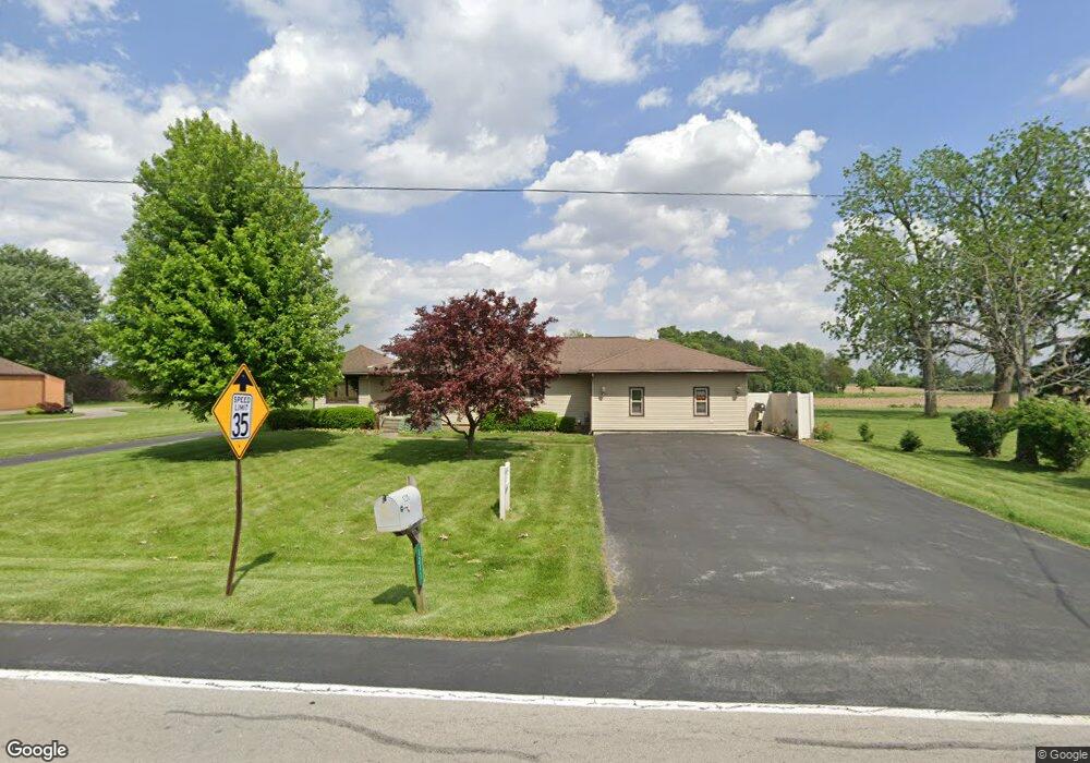
1211 Smith Rd Fremont, OH 43420
Estimated Value: $238,642 - $328,000
3
Beds
2
Baths
2,137
Sq Ft
$125/Sq Ft
Est. Value
About This Home
This home is located at 1211 Smith Rd, Fremont, OH 43420 and is currently estimated at $267,161, approximately $125 per square foot. 1211 Smith Rd is a home located in Sandusky County with nearby schools including Fremont Ross High School, Sacred Heart School, and Temple Christian Academy.
Ownership History
Date
Name
Owned For
Owner Type
Purchase Details
Closed on
Aug 25, 2025
Sold by
Dorobek James S and Dorobek Rita M
Bought by
James S Dorobek Trust and Herdman
Current Estimated Value
Purchase Details
Closed on
Dec 26, 2024
Sold by
Dorobek James S and Dorobek Rita M
Bought by
Dorobek James S
Purchase Details
Closed on
Jan 11, 2018
Sold by
Dorobek James S and Dorobek Rita M
Bought by
Dorobek James S and Dorobek Rita M
Purchase Details
Closed on
Aug 1, 1987
Bought by
Dorobek James S and Dorobek Rita M
Create a Home Valuation Report for This Property
The Home Valuation Report is an in-depth analysis detailing your home's value as well as a comparison with similar homes in the area
Home Values in the Area
Average Home Value in this Area
Purchase History
| Date | Buyer | Sale Price | Title Company |
|---|---|---|---|
| James S Dorobek Trust | -- | None Listed On Document | |
| Dorobek James S | -- | None Listed On Document | |
| Dorobek James S | -- | None Listed On Document | |
| Dorobek James S | -- | None Available | |
| Dorobek James S | $83,000 | -- |
Source: Public Records
Tax History Compared to Growth
Tax History
| Year | Tax Paid | Tax Assessment Tax Assessment Total Assessment is a certain percentage of the fair market value that is determined by local assessors to be the total taxable value of land and additions on the property. | Land | Improvement |
|---|---|---|---|---|
| 2024 | $2,161 | $65,350 | $11,410 | $53,940 |
| 2023 | $2,161 | $53,140 | $9,280 | $43,860 |
| 2022 | $1,844 | $53,140 | $9,280 | $43,860 |
| 2021 | $1,900 | $53,140 | $9,280 | $43,860 |
| 2020 | $1,830 | $50,650 | $9,280 | $41,370 |
| 2019 | $1,828 | $50,650 | $9,280 | $41,370 |
| 2018 | $1,781 | $50,650 | $9,280 | $41,370 |
| 2017 | $1,674 | $47,960 | $9,280 | $38,680 |
| 2016 | $1,467 | $47,960 | $9,280 | $38,680 |
| 2015 | $1,444 | $47,960 | $9,280 | $38,680 |
| 2014 | $1,385 | $44,800 | $6,230 | $38,570 |
| 2013 | $1,356 | $44,800 | $6,230 | $38,570 |
Source: Public Records
Map
Nearby Homes
- 800 Lawndale Dr
- 546 Oaklawn Ave
- 1526 Sunrise Blvd
- 309 S Collinwood Blvd
- 314 S Collinwood Blvd
- 0 S Buchanan St
- 600 S Buchanan St
- 2248 E State St
- 906 Amsden Blvd
- 199 Saint Thomas Dr
- 318 Ethan Dr
- 315 Ethan Dr
- 251 Saint Paul Dr
- 335 Cottage St
- 230 N Pennsylvania Ave
- 263 Saint Paul Dr
- 1014 S County Road 198
- 714 E State St
- 933 E Cole Rd
- 18 Katlyn Dr