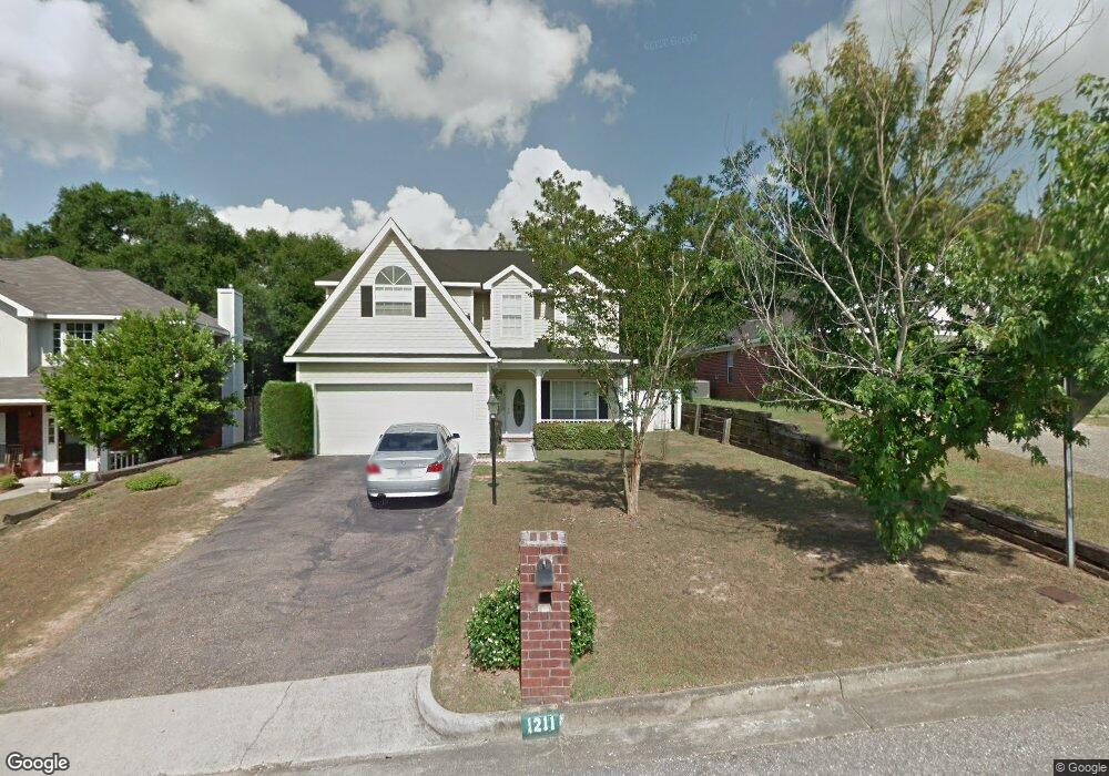
1211 Smithfield Rd E Mobile, AL 36695
Sheldon NeighborhoodEstimated Value: $225,000 - $251,000
3
Beds
3
Baths
1,997
Sq Ft
$119/Sq Ft
Est. Value
About This Home
This home is located at 1211 Smithfield Rd E, Mobile, AL 36695 and is currently estimated at $238,210, approximately $119 per square foot. 1211 Smithfield Rd E is a home located in Mobile County with nearby schools including ER Dickson Elementary School, Burns Middle School, and WP Davidson High School.
Ownership History
Date
Name
Owned For
Owner Type
Purchase Details
Closed on
Nov 12, 2002
Sold by
Harms David L
Bought by
Ibrahim Khaled and Ibrahim Marina
Current Estimated Value
Home Financials for this Owner
Home Financials are based on the most recent Mortgage that was taken out on this home.
Original Mortgage
$121,885
Outstanding Balance
$49,468
Interest Rate
5.98%
Estimated Equity
$188,742
Purchase Details
Closed on
Aug 28, 2000
Sold by
Copeland Katherine G and Harms Katherine G
Bought by
Harms David L
Purchase Details
Closed on
Jul 30, 1999
Sold by
Mitchell Company Inc The
Bought by
Harms Katherine G
Home Financials for this Owner
Home Financials are based on the most recent Mortgage that was taken out on this home.
Original Mortgage
$128,900
Interest Rate
7.62%
Create a Home Valuation Report for This Property
The Home Valuation Report is an in-depth analysis detailing your home's value as well as a comparison with similar homes in the area
Home Values in the Area
Average Home Value in this Area
Purchase History
| Date | Buyer | Sale Price | Title Company |
|---|---|---|---|
| Ibrahim Khaled | -- | -- | |
| Harms David L | $1,500 | Surety Land Title Inc | |
| Harms Katherine G | -- | -- |
Source: Public Records
Mortgage History
| Date | Status | Borrower | Loan Amount |
|---|---|---|---|
| Open | Ibrahim Khaled | $121,885 | |
| Previous Owner | Harms Katherine G | $128,900 |
Source: Public Records
Tax History
| Year | Tax Paid | Tax Assessment Tax Assessment Total Assessment is a certain percentage of the fair market value that is determined by local assessors to be the total taxable value of land and additions on the property. | Land | Improvement |
|---|---|---|---|---|
| 2025 | $1,010 | $16,800 | $2,800 | $14,000 |
| 2024 | $1,010 | $17,000 | $2,800 | $14,200 |
| 2023 | $1,023 | $16,000 | $2,800 | $13,200 |
| 2022 | $960 | $16,170 | $2,800 | $13,370 |
| 2021 | $982 | $16,520 | $2,800 | $13,720 |
| 2020 | $987 | $16,600 | $2,800 | $13,800 |
| 2019 | $978 | $16,460 | $0 | $0 |
| 2018 | $1,005 | $16,880 | $0 | $0 |
| 2017 | $856 | $14,540 | $0 | $0 |
| 2016 | $874 | $14,820 | $0 | $0 |
| 2013 | $665 | $14,840 | $0 | $0 |
Source: Public Records
Map
Nearby Homes
- 1263 Smithfield Rd E
- 1130 Jonathan Ct
- 6939 Johnston Ln
- 7310 Cheryl Ct
- 1361 Dellwyn Ct
- 1000 Choctaw Bluff Rd
- 7311 Carson Rd S Unit 2
- 6701 Somerby Ln
- 1484 Pebble Creek Dr
- 6617 Somerby Ln
- 6605 Somerby Ln
- 7183 Pine Barren Ct
- 7394 Hawkins W
- 7229 Hawkins Manor
- 7224 Hawkins Manor
- 7232 Hawkins Manor
- 7228 Hawkins Manor
- 7382 Hawkins Manor
- 1218 Stratford Ct S
- 1171 Newbury Ln E
- 1215 Smithfield Rd E
- 1209 Smithfield Rd E
- 1210 Smithfield Rd E
- 1217 Smithfield Rd E
- 1214 Smithfield Rd E
- 1205 Smithfield Rd E
- 1221 Smithfield Rd E
- 1229 Smithfield Rd E
- 1218 Smithfield Rd E
- 1222 Smithfield Rd E
- 7098 Crown Pointe Dr
- 7097 Crown Pointe Dr
- 7130 Windmill Place N
- 1179 Windmill Place W
- 1228 Smithfield Rd E
- 1169 Windmill Place W
- 1189 Windmill Place W
- 7094 Crown Pointe Dr
- 1199 Windmill Place W
- 7093 Crown Pointe Dr
Your Personal Tour Guide
Ask me questions while you tour the home.