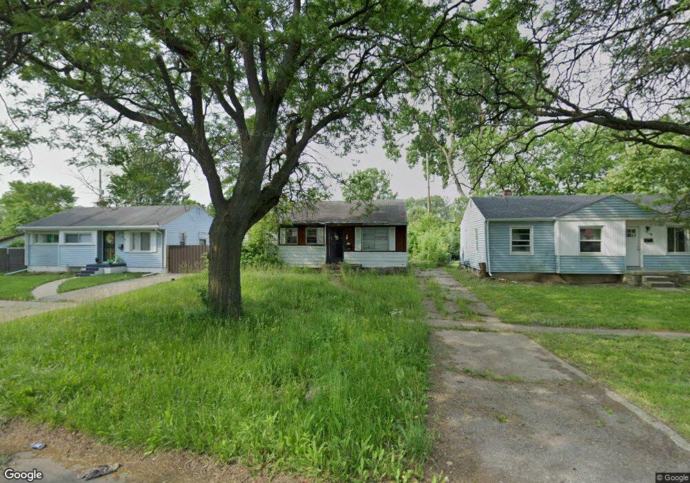
1211 W Home Ave Flint, MI 48505
Bel-Aire Woods NeighborhoodEstimated Value: $49,000 - $83,640
3
Beds
2
Baths
1,337
Sq Ft
$53/Sq Ft
Est. Value
About This Home
This home is located at 1211 W Home Ave, Flint, MI 48505 and is currently estimated at $70,547, approximately $52 per square foot. 1211 W Home Ave is a home located in Genesee County with nearby schools including Brownell STEM Academy, The New Standard Academy, and Eagle's Nest Academy.
Ownership History
Date
Name
Owned For
Owner Type
Purchase Details
Closed on
Dec 20, 2022
Sold by
Genesee County Treasurer
Bought by
Genesee County Land Bank Authority
Current Estimated Value
Purchase Details
Closed on
Apr 26, 2022
Sold by
Bell Chloe P
Bought by
Genesee County Treasurer
Purchase Details
Closed on
Dec 21, 2011
Sold by
Genesee County Treasurer
Bought by
Genesee County Land Bank
Purchase Details
Closed on
Dec 1, 2005
Sold by
Menifee Lanessa
Bought by
Burkina Holding Corp
Purchase Details
Closed on
Oct 1, 2004
Sold by
Menifee Lanessa and Robinson Lanessa
Bought by
Quality Real Estate & Investment Inc
Purchase Details
Closed on
Sep 3, 2004
Sold by
M Iii Enterprise Inc
Bought by
Menifee Lanessa
Purchase Details
Closed on
May 14, 2004
Sold by
Quality Real Estate & Investment Inc
Bought by
Miii Enterprise Inc
Purchase Details
Closed on
Dec 4, 2002
Sold by
Bradley Nina Francis Austin
Bought by
The Provident Bank and Provident Consumer
Create a Home Valuation Report for This Property
The Home Valuation Report is an in-depth analysis detailing your home's value as well as a comparison with similar homes in the area
Home Values in the Area
Average Home Value in this Area
Purchase History
| Date | Buyer | Sale Price | Title Company |
|---|---|---|---|
| Genesee County Land Bank Authority | -- | -- | |
| Genesee County Treasurer | -- | -- | |
| Genesee County Land Bank | -- | None Available | |
| Burkina Holding Corp | $500 | None Available | |
| Quality Real Estate & Investment Inc | -- | -- | |
| Menifee Lanessa | $71,000 | First American Title Ins Co | |
| Miii Enterprise Inc | -- | Stewart Title Guaranty Compa | |
| Quality Real Estate & Investment Inc | $25,000 | Greco Title | |
| The Provident Bank | $34,935 | -- |
Source: Public Records
Tax History
| Year | Tax Paid | Tax Assessment Tax Assessment Total Assessment is a certain percentage of the fair market value that is determined by local assessors to be the total taxable value of land and additions on the property. | Land | Improvement |
|---|---|---|---|---|
| 2025 | -- | $0 | $0 | $0 |
| 2024 | -- | $0 | $0 | $0 |
| 2023 | -- | $0 | $0 | $0 |
| 2022 | $0 | $1,800 | $0 | $0 |
| 2021 | $132 | $1,800 | $0 | $0 |
| 2020 | $128 | $1,200 | $0 | $0 |
| 2019 | $129 | $1,200 | $0 | $0 |
| 2018 | $92 | $1,500 | $0 | $0 |
| 2017 | $20 | $0 | $0 | $0 |
| 2016 | $28 | $0 | $0 | $0 |
| 2015 | -- | $0 | $0 | $0 |
| 2014 | -- | $0 | $0 | $0 |
| 2012 | -- | $0 | $0 | $0 |
Source: Public Records
Map
Nearby Homes
- 1511 W Home Ave
- 5518 Winthrop Blvd
- 5610 Baldwin Blvd
- 5502 Susan St
- 6611 Sally Ct
- 1709 W Home Ave
- 5413 Fleming Rd
- 5714 Suburban Ct
- 1720 Marlowe Dr
- 536 W Home Ave
- 6609 Cranwood Dr
- 5620 Marlowe Dr
- 5416 Dupont St
- 618 W Austin Ave
- 610 W Austin Ave
- 6714 Cranwood Dr
- 1816 Russet Place
- 613 W Foss Ave
- 605 W Foss Ave
- 518 W Ruth Ave
Your Personal Tour Guide
Ask me questions while you tour the home.