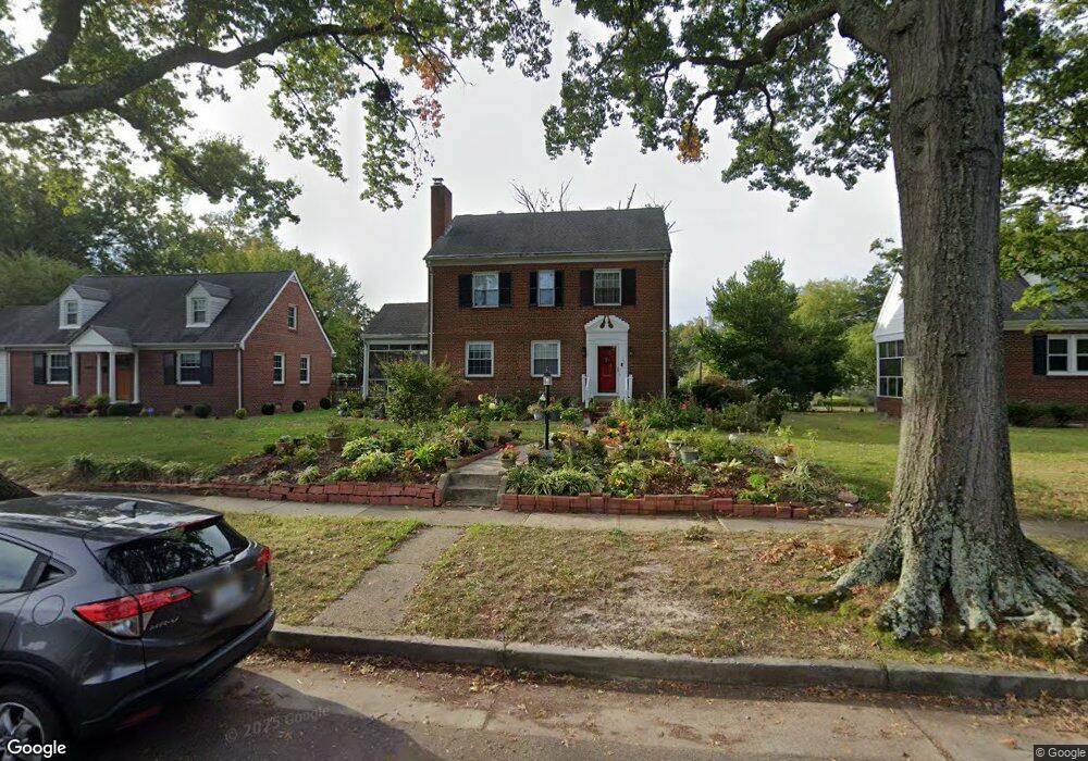
1211 Whitby Rd Richmond, VA 23227
Sherwood Park NeighborhoodEstimated Value: $510,958 - $597,000
Studio
2
Baths
1,792
Sq Ft
$314/Sq Ft
Est. Value
About This Home
This home is located at 1211 Whitby Rd, Richmond, VA 23227 and is currently estimated at $562,490, approximately $313 per square foot. 1211 Whitby Rd is a home located in Richmond City with nearby schools including Linwood Holton Elementary School, Henderson Middle School, and John Marshall High School.
Ownership History
Date
Name
Owned For
Owner Type
Purchase Details
Closed on
Jun 3, 1996
Sold by
Moulder Wayne M and Moulder Margaret S
Bought by
Clark Lynne D
Current Estimated Value
Home Financials for this Owner
Home Financials are based on the most recent Mortgage that was taken out on this home.
Original Mortgage
$132,200
Outstanding Balance
$8,377
Interest Rate
7.91%
Mortgage Type
FHA
Estimated Equity
$554,113
Create a Home Valuation Report for This Property
The Home Valuation Report is an in-depth analysis detailing your home's value as well as a comparison with similar homes in the area
Home Values in the Area
Average Home Value in this Area
Purchase History
| Date | Buyer | Sale Price | Title Company |
|---|---|---|---|
| Clark Lynne D | $133,000 | -- |
Source: Public Records
Mortgage History
| Date | Status | Borrower | Loan Amount |
|---|---|---|---|
| Open | Clark Lynne D | $132,200 |
Source: Public Records
Tax History
| Year | Tax Paid | Tax Assessment Tax Assessment Total Assessment is a certain percentage of the fair market value that is determined by local assessors to be the total taxable value of land and additions on the property. | Land | Improvement |
|---|---|---|---|---|
| 2025 | $5,556 | $475,000 | $165,000 | $310,000 |
| 2024 | $5,556 | $463,000 | $155,000 | $308,000 |
| 2023 | $5,184 | $432,000 | $135,000 | $297,000 |
| 2022 | $4,464 | $372,000 | $95,000 | $277,000 |
| 2020 | $4,116 | $343,000 | $75,000 | $268,000 |
| 2019 | $3,840 | $320,000 | $75,000 | $245,000 |
| 2018 | $3,636 | $303,000 | $75,000 | $228,000 |
| 2017 | $3,276 | $273,000 | $65,000 | $208,000 |
| 2016 | $3,036 | $253,000 | $60,000 | $193,000 |
| 2015 | $2,964 | $252,000 | $60,000 | $192,000 |
| 2014 | $2,964 | $247,000 | $60,000 | $187,000 |
Source: Public Records
Map
Nearby Homes
- 1215 Whitby Rd
- 3014 Seminary Ave
- 2701 Northumberland Ave
- 2920 Hawthorne Ave
- 1350 Westwood Ave Unit U302
- 1350 Westwood Ave Unit U307
- 1350 Westwood Ave Unit U103
- 3102 Moss Side Ave
- 1306 Overbrook Rd
- 815 Edge Hill Rd
- 1473 Overbrook Rd
- 3012 Edgewood Ave
- 3104 Edgewood Ave
- 2439 Ownby Ln Unit B13
- 3410 Montrose Ave
- 2714 Edgewood Ave
- 3122 Griffin Ave
- 1708 Westwood Ave
- 3215 Edgewood Ave
- 3202 Griffin Ave
- 1209 Whitby Rd
- 1213 Whitby Rd
- 1207 Whitby Rd
- 1212 Brookland Pkwy
- 1205 Whitby Rd
- 1210 Brookland Pkwy
- 1217 Whitby Rd
- 1214 Brookland Pkwy
- 1208 Brookland Pkwy
- 1210 Whitby Rd
- 1216 Brookland Pkwy
- 1208 Whitby Rd
- 1212 Whitby Rd
- 1206 Whitby Rd
- 1206 Brookland Pkwy
- 1203 Whitby Rd
- 1219 Whitby Rd
- 1214 Whitby Rd
- 1218 Brookland Pkwy
- 1204 Whitby Rd
Your Personal Tour Guide
Ask me questions while you tour the home.