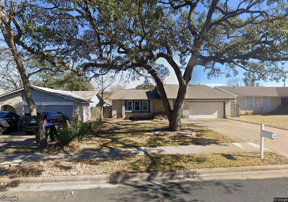
12111 Grey Rock Ln Austin, TX 78750
Anderson Mill NeighborhoodEstimated Value: $385,000 - $420,000
4
Beds
2
Baths
1,476
Sq Ft
$269/Sq Ft
Est. Value
About This Home
This home is located at 12111 Grey Rock Ln, Austin, TX 78750 and is currently estimated at $396,864, approximately $268 per square foot. 12111 Grey Rock Ln is a home located in Williamson County with nearby schools including Purple Sage Elementary School, Noel Grisham Middle, and Westwood High School.
Ownership History
Date
Name
Owned For
Owner Type
Purchase Details
Closed on
Nov 20, 2009
Sold by
Lindenmuth Real Estate Partners Vi Ltd
Bought by
Warn April C and Martin Ryan G
Current Estimated Value
Home Financials for this Owner
Home Financials are based on the most recent Mortgage that was taken out on this home.
Original Mortgage
$117,200
Interest Rate
5.11%
Mortgage Type
New Conventional
Purchase Details
Closed on
Jul 8, 2009
Sold by
Ecounty Foreclosures Inc
Bought by
Lindenmuth Real Estate Partners Vi Ltd
Purchase Details
Closed on
Jun 9, 2009
Sold by
Litz Katherine and Litz Frederick C
Bought by
Ecounty Foreclosures Inc
Purchase Details
Closed on
Jan 10, 2008
Sold by
Litz Katherine
Bought by
Litz Michael
Create a Home Valuation Report for This Property
The Home Valuation Report is an in-depth analysis detailing your home's value as well as a comparison with similar homes in the area
Home Values in the Area
Average Home Value in this Area
Purchase History
| Date | Buyer | Sale Price | Title Company |
|---|---|---|---|
| Warn April C | -- | Itc | |
| Lindenmuth Real Estate Partners Vi Ltd | -- | None Available | |
| Ecounty Foreclosures Inc | $113,365 | None Available | |
| Litz Michael | -- | None Available |
Source: Public Records
Mortgage History
| Date | Status | Borrower | Loan Amount |
|---|---|---|---|
| Previous Owner | Warn April C | $117,200 |
Source: Public Records
Tax History Compared to Growth
Tax History
| Year | Tax Paid | Tax Assessment Tax Assessment Total Assessment is a certain percentage of the fair market value that is determined by local assessors to be the total taxable value of land and additions on the property. | Land | Improvement |
|---|---|---|---|---|
| 2025 | $5,569 | $375,960 | $88,500 | $287,460 |
| 2024 | $5,569 | $345,496 | $88,500 | $256,996 |
| 2023 | $5,621 | $353,911 | $0 | $0 |
| 2022 | $6,908 | $321,737 | $0 | $0 |
| 2021 | $7,185 | $292,488 | $72,000 | $255,872 |
| 2020 | $6,326 | $265,898 | $66,598 | $199,300 |
| 2019 | $6,237 | $254,986 | $60,700 | $194,286 |
| 2018 | $5,224 | $233,667 | $54,891 | $178,776 |
| 2017 | $5,448 | $218,284 | $51,300 | $166,984 |
| 2016 | $5,002 | $200,399 | $51,300 | $180,926 |
| 2015 | $3,972 | $182,181 | $42,200 | $161,747 |
| 2014 | $3,972 | $165,619 | $0 | $0 |
Source: Public Records
Map
Nearby Homes
- 1028 Verbena Dr
- 12106 Grey Fawn Path
- 12206 Saber Trail
- 11811 Buggy Whip Trail
- 11908 Stout Oak Trail
- 11007 Opal Trail
- 12306 Split Rail Pkwy
- 11100 Alison Parke Trail
- 12300 Wipple Tree Cove
- 10606 Mourning Dove Dr
- 11405 Bristle Oak Trail
- 11010 Froke Cedar Trail
- 12306 Double Tree Ln
- 12314 Double Tree Ln
- 12208 Double Tree Ln
- 10404 Mourning Dove Dr
- 11533 Sandy Loam Trail
- 12319 Double Tree Ln
- 10408 Firethorn Ln
- 11512 Powder Mill Trail
- 12109 Grey Rock Ln
- 12113 Grey Rock Ln
- 1062 Verbena Dr
- 1064 Verbena Dr
- 1060 Verbena Dr
- 12107 Grey Rock Ln
- 12115 Grey Rock Ln
- 1066 Verbena Dr
- 12108 Grey Rock Ln
- 1058 Verbena Dr
- 12110 Grey Rock Ln
- 1068 Verbena Dr
- 1070 Verbena Dr
- 1070 Verbena Dr Unit 1336A
- 12106 Grey Rock Ln
- 1056 Verbena Dr
- 12112 Grey Rock Ln
- 12105 Grey Rock Ln
- 12117 Grey Rock Ln
- 1072 Verbena Dr