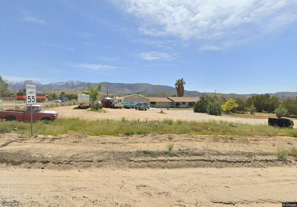
12112 Fort Tejon Rd Pearblossom, CA 93553
Southeast Antelope Valley NeighborhoodEstimated Value: $444,000 - $504,000
3
Beds
3
Baths
2,069
Sq Ft
$232/Sq Ft
Est. Value
About This Home
This home is located at 12112 Fort Tejon Rd, Pearblossom, CA 93553 and is currently estimated at $480,337, approximately $232 per square foot. 12112 Fort Tejon Rd is a home located in Los Angeles County with nearby schools including Pearblossom Elementary School, Keppel Academy, and Littlerock High School.
Ownership History
Date
Name
Owned For
Owner Type
Purchase Details
Closed on
Jun 24, 2011
Sold by
Lockheed Federal Credit Union
Bought by
Rogers John E and Rogers Linda S
Current Estimated Value
Home Financials for this Owner
Home Financials are based on the most recent Mortgage that was taken out on this home.
Original Mortgage
$166,250
Outstanding Balance
$113,636
Interest Rate
4.45%
Mortgage Type
New Conventional
Estimated Equity
$366,701
Purchase Details
Closed on
Apr 5, 2010
Sold by
Burris Mary and Burris David
Bought by
Lockheed Federal Credit Union
Purchase Details
Closed on
Mar 29, 2002
Sold by
Challman Paul B and Challman Michele L
Bought by
Burris David
Home Financials for this Owner
Home Financials are based on the most recent Mortgage that was taken out on this home.
Original Mortgage
$175,920
Interest Rate
7.13%
Create a Home Valuation Report for This Property
The Home Valuation Report is an in-depth analysis detailing your home's value as well as a comparison with similar homes in the area
Home Values in the Area
Average Home Value in this Area
Purchase History
| Date | Buyer | Sale Price | Title Company |
|---|---|---|---|
| Rogers John E | $175,000 | Chicago Title Company | |
| Lockheed Federal Credit Union | $180,000 | Fidelity Natl Title Ins Co | |
| Burris David | $220,000 | Chicago Title Co |
Source: Public Records
Mortgage History
| Date | Status | Borrower | Loan Amount |
|---|---|---|---|
| Open | Rogers John E | $166,250 | |
| Previous Owner | Burris David | $175,920 |
Source: Public Records
Tax History
| Year | Tax Paid | Tax Assessment Tax Assessment Total Assessment is a certain percentage of the fair market value that is determined by local assessors to be the total taxable value of land and additions on the property. | Land | Improvement |
|---|---|---|---|---|
| 2025 | $3,218 | $268,156 | $66,565 | $201,591 |
| 2024 | $3,218 | $262,899 | $65,260 | $197,639 |
| 2023 | $3,089 | $257,745 | $63,981 | $193,764 |
| 2022 | $3,001 | $252,692 | $62,727 | $189,965 |
| 2021 | $2,941 | $247,739 | $61,498 | $186,241 |
| 2019 | $2,856 | $240,393 | $59,675 | $180,718 |
| 2018 | $2,834 | $235,680 | $58,505 | $177,175 |
| 2016 | $2,652 | $226,530 | $56,234 | $170,296 |
| 2015 | $2,615 | $223,128 | $55,390 | $167,738 |
| 2014 | $2,620 | $218,758 | $54,305 | $164,453 |
Source: Public Records
Map
Nearby Homes
- 11250 Fort Tejon Rd
- 0 121st East & Ave X Unit 23004069
- 12332 E Avenue X
- 124 E Avenue X 12
- 0 Avenue West 14
- 0 E 126th St Unit 25008459
- 000 E Cor 126 Ste Pav Ave W14 Ste Ave
- 0 E
- 0 Vic Ave X-12
- 0 Ft Tejon and Butterfield Unit 24005448
- 0 Vac Pearblossom Hw Vic Longvie Unit SR25259359
- 0 Vic Ave Y4 126 St E Lot 2 St E
- 0 E Ave Y 12 Unit 25003571
- 0 Cor Avenue W8 Pav 126 Ste
- 0 126th St Unit JT25253691
- 131st 116th St E
- 0 Longview Rd
- 0 Vic Longview Ave Unit W11
- Cor 121 E V14 St
- 0 E Vac Vic Ave Unit T8/126
- 12100 Fort Tejon Rd
- 12144 Fort Tejon Rd
- 32420 121st St E
- 12111 Fort Tejon Rd
- 12143 Fort Tejon Rd
- 1 Fort Tejon & 121st St E
- 32515 121st St E
- 32323 122nd St E
- 32314 121st St E
- 12133 E Avenue x8
- 32534 121st St E
- 0 121st E & Ave X 8 Unit 24003195
- 32258 121st St E
- 0 E Avenue X 8
- 12140 E Avenue x8
- 32626 121st St E
- 32238 121st St E
- 32639 Delbana Ave
- 0 Vic 116 Ste Ave X8
- 0 122nd Unit PW18115086
Your Personal Tour Guide
Ask me questions while you tour the home.