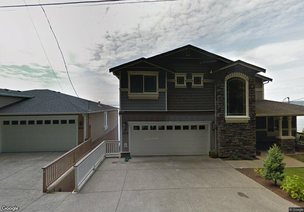
12112 Possession Ln Edmonds, WA 98026
Wind and Tide NeighborhoodEstimated Value: $1,757,360 - $2,393,000
3
Beds
3
Baths
3,300
Sq Ft
$646/Sq Ft
Est. Value
About This Home
This home is located at 12112 Possession Ln, Edmonds, WA 98026 and is currently estimated at $2,131,787, approximately $645 per square foot. 12112 Possession Ln is a home located in Snohomish County with nearby schools including Picnic Point Elementary School, Harbour Pointe Middle School, and Kamiak High School.
Ownership History
Date
Name
Owned For
Owner Type
Purchase Details
Closed on
Oct 21, 2009
Sold by
Begis Jacob
Bought by
Mcnutt Laurence P and Mcnutt Gail M
Current Estimated Value
Home Financials for this Owner
Home Financials are based on the most recent Mortgage that was taken out on this home.
Original Mortgage
$124,500
Outstanding Balance
$36,464
Interest Rate
5.05%
Mortgage Type
Stand Alone Second
Estimated Equity
$2,095,323
Purchase Details
Closed on
Oct 26, 2006
Sold by
Welch Helen Marie and Pearce Helen Welch
Bought by
Begis Jacob
Home Financials for this Owner
Home Financials are based on the most recent Mortgage that was taken out on this home.
Original Mortgage
$80,000
Interest Rate
6.28%
Mortgage Type
Seller Take Back
Create a Home Valuation Report for This Property
The Home Valuation Report is an in-depth analysis detailing your home's value as well as a comparison with similar homes in the area
Home Values in the Area
Average Home Value in this Area
Purchase History
| Date | Buyer | Sale Price | Title Company |
|---|---|---|---|
| Mcnutt Laurence P | $865,000 | Stewart Title Of Island Coun | |
| Begis Jacob | $125,000 | Chicago Title |
Source: Public Records
Mortgage History
| Date | Status | Borrower | Loan Amount |
|---|---|---|---|
| Open | Mcnutt Laurence P | $124,500 | |
| Open | Mcnutt Laurence P | $567,500 | |
| Previous Owner | Begis Jacob | $80,000 |
Source: Public Records
Tax History Compared to Growth
Tax History
| Year | Tax Paid | Tax Assessment Tax Assessment Total Assessment is a certain percentage of the fair market value that is determined by local assessors to be the total taxable value of land and additions on the property. | Land | Improvement |
|---|---|---|---|---|
| 2025 | $13,293 | $1,642,600 | $645,500 | $997,100 |
| 2024 | $13,293 | $1,598,400 | $631,100 | $967,300 |
| 2023 | $14,970 | $1,885,300 | $696,200 | $1,189,100 |
| 2022 | $14,408 | $1,537,400 | $527,400 | $1,010,000 |
| 2020 | $12,879 | $1,332,600 | $494,300 | $838,300 |
| 2019 | $11,418 | $1,185,900 | $438,000 | $747,900 |
| 2018 | $11,789 | $1,067,900 | $397,800 | $670,100 |
| 2017 | $11,450 | $1,063,700 | $389,800 | $673,900 |
| 2016 | $10,234 | $944,500 | $312,800 | $631,700 |
| 2015 | $10,418 | $880,800 | $291,800 | $589,000 |
| 2013 | $9,455 | $750,300 | $283,500 | $466,800 |
Source: Public Records
Map
Nearby Homes
- 12104 Possession Ln
- 11902 Possession Ln
- 12011 Marine View Dr
- 12117 Clearview Dr
- 6523 128th Place SW
- 6509 128th Place SW
- 6053 Championship Ct
- 12807 60th Ave W
- 11017 Villa Rosa Ln Unit 11017
- 10961 Villa Monte Ct Unit 10961
- 6625 136th Place SW
- 5824 111th Place SW
- 5615 114th St SW
- 5500 Harbour Pointe Blvd Unit B202
- 5500 Harbour Pointe Blvd Unit R103
- 13813 68th Ave W
- 12303 Harbour Pointe Blvd Unit W101
- 106 Xx MacArthur Ln
- 5400 Harbour Pointe Blvd Unit F 201
- 13802 60th Ave W
- 12118 Possession Ln
- 12126 Possession Ln
- 12028 Possession Ln
- 12132 Possession Ln
- 12204 Possession Ln
- 12024 Possession Ln
- 12208 Possession Ln
- 12016 Possession Ln
- 12210 Possession Ln
- 12010 Possession Ln
- 12215 Possession Ln
- 12212 Possession Ln
- 12002 Possession Ln
- 11928 Possession Ln
- 12102 Marine View Dr
- 11920 Possession Ln
- 12309 Possession Ln
- 12308 Possession Ln
- 12022 Marine View Dr
- 11916 Possession Ln