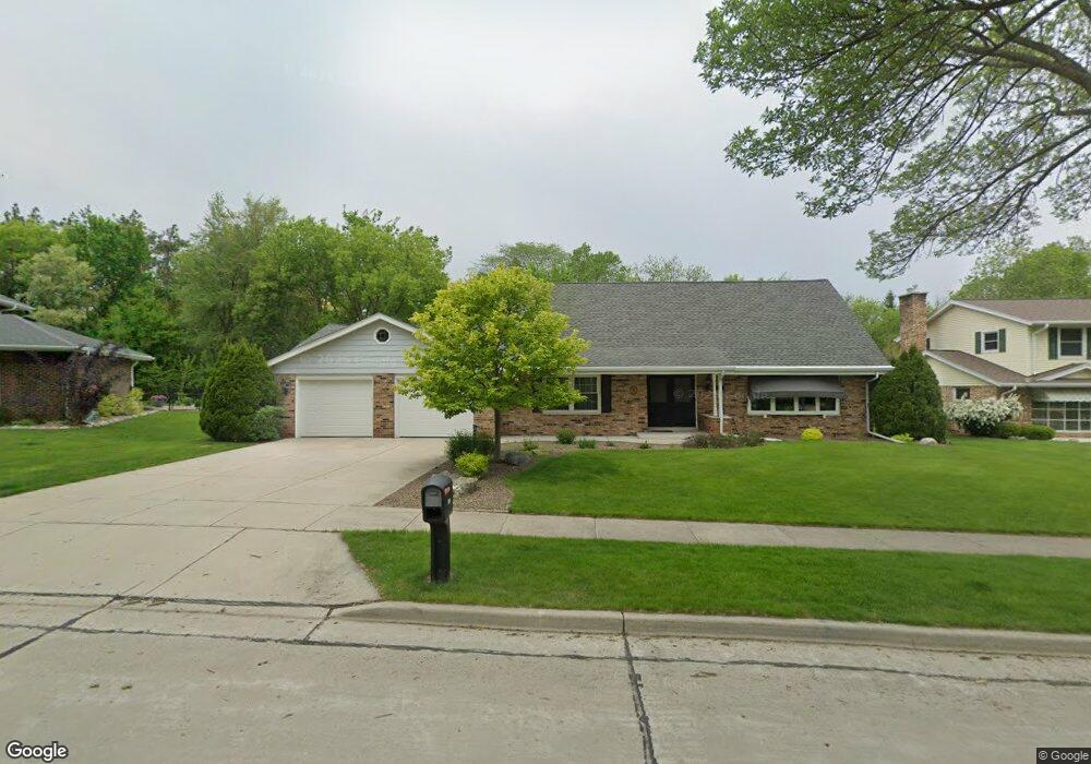
12112 W Holt Ave Milwaukee, WI 53227
Orchard Hills NeighborhoodEstimated Value: $439,000 - $453,271
3
Beds
3
Baths
2,471
Sq Ft
$181/Sq Ft
Est. Value
About This Home
This home is located at 12112 W Holt Ave, Milwaukee, WI 53227 and is currently estimated at $446,068, approximately $180 per square foot. 12112 W Holt Ave is a home located in Milwaukee County with nearby schools including Hoover Elementary School, Lane Intermediate School, and Nathan Hale High School.
Ownership History
Date
Name
Owned For
Owner Type
Purchase Details
Closed on
Aug 31, 2022
Sold by
Clark Wayne B and Clark Peter W
Bought by
Clark Wayne B and Clark Peter W
Current Estimated Value
Purchase Details
Closed on
Oct 6, 2021
Sold by
Clark Wayne B
Bought by
Clark Wayne B and Clark Peter W
Home Financials for this Owner
Home Financials are based on the most recent Mortgage that was taken out on this home.
Original Mortgage
$90,400
Interest Rate
2.8%
Mortgage Type
New Conventional
Create a Home Valuation Report for This Property
The Home Valuation Report is an in-depth analysis detailing your home's value as well as a comparison with similar homes in the area
Home Values in the Area
Average Home Value in this Area
Purchase History
| Date | Buyer | Sale Price | Title Company |
|---|---|---|---|
| Clark Wayne B | -- | None Listed On Document | |
| Clark Wayne B | $87,800 | None Available |
Source: Public Records
Mortgage History
| Date | Status | Borrower | Loan Amount |
|---|---|---|---|
| Previous Owner | Clark Wayne B | $90,400 |
Source: Public Records
Tax History Compared to Growth
Tax History
| Year | Tax Paid | Tax Assessment Tax Assessment Total Assessment is a certain percentage of the fair market value that is determined by local assessors to be the total taxable value of land and additions on the property. | Land | Improvement |
|---|---|---|---|---|
| 2024 | $6,728 | $342,600 | $84,800 | $257,800 |
| 2023 | $6,419 | $236,600 | $40,700 | $195,900 |
| 2022 | $6,440 | $236,600 | $40,700 | $195,900 |
| 2021 | $6,301 | $236,600 | $40,700 | $195,900 |
| 2020 | $6,388 | $236,600 | $40,700 | $195,900 |
| 2019 | $6,177 | $236,600 | $40,700 | $195,900 |
| 2018 | $6,957 | $236,600 | $40,700 | $195,900 |
| 2017 | $6,485 | $236,600 | $40,700 | $195,900 |
| 2016 | $6,276 | $236,600 | $40,700 | $195,900 |
| 2015 | $6,264 | $236,600 | $40,700 | $195,900 |
| 2014 | $6,834 | $257,900 | $40,700 | $217,200 |
Source: Public Records
Map
Nearby Homes
- 11924 W Ohio Ave
- 3239 S 121st St
- 3129 S 122nd St Unit 18
- 12720 W Verona Dr
- 12520 W Crawford Dr
- 3470 S 129th St
- 2938 S Waukesha Rd
- 2902 S 124th St
- 12374 W Waterford Ave Unit 4
- 13196 W National Ave
- 11444 W Montana Ave
- 4052 S 124th St
- 4120 S 124th St
- 2544 S Seymour Place
- 3817 S Oakbrook Dr Unit 3817
- 4013 S 106th St
- 14048 Waters Edge Trail Unit 14048
- 14068 W Tiffany Place
- 14128 Waterford Square Dr Unit 14128
- 9851 W Beloit Rd Unit C8
- 12124 W Holt Ave
- 12119 W Holt Ave
- 12102 W Holt Ave
- 12107 W Holt Ave
- 12136 W Holt Ave
- 12143 W Holt Ave
- 12040 W Holt Ave
- 12045 W Holt Ave
- 3420 S 122nd St
- 3380 S 122nd St
- 12028 W Holt Ave
- 12035 W Holt Ave
- 12021 W Ohio Ave
- 12011 W Ohio Ave
- 3393 S 122nd St
- 12209 W Holt Ave
- 12045 W Ohio Ave
- 12023 W Holt Ave
- 12144 W Verona Ct
- 11965 W Ohio Ave