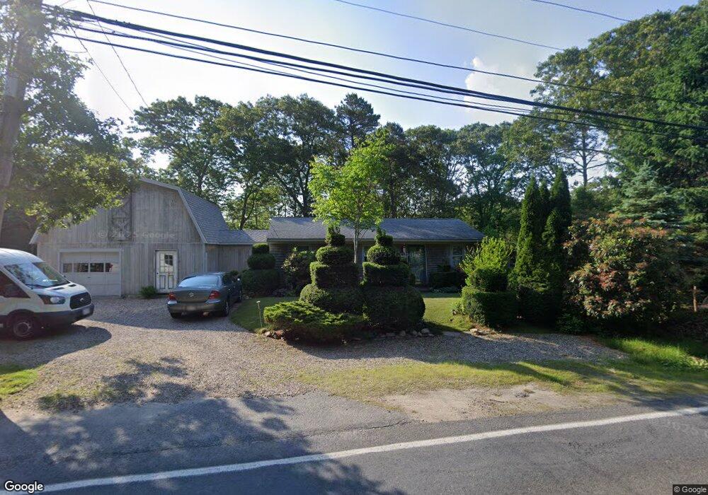
1212 Cotuit Rd Marstons Mills, MA 02648
Marstons Mills NeighborhoodEstimated Value: $519,000 - $568,000
3
Beds
1
Bath
1,072
Sq Ft
$500/Sq Ft
Est. Value
About This Home
This home is located at 1212 Cotuit Rd, Marstons Mills, MA 02648 and is currently estimated at $536,342, approximately $500 per square foot. 1212 Cotuit Rd is a home located in Barnstable County with nearby schools including West Villages Elementary School, Barnstable United Elementary School, and Barnstable Intermediate School.
Ownership History
Date
Name
Owned For
Owner Type
Purchase Details
Closed on
Feb 7, 2011
Sold by
Nakrosis Paul
Bought by
Nakrosis Paul
Current Estimated Value
Purchase Details
Closed on
Jan 15, 1983
Bought by
Thomas Paul D and Thomas Carolyn C
Create a Home Valuation Report for This Property
The Home Valuation Report is an in-depth analysis detailing your home's value as well as a comparison with similar homes in the area
Home Values in the Area
Average Home Value in this Area
Purchase History
| Date | Buyer | Sale Price | Title Company |
|---|---|---|---|
| Nakrosis Paul | -- | -- | |
| Thomas Paul D | $45,000 | -- |
Source: Public Records
Mortgage History
| Date | Status | Borrower | Loan Amount |
|---|---|---|---|
| Previous Owner | Thomas Paul D | $52,000 |
Source: Public Records
Tax History Compared to Growth
Tax History
| Year | Tax Paid | Tax Assessment Tax Assessment Total Assessment is a certain percentage of the fair market value that is determined by local assessors to be the total taxable value of land and additions on the property. | Land | Improvement |
|---|---|---|---|---|
| 2025 | $3,910 | $483,300 | $155,900 | $327,400 |
| 2024 | $3,768 | $482,400 | $155,900 | $326,500 |
| 2023 | $3,516 | $421,600 | $141,700 | $279,900 |
| 2022 | $1,138 | $348,400 | $105,000 | $243,400 |
| 2021 | $3,184 | $303,500 | $105,000 | $198,500 |
| 2020 | $3,247 | $296,300 | $105,000 | $191,300 |
| 2019 | $3,065 | $271,700 | $105,000 | $166,700 |
| 2018 | $2,803 | $249,800 | $110,500 | $139,300 |
| 2017 | $2,604 | $242,000 | $110,500 | $131,500 |
| 2016 | $2,649 | $243,000 | $111,500 | $131,500 |
| 2015 | $2,563 | $236,200 | $109,000 | $127,200 |
Source: Public Records
Map
Nearby Homes
- 32 Willington Ave
- 68 Lakeside Dr
- 38 Lakeside Dr
- 128 Lakeside Dr
- 5 Conaumet Rd
- 1028 Old Falmouth Rd
- 1044 Old Falmouth Rd
- 34 Mistic Dr
- 50 Currycomb Cir
- 74 Saddler Ln
- 87 Foxglove Rd
- 7 Ebenezer
- 90 Guildford Rd
- 6 George Gallant Rd
- 3040 Falmouth Rd Unit H
- 3040 Falmouth Rd Unit H
- 120 Great Hill Dr
- 315 Blackthorn Rd
- 515 Cedar St
- 75 Old Toll Rd
- 80 New London Rd
- 1200 Cotuit Rd
- 1230 Cotuit Rd
- 777 Race Ln
- 73 New London Rd
- 765 Race Ln
- 60 New London Rd
- 221 Route 149
- 46 Route 149
- 223 Route 149
- 1170 Rt-149
- 42 Wheeler Rd
- 57 New London Rd
- 25 Norwich Rd
- 1170 Cotuit Rd
- 0 U Connecticut Rd
- 0 Rte 149 Unit 5014290
- 0 Rte 149 Unit 195A 2037681
- 0 Rte 149 Unit 195A
- 0 U Conn Unit 71818918