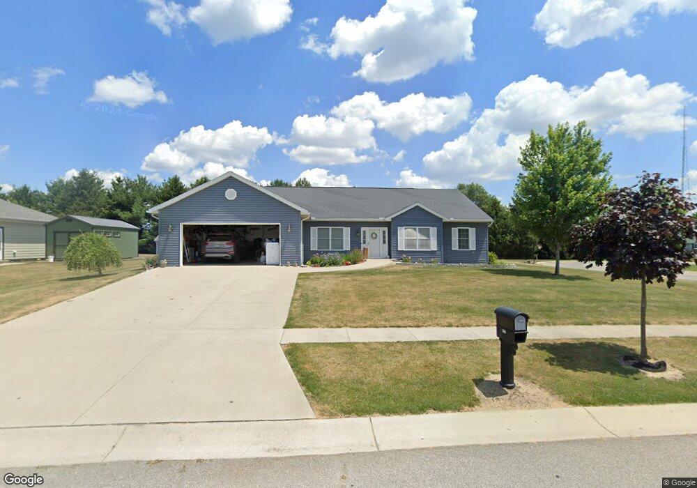
1212 Lillian Ln Unit 31 Wauseon, OH 43567
Estimated Value: $349,000 - $416,000
3
Beds
2
Baths
2,188
Sq Ft
$173/Sq Ft
Est. Value
About This Home
This home is located at 1212 Lillian Ln Unit 31, Wauseon, OH 43567 and is currently estimated at $377,530, approximately $172 per square foot. 1212 Lillian Ln Unit 31 is a home located in Fulton County with nearby schools including Wauseon Primary School, Wauseon Elementary School, and Wauseon Middle School.
Ownership History
Date
Name
Owned For
Owner Type
Purchase Details
Closed on
Dec 8, 2020
Sold by
Shroades Molly M and Gase Molly M
Bought by
Lowe Suzan M
Current Estimated Value
Home Financials for this Owner
Home Financials are based on the most recent Mortgage that was taken out on this home.
Original Mortgage
$195,000
Outstanding Balance
$175,991
Interest Rate
2.7%
Mortgage Type
New Conventional
Estimated Equity
$191,588
Purchase Details
Closed on
Aug 8, 2014
Sold by
Gase William L and Gase Becky L
Bought by
Gase Molly M
Purchase Details
Closed on
Jul 22, 2013
Sold by
Warncke Larry G and Warncke Neva L
Bought by
Gase William L and Gase Becky L
Create a Home Valuation Report for This Property
The Home Valuation Report is an in-depth analysis detailing your home's value as well as a comparison with similar homes in the area
Home Values in the Area
Average Home Value in this Area
Purchase History
Date | Buyer | Sale Price | Title Company |
---|---|---|---|
Lowe Suzan M | $275,000 | None Available | |
Gase Molly M | -- | Attorney | |
Gase William L | $25,000 | Attorney |
Source: Public Records
Mortgage History
Date | Status | Borrower | Loan Amount |
---|---|---|---|
Open | Lowe Suzan M | $195,000 |
Source: Public Records
Tax History Compared to Growth
Tax History
Year | Tax Paid | Tax Assessment Tax Assessment Total Assessment is a certain percentage of the fair market value that is determined by local assessors to be the total taxable value of land and additions on the property. | Land | Improvement |
---|---|---|---|---|
2024 | $4,867 | $107,740 | $11,100 | $96,640 |
2023 | $4,867 | $107,740 | $11,100 | $96,640 |
2022 | $4,062 | $78,260 | $9,240 | $69,020 |
2021 | $4,266 | $78,260 | $9,240 | $69,020 |
2020 | $4,594 | $78,260 | $9,240 | $69,020 |
2019 | $4,636 | $77,810 | $11,800 | $66,010 |
2018 | $4,271 | $77,810 | $11,800 | $66,010 |
2017 | $4,214 | $77,810 | $11,800 | $66,010 |
2016 | $4,322 | $74,660 | $11,800 | $62,860 |
2015 | $4,065 | $74,660 | $11,800 | $62,860 |
2014 | $613 | $74,660 | $11,800 | $62,860 |
2013 | $375 | $6,690 | $6,690 | $0 |
Source: Public Records
Map
Nearby Homes
- 1270 S Park Ln
- 640 Hemlock St
- 750 E Linfoot St
- 511 N Ottokee St
- 460 Airport Hwy
- 735 Hemlock St
- 238 N Franklin St
- 232 N Franklin St
- 1209 Apache Dr
- 1216 Apache Dr
- 259 W Elm St
- 745 N Harvest Ln
- 00 Glenwood
- 0 Glenwood Unit 6124946
- 13354 U S 20a
- 638 W Elm St
- 125 Cherry St
- 223 E Leggett St
- 403 W Chestnut St
- 417 Indian Rd
- 1212 Lillian Ln Unit 31
- 1212 Lillian Ln
- 1216 Lillian Ln
- 1220 Lillian Ln Unit 33
- 1220 Lillian Ln
- 1213 Lillian Ln
- 1217 Lillian Ln Unit 39
- 1217 Lillian Ln
- 0 Neva Dr Unit 6015949
- 0 Neva Dr Unit 30 4648988
- 0 Neva Dr Unit 41 4648987
- 0000 Neva Dr
- 0 Neva Dr Unit 30 4658415
- 0 Neva Dr Unit 30 5001358
- 00 Neva Dr
- 0 Neva Dr
- 0 Neva Dr Unit 6087983
- 270 Neva Dr
- 1205 Old Orchard Dr
- 305 Royal Bounty Ln