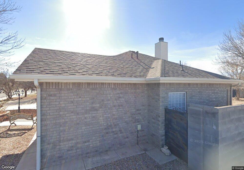
1212 Mullis St Roswell, NM 88201
Estimated Value: $319,000 - $367,000
3
Beds
2
Baths
2,185
Sq Ft
$157/Sq Ft
Est. Value
About This Home
This home is located at 1212 Mullis St, Roswell, NM 88201 and is currently estimated at $342,670, approximately $156 per square foot. 1212 Mullis St is a home located in Chaves County with nearby schools including Military Heights Elementary School, Berrendo Middle School, and Goddard High School.
Ownership History
Date
Name
Owned For
Owner Type
Purchase Details
Closed on
May 13, 2025
Sold by
Moretto Reann C and R Moretto Family 2000 Revocable Trust
Bought by
Norris Family Living Trust and Norris
Current Estimated Value
Purchase Details
Closed on
Dec 28, 2017
Sold by
Moretto Renato Elesandro Guisppe Giascomo and Moretto Reann Charlea
Bought by
Moretto Renato A and Moretto Reann C
Home Financials for this Owner
Home Financials are based on the most recent Mortgage that was taken out on this home.
Original Mortgage
$100,000
Interest Rate
3.95%
Mortgage Type
New Conventional
Create a Home Valuation Report for This Property
The Home Valuation Report is an in-depth analysis detailing your home's value as well as a comparison with similar homes in the area
Home Values in the Area
Average Home Value in this Area
Purchase History
| Date | Buyer | Sale Price | Title Company |
|---|---|---|---|
| Norris Family Living Trust | -- | None Listed On Document | |
| Moretto Renato A | -- | Landmark Title Co |
Source: Public Records
Mortgage History
| Date | Status | Borrower | Loan Amount |
|---|---|---|---|
| Previous Owner | Moretto Renato A | $100,000 |
Source: Public Records
Tax History Compared to Growth
Tax History
| Year | Tax Paid | Tax Assessment Tax Assessment Total Assessment is a certain percentage of the fair market value that is determined by local assessors to be the total taxable value of land and additions on the property. | Land | Improvement |
|---|---|---|---|---|
| 2025 | $2,430 | $92,028 | $10,240 | $81,788 |
| 2024 | $2,430 | $89,347 | $10,229 | $79,118 |
| 2023 | $2,435 | $86,745 | $10,219 | $76,526 |
| 2022 | $2,342 | $84,218 | $10,107 | $74,111 |
| 2021 | $2,324 | $81,765 | $10,015 | $71,750 |
| 2020 | $2,257 | $79,385 | $9,823 | $69,562 |
| 2019 | $2,187 | $77,072 | $9,560 | $67,512 |
| 2018 | $2,120 | $74,827 | $9,333 | $65,494 |
| 2017 | $2,086 | $74,294 | $9,333 | $64,961 |
| 2016 | $2,095 | $75,378 | $9,333 | $66,045 |
| 2015 | $2,267 | $74,125 | $9,333 | $64,792 |
| 2014 | $4,427 | $72,373 | $9,333 | $63,040 |
Source: Public Records
Map
Nearby Homes
- 1201 Saunders Dr
- 3207 Dow Dr
- 1006 de Bremond Dr
- 906 Pearson Dr
- 805 Mason Dr
- 3203 Highland Rd
- 2803 W 8th St
- 3109 Riverside Dr
- 307 N Sycamore Ave
- 00002 N Sycamore Ave
- 00001 N Sycamore Ave
- 708 N Sycamore Ave
- 2607 Riverside Dr
- 205 Pima Dr
- 00 S Balsam Ave
- 7 Oak Dr
- 4608 W 2nd St
- 2116 W 1st St
- 6399 W 2nd St
- 412 S Pine Ave
- 1210 Mullis St
- 1207 Mullis St
- 1209 Saunders Dr
- 1208 Mullis St
- 3411 Dow Dr
- 3501 Carol Ann Way
- 1211 de Bremond Dr
- 1206 Mullis Ave
- 3409 Dow Dr
- 1303 Mullis St
- 1205 Saunders Dr
- 3507 Carol Ann Way
- 1209 de Bremond Dr
- 3406 Dow Dr
- 3407 Dow Dr
- 1402 Simpson Dr
- 1206 de Bremond Dr
- 1203 Saunders Dr
- 3509 Carol Ann Way