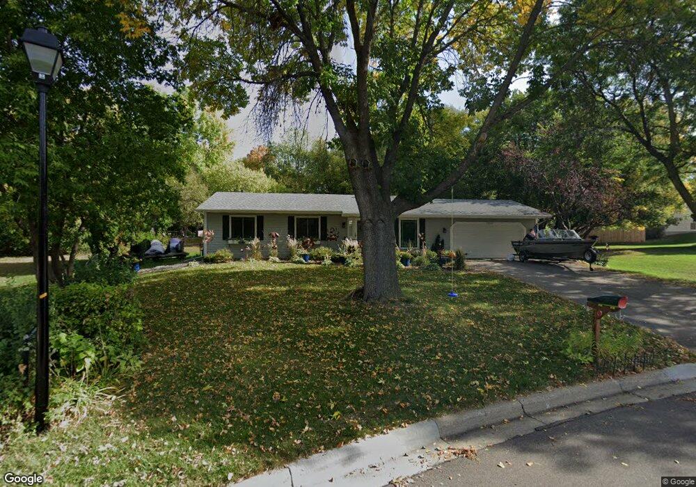
1212 W 139th St Burnsville, MN 55337
Estimated Value: $374,654 - $397,000
3
Beds
4
Baths
1,232
Sq Ft
$312/Sq Ft
Est. Value
About This Home
This home is located at 1212 W 139th St, Burnsville, MN 55337 and is currently estimated at $384,164, approximately $311 per square foot. 1212 W 139th St is a home located in Dakota County with nearby schools including Gideon Pond Elementary School, Joseph Nicollet Middle School, and Burnsville High School.
Ownership History
Date
Name
Owned For
Owner Type
Purchase Details
Closed on
Jan 25, 2013
Sold by
Pederson Curt D and Pederson Janell R
Bought by
Pederson Curt D and Pederson Janell R
Current Estimated Value
Home Financials for this Owner
Home Financials are based on the most recent Mortgage that was taken out on this home.
Original Mortgage
$221,519
Outstanding Balance
$158,106
Interest Rate
3.87%
Mortgage Type
FHA
Estimated Equity
$226,058
Purchase Details
Closed on
Apr 22, 2008
Sold by
Walker Lyndon A and Walker Renne A
Bought by
Pederson Curt D and Leblond Janell R
Purchase Details
Closed on
Nov 21, 2003
Sold by
Moen Richard J and Moen Nora
Bought by
Wokson Renre A and Walker Lyndon A
Create a Home Valuation Report for This Property
The Home Valuation Report is an in-depth analysis detailing your home's value as well as a comparison with similar homes in the area
Home Values in the Area
Average Home Value in this Area
Purchase History
| Date | Buyer | Sale Price | Title Company |
|---|---|---|---|
| Pederson Curt D | -- | All Star Title | |
| Pederson Curt D | $234,043 | -- | |
| Wokson Renre A | $239,900 | -- |
Source: Public Records
Mortgage History
| Date | Status | Borrower | Loan Amount |
|---|---|---|---|
| Open | Pederson Curt D | $221,519 |
Source: Public Records
Tax History Compared to Growth
Tax History
| Year | Tax Paid | Tax Assessment Tax Assessment Total Assessment is a certain percentage of the fair market value that is determined by local assessors to be the total taxable value of land and additions on the property. | Land | Improvement |
|---|---|---|---|---|
| 2024 | $3,472 | $315,400 | $90,900 | $224,500 |
| 2023 | $3,472 | $314,500 | $97,200 | $217,300 |
| 2022 | $2,992 | $315,900 | $97,000 | $218,900 |
| 2021 | $3,042 | $265,300 | $84,300 | $181,000 |
| 2020 | $3,052 | $255,900 | $80,300 | $175,600 |
| 2019 | $2,746 | $245,600 | $76,500 | $169,100 |
| 2018 | $2,648 | $233,900 | $72,900 | $161,000 |
| 2017 | $2,409 | $220,300 | $69,400 | $150,900 |
| 2016 | $2,415 | $200,000 | $66,100 | $133,900 |
| 2015 | $2,253 | $173,457 | $57,520 | $115,937 |
| 2014 | -- | $168,661 | $56,250 | $112,411 |
| 2013 | -- | $152,638 | $50,558 | $102,080 |
Source: Public Records
Map
Nearby Homes
- 1701 W 138th St
- 1200 W 136th St
- 1725 W 140th St
- 1724 W 140th St
- 1009 Knob Hill Rd
- 1905 W 140th St
- 13631 Oakwood Curve
- 2104 W 140th St
- 2108 Friendship Ln
- 13236 Fremont Ave S
- 521 Timberland Dr
- 13212 Fremont Ave S
- 304 Valley High Rd
- 13303 Morgan Ave S
- 2408 Friendship Ln
- 1557 Summit Shores Vista
- 1598 Summit Shores Cir
- 1420 Summit Shores Dr
- 13817 Thomas Ave S
- 400 Unique Dr
- 1208 W 139th St
- 1204 W 139th St
- 1301 W 139th St
- 1305 W 139th St
- 1213 W 139th St
- 1112 W 139th St
- 13900 Fremont Ave S
- 1209 W 139th St
- 1309 W 139th St
- 1309 139th St W
- 1400 W 139th St
- 1104 W 139th St
- 13904 Fremont Ave S
- 1108 W 139th St
- 13905 Fremont Ave S
- 1405 W 139th St
- 1401 W 139th St
- 1404 W 139th St
- 1205 W 139th St
- 1409 W 139th St