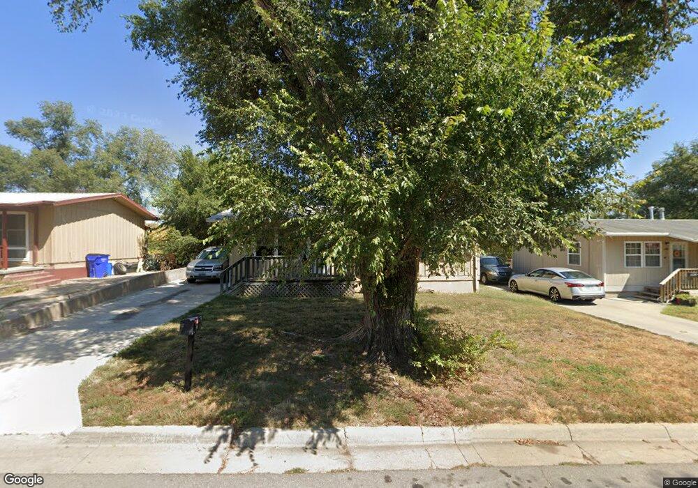
1212 W 21st St Junction City, KS 66441
Estimated Value: $122,000 - $157,000
5
Beds
2
Baths
1,850
Sq Ft
$76/Sq Ft
Est. Value
About This Home
This home is located at 1212 W 21st St, Junction City, KS 66441 and is currently estimated at $139,941, approximately $75 per square foot. 1212 W 21st St is a home located in Geary County with nearby schools including Westwood Elementary School, Junction City Middle School, and Junction City Senior High School.
Ownership History
Date
Name
Owned For
Owner Type
Purchase Details
Closed on
Jan 12, 2023
Sold by
Exchange Bank
Bought by
Burke David R and Gearhart Kristen M
Current Estimated Value
Home Financials for this Owner
Home Financials are based on the most recent Mortgage that was taken out on this home.
Original Mortgage
$99,000
Outstanding Balance
$66,459
Interest Rate
6.49%
Mortgage Type
Seller Take Back
Estimated Equity
$73,482
Purchase Details
Closed on
Dec 9, 2022
Sold by
Redemption Investment Group Llc
Bought by
Exchange Bank
Home Financials for this Owner
Home Financials are based on the most recent Mortgage that was taken out on this home.
Original Mortgage
$99,000
Outstanding Balance
$66,459
Interest Rate
6.49%
Mortgage Type
Seller Take Back
Estimated Equity
$73,482
Purchase Details
Closed on
Apr 19, 2021
Sold by
Redemption Investment Group Llc
Bought by
Bibbs Charles N L and Bibbs Cathyy L
Create a Home Valuation Report for This Property
The Home Valuation Report is an in-depth analysis detailing your home's value as well as a comparison with similar homes in the area
Home Values in the Area
Average Home Value in this Area
Purchase History
| Date | Buyer | Sale Price | Title Company |
|---|---|---|---|
| Burke David R | -- | Junction City Abstract Title | |
| Exchange Bank | -- | -- | |
| Bibbs Charles N L | -- | None Available |
Source: Public Records
Mortgage History
| Date | Status | Borrower | Loan Amount |
|---|---|---|---|
| Open | Burke David R | $99,000 |
Source: Public Records
Tax History Compared to Growth
Tax History
| Year | Tax Paid | Tax Assessment Tax Assessment Total Assessment is a certain percentage of the fair market value that is determined by local assessors to be the total taxable value of land and additions on the property. | Land | Improvement |
|---|---|---|---|---|
| 2025 | $2,044 | $14,882 | $1,329 | $13,553 |
| 2024 | $1,844 | $13,908 | $1,272 | $12,636 |
| 2023 | $1,925 | $13,373 | $1,196 | $12,177 |
| 2022 | $0 | $11,629 | $1,139 | $10,490 |
| 2021 | $0 | $11,336 | $1,072 | $10,264 |
| 2020 | $1,743 | $10,900 | $1,078 | $9,822 |
| 2019 | $1,711 | $10,686 | $822 | $9,864 |
| 2018 | $1,668 | $10,476 | $822 | $9,654 |
| 2017 | $1,684 | $10,477 | $903 | $9,574 |
| 2016 | $1,698 | $10,458 | $875 | $9,583 |
| 2015 | $1,576 | $10,126 | $569 | $9,557 |
| 2014 | $1,458 | $9,799 | $872 | $8,927 |
Source: Public Records
Map
Nearby Homes
- 1129 W 20th Cir
- 2117 Thompson Dr
- 1906 Ehlers Ct
- 1505 Dean Ave
- 2007 Quail Run
- 1409 W 14th St
- 2003 Brooke Bend
- 1631 W 14th Street Place
- 1703 Lydia Ln
- 2014 Deer Trail
- 1834 Katie Rose Trail
- 1504 Thompson Dr
- 1840 Katie Rose Trail
- 1309 Hale Dr
- 1904 Davis Dr
- 1202 W 12th St
- 1119 Fair St
- 811 W 13th St
- 0000 Rucker Rd
- 623 W 13th St