Estimated Value: $110,364 - $206,000
--
Bed
--
Bath
--
Sq Ft
9,017
Sq Ft Lot
About This Home
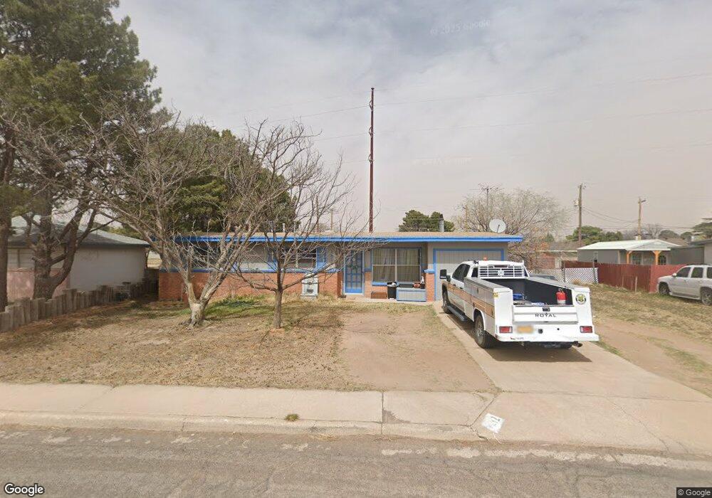
This home is located at 1212 W Coal Ave, Hobbs, NM 88240 and is currently estimated at $154,341. 1212 W Coal Ave is a home located in Lea County with nearby schools including Stone Elementary School, Houston Middle School, and Hobbs Freshman High School.
Ownership History
Date
Name
Owned For
Owner Type
Purchase Details
Closed on
Mar 13, 2018
Sold by
Snider Pamela Jeanne
Bought by
Snider James Harvay and Snider Pamela Jeanne
Current Estimated Value
Purchase Details
Closed on
Sep 10, 2010
Sold by
Snider Pamela J and Snider James Harvey
Bought by
Snider Pamela J
Home Financials for this Owner
Home Financials are based on the most recent Mortgage that was taken out on this home.
Original Mortgage
$5,250,000
Interest Rate
4.48%
Mortgage Type
FHA
Create a Home Valuation Report for This Property
The Home Valuation Report is an in-depth analysis detailing your home's value as well as a comparison with similar homes in the area
Home Values in the Area
Average Home Value in this Area
Purchase History
| Date | Buyer | Sale Price | Title Company |
|---|---|---|---|
| Snider James Harvay | -- | None Available | |
| Snider Pamela J | -- | -- |
Source: Public Records
Mortgage History
| Date | Status | Borrower | Loan Amount |
|---|---|---|---|
| Previous Owner | Snider Pamela J | $5,250,000 |
Source: Public Records
Tax History Compared to Growth
Tax History
| Year | Tax Paid | Tax Assessment Tax Assessment Total Assessment is a certain percentage of the fair market value that is determined by local assessors to be the total taxable value of land and additions on the property. | Land | Improvement |
|---|---|---|---|---|
| 2024 | $379 | $19,880 | $2,522 | $17,358 |
| 2023 | $369 | $19,301 | $2,449 | $16,852 |
| 2022 | $348 | $19,301 | $2,449 | $16,852 |
| 2021 | $333 | $18,193 | $2,309 | $15,884 |
| 2020 | $313 | $17,663 | $2,242 | $15,421 |
| 2019 | $294 | $17,149 | $2,177 | $14,972 |
| 2018 | $383 | $16,650 | $2,114 | $14,536 |
| 2017 | $391 | $48,495 | $6,156 | $42,339 |
| 2016 | $394 | $47,082 | $5,976 | $41,106 |
| 2015 | $349 | $45,711 | $5,802 | $39,909 |
| 2014 | -- | $44,382 | $5,634 | $38,748 |
Source: Public Records
Map
Nearby Homes
- 3131 N Cibola Ave
- 1306 W Taos St
- 1203 W Caprock St
- 1401 W Caprock St
- 728 W Cielo Dr
- 1107 E La Brea Ave
- 405 W Coal Ave
- 414 W Saint Anne Place
- 5109 W Grey Ghost Rd
- 200 W Navajo Dr
- 1926 N Mobile St
- 921 Nambe St
- 4007 Mescalero Dr
- 3101 N Fowler St
- 3808 N Roth Rd
- 26 N Acoma Dr
- 928 W Mesa Verde Dr
- 1218 W Breeze
- 1115 W Breeze
- 1111 W Breeze
- 1216 W Coal Ave
- 1206 W Coal Ave
- 1222 W Coal Ave
- 1200 W Coal Ave
- 2936 N Northwest Dr
- 1205 W Copper Ave
- 1211 W Coal Ave
- 3014 N Northwest Dr
- 1132 W Coal Ave
- 2930 N Northwest Dr
- 1201 W Copper Ave
- 1209 W Copper Ave
- 1207 W Coal Ave
- 1221 W Copper Ave
- 1300 W Coal Ave
- 1133 W Copper Ave
- 1227 W Copper Ave
- 2924 N Northwest Dr
- 1126 W Coal Ave
- 3028 N Northwest Dr