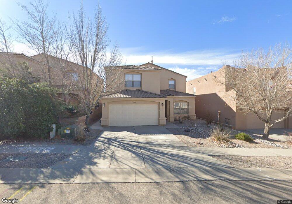
12124 Dan Patch Rd SE Albuquerque, NM 87123
Juan Tabo Hills NeighborhoodEstimated Value: $445,000 - $466,046
4
Beds
4
Baths
2,607
Sq Ft
$174/Sq Ft
Est. Value
About This Home
This home is located at 12124 Dan Patch Rd SE, Albuquerque, NM 87123 and is currently estimated at $454,262, approximately $174 per square foot. 12124 Dan Patch Rd SE is a home located in Bernalillo County with nearby schools including Manzano Mesa Elementary School, Van Buren Middle School, and Highland High School.
Ownership History
Date
Name
Owned For
Owner Type
Purchase Details
Closed on
Nov 26, 2007
Sold by
Lovato Michael D
Bought by
Lovato Michael D and Yamauchi Yuko
Current Estimated Value
Purchase Details
Closed on
Aug 27, 2007
Sold by
Vantage Builders Inc
Bought by
Lovato Michael D
Home Financials for this Owner
Home Financials are based on the most recent Mortgage that was taken out on this home.
Original Mortgage
$236,000
Outstanding Balance
$149,881
Interest Rate
6.72%
Mortgage Type
Purchase Money Mortgage
Estimated Equity
$304,381
Create a Home Valuation Report for This Property
The Home Valuation Report is an in-depth analysis detailing your home's value as well as a comparison with similar homes in the area
Home Values in the Area
Average Home Value in this Area
Purchase History
| Date | Buyer | Sale Price | Title Company |
|---|---|---|---|
| Lovato Michael D | -- | None Available | |
| Lovato Michael D | -- | New Mexico Title Company |
Source: Public Records
Mortgage History
| Date | Status | Borrower | Loan Amount |
|---|---|---|---|
| Open | Lovato Michael D | $236,000 |
Source: Public Records
Tax History
| Year | Tax Paid | Tax Assessment Tax Assessment Total Assessment is a certain percentage of the fair market value that is determined by local assessors to be the total taxable value of land and additions on the property. | Land | Improvement |
|---|---|---|---|---|
| 2025 | $4,408 | $106,332 | $24,342 | $81,990 |
| 2024 | $4,271 | $103,235 | $23,633 | $79,602 |
| 2023 | $4,198 | $100,229 | $22,945 | $77,284 |
| 2022 | $4,054 | $97,309 | $22,276 | $75,033 |
| 2021 | $3,915 | $94,476 | $21,628 | $72,848 |
| 2020 | $3,849 | $91,724 | $20,998 | $70,726 |
| 2019 | $3,788 | $90,331 | $23,633 | $66,698 |
| 2018 | $3,651 | $90,331 | $23,633 | $66,698 |
| 2017 | $3,536 | $87,701 | $22,945 | $64,756 |
| 2016 | $3,432 | $82,667 | $21,628 | $61,039 |
| 2015 | $80,259 | $80,259 | $20,998 | $59,261 |
| 2014 | $3,323 | $80,259 | $20,998 | $59,261 |
| 2013 | -- | $80,259 | $20,998 | $59,261 |
Source: Public Records
Map
Nearby Homes
- 1947 Black Gold St SE
- 1915 Nasrullah St SE
- 1859 Bold Ruler Rd
- 1121 Wagon Wheel St SE
- 2015 Salvator Dr SE
- 2008 Vernon Dr SE
- 11909 Blue Ribbon Rd SE
- 11924 Giacomo Ave SE
- 1000 Cuatro Cerros Trail SE
- 1815 Man o War St SE
- 1037 Santa Ana Ave SE
- 601 Navarra Way SE
- 1739 Man o War St SE
- 1515 Borrego Dr SE
- 1651 Domino Dr SE
- 1805 Sunset St SE
- 720 Lamp Post Cir SE
- 2001 Canyon Wren Ct SE
- 811 Lamp Post Cir SE
- 13140 Nandina Ln SE
- 12128 Dan Patch Rd SE
- 12120 Dan Patch Rd SE
- 12132 Dan Patch Rd SE
- 12116 Dan Patch Rd SE
- 12123 Gallant Fox Rd SE
- 12127 Gallant Fox Rd SE
- 12119 Gallant Fox Rd SE
- 12131 Gallant Fox Rd SE
- 12112 Dan Patch Rd SE
- 12127 Dan Patch Rd SE
- 12115 Gallant Fox Rd SE
- 12131 Dan Patch Rd SE
- 12123 Dan Patch Rd SE
- 12135 Dan Patch Rd SE
- 12119 Dan Patch Rd SE
- 12109 Gallant Fox Rd SE
- 12108 Dan Patch Rd SE
- 12115 Dan Patch Rd SE
- 12105 Gallant Fox Rd SE
- 12104 Dan Patch Rd SE
Your Personal Tour Guide
Ask me questions while you tour the home.