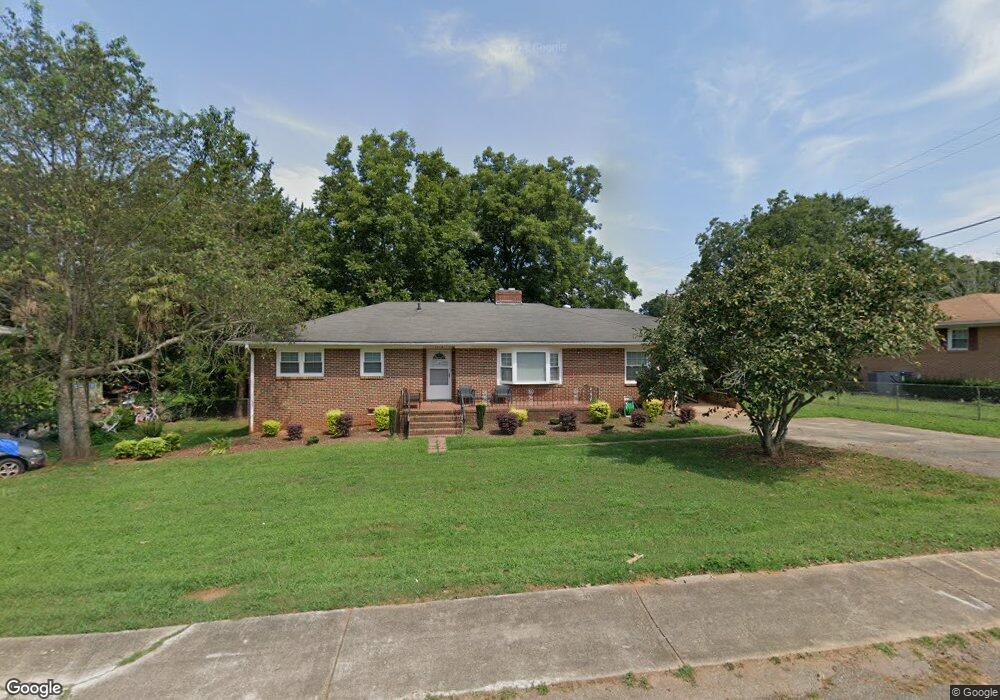
1213 Bolt Dr Anderson, SC 29621
Estimated Value: $183,000 - $202,000
3
Beds
2
Baths
1,759
Sq Ft
$109/Sq Ft
Est. Value
About This Home
This home is located at 1213 Bolt Dr, Anderson, SC 29621 and is currently estimated at $192,075, approximately $109 per square foot. 1213 Bolt Dr is a home located in Anderson County with nearby schools including Nevitt Forest Elementary School, Glenview Middle School, and T.L. Hanna High School.
Ownership History
Date
Name
Owned For
Owner Type
Purchase Details
Closed on
Mar 29, 2011
Sold by
City Of Anderson
Bought by
Butler Tadausa
Current Estimated Value
Home Financials for this Owner
Home Financials are based on the most recent Mortgage that was taken out on this home.
Original Mortgage
$67,900
Outstanding Balance
$26,075
Interest Rate
4.95%
Mortgage Type
Seller Take Back
Estimated Equity
$166,000
Purchase Details
Closed on
Oct 19, 2009
Sold by
Goodwyn Gladys E
Bought by
Federal Home Loan Mortgage Corp
Create a Home Valuation Report for This Property
The Home Valuation Report is an in-depth analysis detailing your home's value as well as a comparison with similar homes in the area
Home Values in the Area
Average Home Value in this Area
Purchase History
| Date | Buyer | Sale Price | Title Company |
|---|---|---|---|
| Butler Tadausa | $67,900 | -- | |
| Federal Home Loan Mortgage Corp | $75,643 | -- |
Source: Public Records
Mortgage History
| Date | Status | Borrower | Loan Amount |
|---|---|---|---|
| Open | Butler Tadausa | $67,900 |
Source: Public Records
Tax History Compared to Growth
Tax History
| Year | Tax Paid | Tax Assessment Tax Assessment Total Assessment is a certain percentage of the fair market value that is determined by local assessors to be the total taxable value of land and additions on the property. | Land | Improvement |
|---|---|---|---|---|
| 2024 | $930 | $3,940 | $280 | $3,660 |
| 2023 | $930 | $3,940 | $280 | $3,660 |
| 2022 | $904 | $3,940 | $280 | $3,660 |
| 2021 | $910 | $3,800 | $320 | $3,480 |
| 2020 | $907 | $3,800 | $320 | $3,480 |
| 2019 | $907 | $3,800 | $320 | $3,480 |
| 2018 | $915 | $3,800 | $320 | $3,480 |
| 2017 | -- | $3,800 | $320 | $3,480 |
| 2016 | $903 | $3,710 | $320 | $3,390 |
| 2015 | $912 | $3,710 | $320 | $3,390 |
| 2014 | $908 | $3,710 | $320 | $3,390 |
Source: Public Records
Map
Nearby Homes
- 1015 Fairfield Dr
- East West E West Parkway Hobson Rd
- 1300 Belhaven Rd
- 1006 Plantation Rd
- 2703 Leftwich Ln
- 304 Fleming Dr
- 1408 Forest Ln
- 2510 Fleming Dr
- 2211 E River St
- 00 Broadway Lake Rd
- Palmetto II Plan at Clarke Townes
- Aspen Plan at Clarke Townes
- 107 Lowland Dr
- 105 Lowland Dr
- 103 Lowland Dr
- 209 Islay Way
- 102 Lowland Dr
- 217 Islay Way
- 108 Lowland Dr