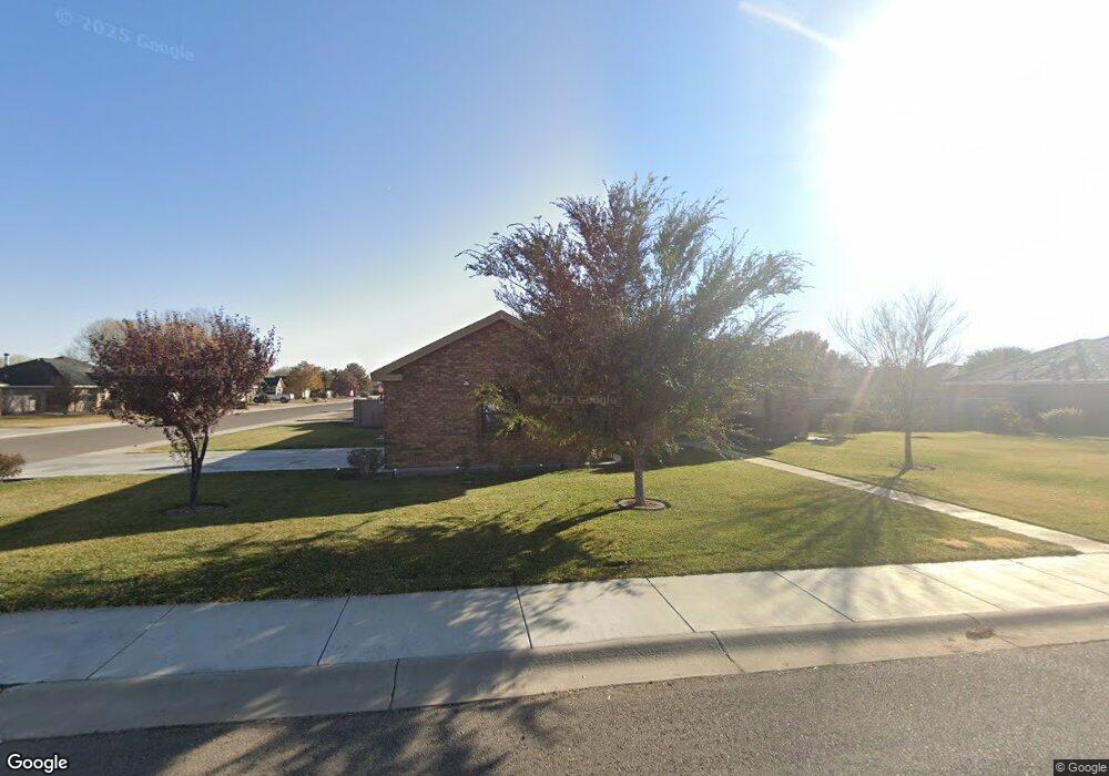
1213 Leslie Ln Roswell, NM 88201
Estimated Value: $368,530 - $411,000
3
Beds
2
Baths
2,310
Sq Ft
$170/Sq Ft
Est. Value
About This Home
This home is located at 1213 Leslie Ln, Roswell, NM 88201 and is currently estimated at $393,633, approximately $170 per square foot. 1213 Leslie Ln is a home with nearby schools including Military Heights Elementary School, Berrendo Middle School, and Goddard High School.
Ownership History
Date
Name
Owned For
Owner Type
Purchase Details
Closed on
Nov 10, 2016
Sold by
Macha Jay
Bought by
Perryman Denise
Current Estimated Value
Purchase Details
Closed on
Jun 1, 2016
Sold by
Hubbard & Sons Inc
Bought by
Macha Jay
Home Financials for this Owner
Home Financials are based on the most recent Mortgage that was taken out on this home.
Original Mortgage
$200,000
Interest Rate
3.59%
Mortgage Type
New Conventional
Purchase Details
Closed on
Aug 17, 2015
Sold by
Dennis William C and Dennis Carol
Bought by
Hubbard & Sons Inc
Create a Home Valuation Report for This Property
The Home Valuation Report is an in-depth analysis detailing your home's value as well as a comparison with similar homes in the area
Home Values in the Area
Average Home Value in this Area
Purchase History
| Date | Buyer | Sale Price | Title Company |
|---|---|---|---|
| Perryman Denise | -- | None Available | |
| Macha Jay | -- | Landmark Title | |
| Hubbard & Sons Inc | -- | Fidelity National Title Of N |
Source: Public Records
Mortgage History
| Date | Status | Borrower | Loan Amount |
|---|---|---|---|
| Previous Owner | Macha Jay | $200,000 | |
| Closed | Hubbard & Sons Inc | $0 |
Source: Public Records
Tax History Compared to Growth
Tax History
| Year | Tax Paid | Tax Assessment Tax Assessment Total Assessment is a certain percentage of the fair market value that is determined by local assessors to be the total taxable value of land and additions on the property. | Land | Improvement |
|---|---|---|---|---|
| 2025 | $2,629 | $101,340 | $10,333 | $91,007 |
| 2024 | $2,629 | $98,388 | $10,333 | $88,055 |
| 2023 | $2,634 | $95,523 | $10,333 | $85,190 |
| 2022 | $2,544 | $93,187 | $10,333 | $82,854 |
| 2021 | $2,523 | $90,473 | $10,333 | $80,140 |
| 2020 | $2,452 | $87,972 | $10,236 | $77,736 |
| 2019 | $2,375 | $85,410 | $9,719 | $75,691 |
| 2018 | $2,232 | $80,492 | $9,333 | $71,159 |
| 2017 | $2,194 | $79,854 | $9,333 | $70,521 |
| 2016 | $308 | $9,333 | $9,333 | $0 |
| 2015 | $172 | $4,833 | $4,833 | $0 |
| 2014 | $344 | $4,833 | $4,833 | $0 |
Source: Public Records
Map
Nearby Homes
- 1201 Saunders Dr
- 1006 de Bremond Dr
- 906 Pearson Dr
- 3207 Dow Dr
- 805 Mason Dr
- 3203 Highland Rd
- 2803 W 8th St
- 3109 Riverside Dr
- 307 N Sycamore Ave
- 00002 N Sycamore Ave
- 00001 N Sycamore Ave
- 708 N Sycamore Ave
- 2607 Riverside Dr
- 205 Pima Dr
- 4608 W 2nd St
- 00 S Balsam Ave
- 7 Oak Dr
- 2116 W 1st St
- 103 Avenue D
- 309 Avenue F
- 1209 Leslie Ln
- 1214 Leslie Ln
- 1208 Le Ann Dr
- 1206 Le Ann Dr
- 3601 Carol Ann Way
- 1210 Leslie Ln
- 3605 Carol Ann Way
- 3513 Carol Ann Way
- 1205 Leslie Ln
- 3609 Carolann Way
- 1204 Le Ann Dr
- 1206 Leslie Ln
- 3613 Carolann Way
- 3511 Carol Ann Way
- 1207 Le Ann Dr
- 1205 Le Ann Dr
- 1201 Leslie Ln
- 1202 Leslie Ln
- 1202 Le Ann Dr
- 3509 Carol Ann Way