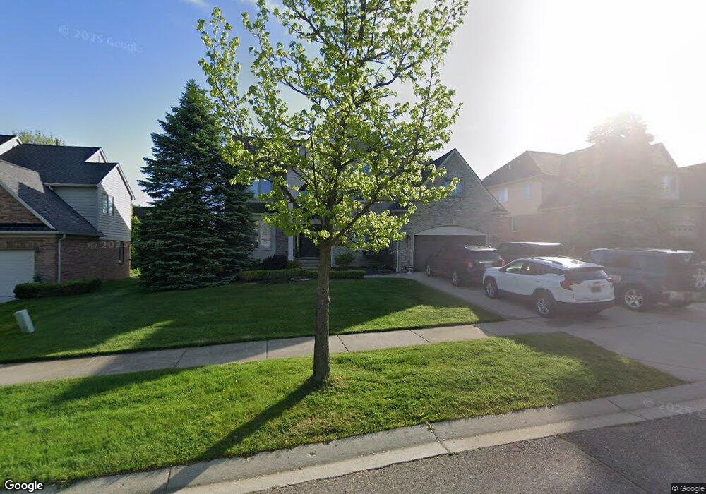
1213 Welland Dr Rochester, MI 48306
Estimated Value: $665,175 - $718,000
4
Beds
3
Baths
2,979
Sq Ft
$233/Sq Ft
Est. Value
About This Home
This home is located at 1213 Welland Dr, Rochester, MI 48306 and is currently estimated at $692,794, approximately $232 per square foot. 1213 Welland Dr is a home located in Oakland County with nearby schools including Hart Middle School, Hugger Elementary School, and Stoney Creek High School.
Ownership History
Date
Name
Owned For
Owner Type
Purchase Details
Closed on
Mar 19, 2021
Sold by
Askar Bassam Gorge and Askar Nagham Moumar
Bought by
Askar Bassam G and Askar Nagham F
Current Estimated Value
Purchase Details
Closed on
Sep 23, 2016
Sold by
Askar Bassam Gorge and Askar Nagham Moumar
Bought by
Askar Bassam Gorge and Askar Nagham Moumar
Home Financials for this Owner
Home Financials are based on the most recent Mortgage that was taken out on this home.
Original Mortgage
$347,000
Outstanding Balance
$277,170
Interest Rate
3.43%
Mortgage Type
New Conventional
Estimated Equity
$415,624
Purchase Details
Closed on
Nov 17, 2000
Sold by
Lochirco Custon Homes In
Bought by
Askar Bassam G
Home Financials for this Owner
Home Financials are based on the most recent Mortgage that was taken out on this home.
Original Mortgage
$277,600
Interest Rate
7.86%
Create a Home Valuation Report for This Property
The Home Valuation Report is an in-depth analysis detailing your home's value as well as a comparison with similar homes in the area
Home Values in the Area
Average Home Value in this Area
Purchase History
| Date | Buyer | Sale Price | Title Company |
|---|---|---|---|
| Askar Bassam G | -- | None Available | |
| Askar Bassam Gorge | -- | Devon Title Agency | |
| Askar Bassam G | $347,000 | -- |
Source: Public Records
Mortgage History
| Date | Status | Borrower | Loan Amount |
|---|---|---|---|
| Open | Askar Bassam Gorge | $347,000 | |
| Closed | Askar Bassam G | $277,600 |
Source: Public Records
Tax History Compared to Growth
Tax History
| Year | Tax Paid | Tax Assessment Tax Assessment Total Assessment is a certain percentage of the fair market value that is determined by local assessors to be the total taxable value of land and additions on the property. | Land | Improvement |
|---|---|---|---|---|
| 2024 | $6,325 | $297,650 | $0 | $0 |
| 2023 | $6,057 | $265,730 | $0 | $0 |
| 2022 | $6,443 | $246,070 | $0 | $0 |
| 2021 | $6,053 | $242,710 | $0 | $0 |
| 2020 | $5,683 | $233,920 | $0 | $0 |
| 2019 | $6,248 | $227,680 | $0 | $0 |
| 2018 | $6,240 | $224,950 | $0 | $0 |
| 2017 | $6,118 | $223,490 | $0 | $0 |
| 2016 | $5,924 | $215,320 | $0 | $0 |
| 2015 | -- | $204,240 | $0 | $0 |
| 2014 | -- | $190,040 | $0 | $0 |
| 2011 | -- | $161,350 | $0 | $0 |
Source: Public Records
Map
Nearby Homes
- 628 Springview Dr Unit 120
- 674 Springview Dr
- 877 Quarry
- 1983 Dunham Dr
- 861 Quarry
- 767 E Bluff Ct Unit 7
- 1322 Copper Cir Unit 26
- 1600 Mill Race
- 1955 Clearwood Ct Unit 665
- 1985 Monarch Dr Unit 7
- 620 Appoline Ct
- 2113 Marissa Way Unit 99
- 6230 Winkler Mill Rd
- 2156 Willow Cir
- 54673 Marissa Way Unit 93
- 1022 Pointe Place Blvd
- 2282 Kingscross Dr
- 2423 Buckthorn Dr
- 1688 Deepwood Cir
- 2583 Barberry Dr