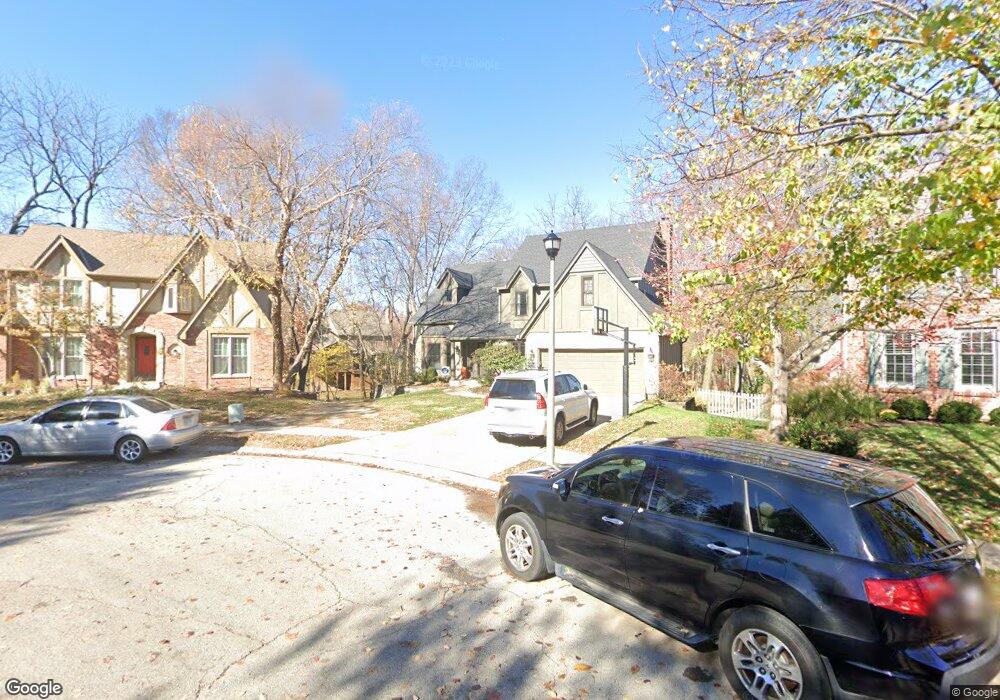
12132 Mastin St Overland Park, KS 66213
Nottingham NeighborhoodEstimated Value: $507,000 - $584,596
4
Beds
3
Baths
2,432
Sq Ft
$224/Sq Ft
Est. Value
About This Home
This home is located at 12132 Mastin St, Overland Park, KS 66213 and is currently estimated at $545,649, approximately $224 per square foot. 12132 Mastin St is a home located in Johnson County with nearby schools including Oak Hill Elementary School, Oxford Middle, and Blue Valley Northwest High School.
Ownership History
Date
Name
Owned For
Owner Type
Purchase Details
Closed on
Aug 17, 2023
Sold by
Mclellan Robin E
Bought by
Mclellan Trust and Mclellan
Current Estimated Value
Purchase Details
Closed on
Dec 13, 2005
Sold by
Haimowitz Joseph H and Kozicki Sharon
Bought by
Mclellan Robin E
Home Financials for this Owner
Home Financials are based on the most recent Mortgage that was taken out on this home.
Original Mortgage
$201,600
Interest Rate
6.3%
Mortgage Type
New Conventional
Create a Home Valuation Report for This Property
The Home Valuation Report is an in-depth analysis detailing your home's value as well as a comparison with similar homes in the area
Home Values in the Area
Average Home Value in this Area
Purchase History
| Date | Buyer | Sale Price | Title Company |
|---|---|---|---|
| Mclellan Trust | -- | None Listed On Document | |
| Mclellan Robin E | -- | Kansas City Title |
Source: Public Records
Mortgage History
| Date | Status | Borrower | Loan Amount |
|---|---|---|---|
| Previous Owner | Mclellan Robin E | $201,600 |
Source: Public Records
Tax History Compared to Growth
Tax History
| Year | Tax Paid | Tax Assessment Tax Assessment Total Assessment is a certain percentage of the fair market value that is determined by local assessors to be the total taxable value of land and additions on the property. | Land | Improvement |
|---|---|---|---|---|
| 2024 | $6,928 | $67,402 | $11,768 | $55,634 |
| 2023 | $5,857 | $56,212 | $11,768 | $44,444 |
| 2022 | $5,525 | $52,084 | $11,768 | $40,316 |
| 2021 | $5,191 | $46,460 | $10,235 | $36,225 |
| 2020 | $5,105 | $45,390 | $8,191 | $37,199 |
| 2019 | $5,053 | $43,977 | $5,854 | $38,123 |
| 2018 | $4,876 | $41,596 | $5,854 | $35,742 |
| 2017 | $4,627 | $38,779 | $5,854 | $32,925 |
| 2016 | $4,506 | $37,732 | $5,854 | $31,878 |
| 2015 | $4,278 | $35,685 | $5,854 | $29,831 |
| 2013 | -- | $31,212 | $5,854 | $25,358 |
Source: Public Records
Map
Nearby Homes
- 12120 Perry St
- 12209 Wedd St
- 11928 Grant St
- 12024 Goddard St
- 12229 Carter St
- 9505 W 122nd St
- 9424 W 122nd St
- 10438 W 125th Terrace
- 12313 England St
- 9417 W 120th St
- 9117 W 125th Terrace
- 12509 King St
- 13416 W 178th St
- 13408 W 178th St
- 12553 Grandview St
- 11920 Grandview St
- 9024 W 121st Terrace
- 11739 Grant St
- 9001 W 121st Terrace
- 8812 W 124th Terrace
- 12128 Mastin St
- 12136 Mastin St
- 12116 Mastin St
- 12112 Mastin St
- 12117 Perry St
- 12113 Perry St
- 12121 Perry St
- 12109 Perry St
- 12124 Mastin St
- 12201 Perry St
- 12140 Mastin St
- 12200 Mastin St
- 12144 Mastin St
- 12108 Mastin St
- 12105 Perry St
- 12205 Perry St
- 12204 Mastin St
- 12104 Mastin St
- 12209 Perry St
- 12109 Mastin St