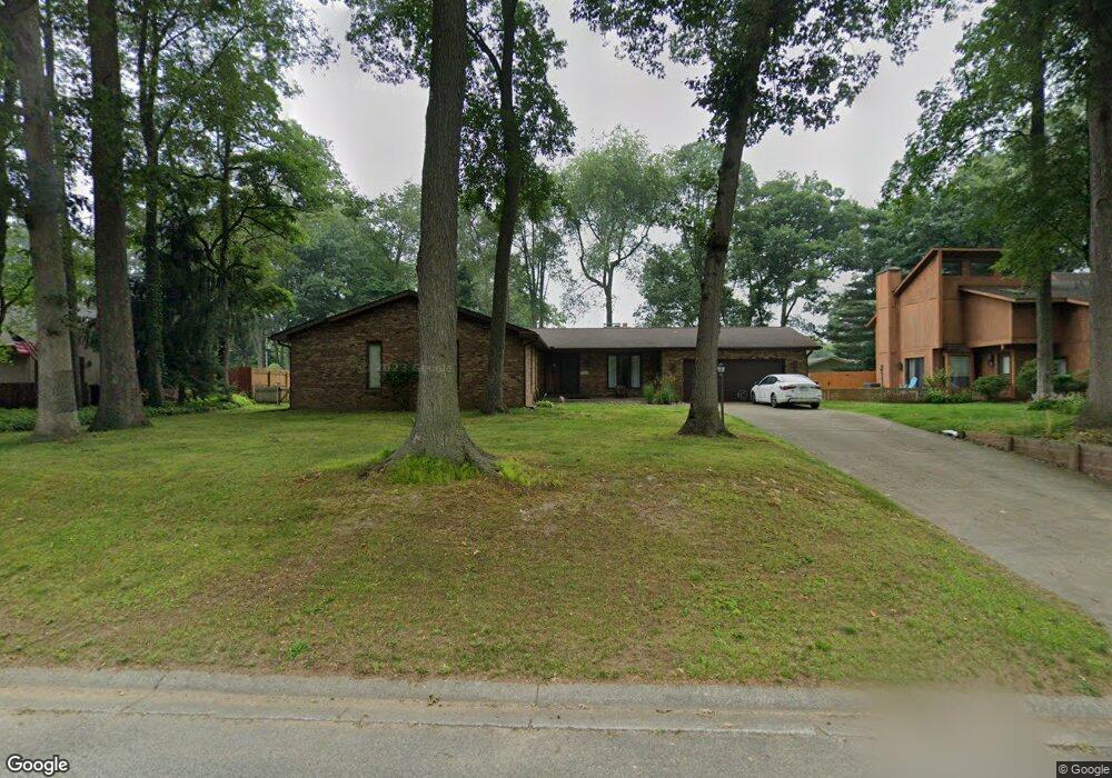
12139 Lupine Ln Granger, IN 46530
Estimated Value: $295,031 - $404,000
3
Beds
2
Baths
1,764
Sq Ft
$186/Sq Ft
Est. Value
About This Home
This home is located at 12139 Lupine Ln, Granger, IN 46530 and is currently estimated at $327,758, approximately $185 per square foot. 12139 Lupine Ln is a home located in St. Joseph County with nearby schools including Horizon Elementary School, Discovery Middle School, and Penn High School.
Ownership History
Date
Name
Owned For
Owner Type
Purchase Details
Closed on
Oct 31, 2006
Sold by
Nijak Kurt
Bought by
Boots Michael and Boots Carrie
Current Estimated Value
Home Financials for this Owner
Home Financials are based on the most recent Mortgage that was taken out on this home.
Original Mortgage
$120,000
Outstanding Balance
$71,657
Interest Rate
6.38%
Mortgage Type
New Conventional
Estimated Equity
$256,101
Create a Home Valuation Report for This Property
The Home Valuation Report is an in-depth analysis detailing your home's value as well as a comparison with similar homes in the area
Home Values in the Area
Average Home Value in this Area
Purchase History
| Date | Buyer | Sale Price | Title Company |
|---|---|---|---|
| Boots Michael | -- | Meridian Title Corp |
Source: Public Records
Mortgage History
| Date | Status | Borrower | Loan Amount |
|---|---|---|---|
| Open | Boots Michael | $120,000 |
Source: Public Records
Tax History Compared to Growth
Tax History
| Year | Tax Paid | Tax Assessment Tax Assessment Total Assessment is a certain percentage of the fair market value that is determined by local assessors to be the total taxable value of land and additions on the property. | Land | Improvement |
|---|---|---|---|---|
| 2024 | $2,192 | $250,900 | $56,900 | $194,000 |
| 2023 | $2,327 | $266,100 | $56,900 | $209,200 |
| 2022 | $2,327 | $260,500 | $56,900 | $203,600 |
| 2021 | $2,056 | $219,100 | $35,600 | $183,500 |
| 2020 | $1,810 | $201,200 | $32,700 | $168,500 |
| 2019 | $1,675 | $189,100 | $30,700 | $158,400 |
| 2018 | $1,578 | $183,300 | $28,800 | $154,500 |
| 2017 | $1,578 | $177,600 | $28,800 | $148,800 |
| 2016 | $1,468 | $167,400 | $18,600 | $148,800 |
| 2014 | $1,173 | $139,600 | $15,700 | $123,900 |
Source: Public Records
Map
Nearby Homes
- 11963 Peacock Cir
- 51891 Covered Wagon Trail
- 52303 Broken Arrow Dr
- 12793 Brick Rd Unit Lot 4
- 11580 Anderson Rd
- 52070 Olympus Pass
- Elements 2390 Plan at The Hills at St. Joe Farm - Elements
- Integrity 2080 Plan at The Hills at St. Joe Farm
- Elements 2700 Plan at The Hills at St. Joe Farm - Elements
- Elements 2070 Plan at The Hills at St. Joe Farm - Elements
- Integrity 1880 Plan at The Hills at St. Joe Farm
- Integrity 2280 Plan at The Hills at St. Joe Farm
- Integrity 1605 Plan at The Hills at St. Joe Farm
- Integrity 1610 Plan at The Hills at St. Joe Farm
- 12983 Brick Rd
- 52335 Gumwood Dr
- 16390 Greystone Dr
- 16370 Greystone Dr
- 16371 Greystone Dr
- 16391 Greystone Dr Unit 2
- 12161 Lupine Ln
- 12121 Lupine Ln
- 12136 Balsam Cir
- 12112 Balsam Cir
- 12099 Lupine Ln
- 52122 Goldenrod Ln
- 12144 Lupine Ln
- 52100 Goldenrod Ln
- 12090 Balsam Cir
- 12150 Balsam Cir
- 12122 Lupine Ln
- 12166 Lupine Ln
- 52088 Goldenrod Ln
- 12098 Lupine Ln
- 12077 Lupine Ln
- 12188 Lupine Ln
- 12133 Balsam Cir
- 12115 Balsam Cir
- 12078 Balsam Cir
- 52066 Goldenrod Ln