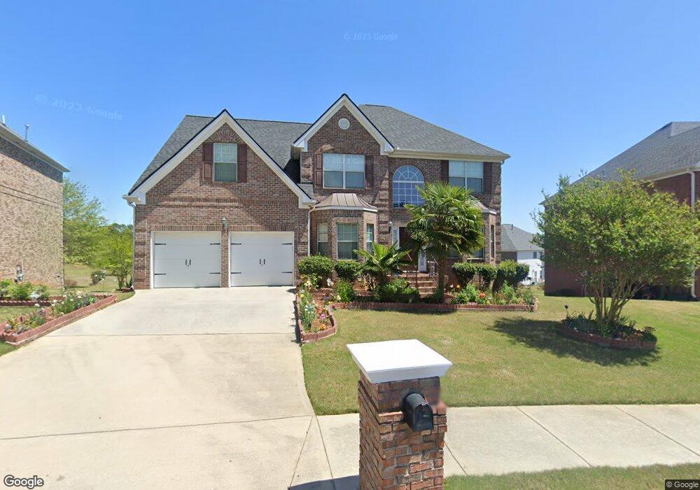
12139 Pheasant Dr Covington, GA 30014
Estimated Value: $388,496 - $550,000
Studio
2
Baths
2,819
Sq Ft
$158/Sq Ft
Est. Value
About This Home
This home is located at 12139 Pheasant Dr, Covington, GA 30014 and is currently estimated at $444,124, approximately $157 per square foot. 12139 Pheasant Dr is a home located in Newton County with nearby schools including Flint Hill Elementary School, Cousins Middle School, and Eastside High School.
Ownership History
Date
Name
Owned For
Owner Type
Purchase Details
Closed on
Mar 17, 2010
Sold by
Adam Strong
Bought by
Gilstrap Gloria J
Current Estimated Value
Purchase Details
Closed on
Apr 18, 2008
Sold by
Barclay Rachael J
Bought by
Barclay Neville K and Barclay Rachael J
Home Financials for this Owner
Home Financials are based on the most recent Mortgage that was taken out on this home.
Original Mortgage
$256,480
Interest Rate
6.08%
Mortgage Type
New Conventional
Create a Home Valuation Report for This Property
The Home Valuation Report is an in-depth analysis detailing your home's value as well as a comparison with similar homes in the area
Home Values in the Area
Average Home Value in this Area
Purchase History
| Date | Buyer | Sale Price | Title Company |
|---|---|---|---|
| Gilstrap Gloria J | -- | -- | |
| Strong Adam | -- | -- | |
| Barclay Neville K | -- | -- | |
| Barclay Rachael J | $270,100 | -- |
Source: Public Records
Mortgage History
| Date | Status | Borrower | Loan Amount |
|---|---|---|---|
| Previous Owner | Barclay Rachael J | $256,480 |
Source: Public Records
Tax History
| Year | Tax Paid | Tax Assessment Tax Assessment Total Assessment is a certain percentage of the fair market value that is determined by local assessors to be the total taxable value of land and additions on the property. | Land | Improvement |
|---|---|---|---|---|
| 2025 | $3,345 | $153,080 | $22,000 | $131,080 |
| 2024 | $3,247 | $144,000 | $22,000 | $122,000 |
| 2023 | $3,332 | $128,360 | $8,800 | $119,560 |
| 2022 | $2,817 | $110,600 | $8,800 | $101,800 |
| 2021 | $2,627 | $96,360 | $8,800 | $87,560 |
| 2020 | $2,753 | $93,600 | $8,800 | $84,800 |
| 2019 | $2,527 | $86,720 | $8,800 | $77,920 |
| 2018 | $2,179 | $77,440 | $6,800 | $70,640 |
| 2017 | $2,233 | $78,760 | $6,800 | $71,960 |
| 2016 | $2,117 | $75,920 | $6,800 | $69,120 |
| 2015 | $1,967 | $69,560 | $6,800 | $62,760 |
| 2014 | $1,967 | $69,560 | $0 | $0 |
Source: Public Records
Map
Nearby Homes
- 12258 Vista Dr
- 11884 Rizvan Place
- 11864 Rizvan Place
- 11872 Rizvan Place
- 11878 Rizvan Place
- 13158 Greywolf Ln
- 13466 Whitman Ln SE
- 13280 Tolstoy Dr SE
- 13622 Whitman Ln SE
- 13268 Tolstoy Dr SE
- 13628 Whitman Ln SE
- 13611 Whitman Ln SE
- 13274 Tolstoy Dr SE
- 13478 Whitman Ln SE
- 13304 Tolstoy Dr SE
- 13605 Whitman Ln SE
- 11138 Suria Dr
- 11098 Suria Dr
- 11124 Suria Dr
- 13472 Whitman Ln
- 12133 Pheasant Dr
- 12147 Pheasant Dr
- 12100 Greywolf Ln
- 12101 Greywolf Ln
- 12106 Greywolf Ln
- 12107 Greywolf Ln
- 12112 Greywolf Ln
- 100 Pheasant Dr
- 12113 Greywolf Ln
- 12118 Grey Wolf Ln
- 12118 Greywolf Ln
- 12118 Greywolf Lot 72 Ln
- 12119 Greywolf Ln
- 12124 Greywolf Ln
- 12125 Greywolf Ln
- 12130 Greywolf Ln
- 12131 Greywolf Ln
- 12137 Grey Wolf Ln
- 12136 Greywolf Ln
- 12137 Greywolf Ln
Your Personal Tour Guide
Ask me questions while you tour the home.