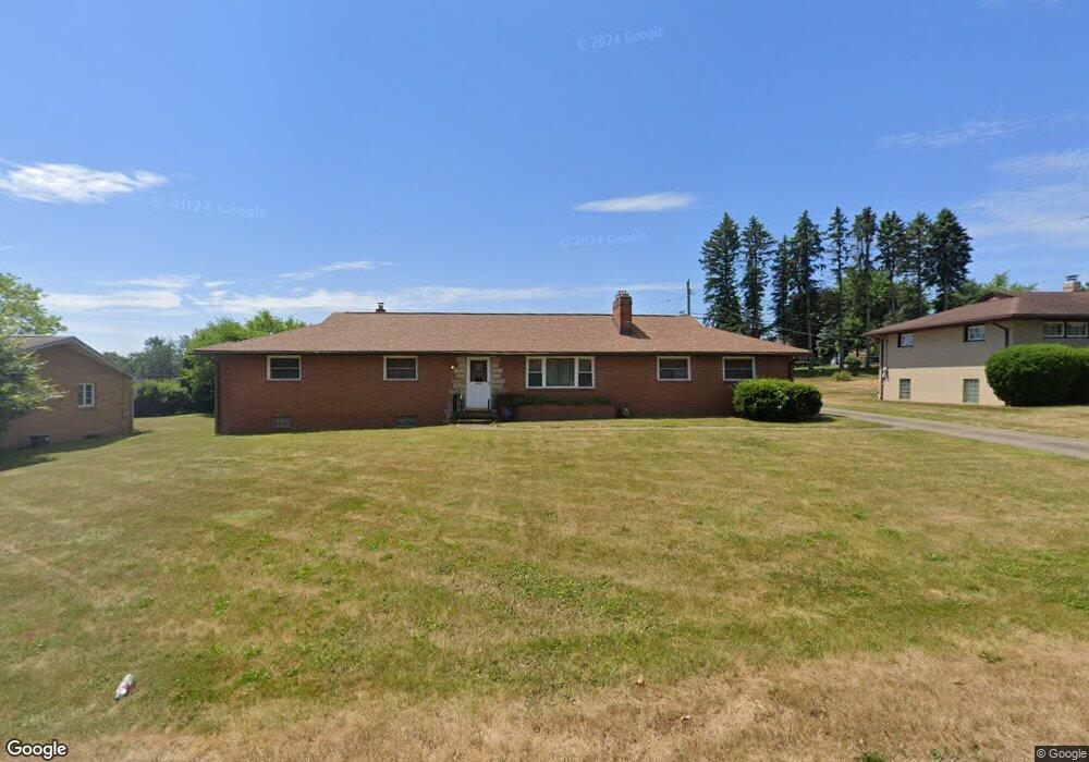
1214 32nd St NE Canton, OH 44714
Plain Township NeighborhoodEstimated Value: $202,179 - $244,000
3
Beds
3
Baths
1,537
Sq Ft
$145/Sq Ft
Est. Value
About This Home
This home is located at 1214 32nd St NE, Canton, OH 44714 and is currently estimated at $223,295, approximately $145 per square foot. 1214 32nd St NE is a home located in Stark County with nearby schools including Frazer Elementary School, Glenwood Intermediate School, and GlenOak High School.
Ownership History
Date
Name
Owned For
Owner Type
Purchase Details
Closed on
Jun 28, 2007
Sold by
Mostov Donald B and Mostov Linda R
Bought by
Ramsey Douglas L and Ramsey Andrea B
Current Estimated Value
Home Financials for this Owner
Home Financials are based on the most recent Mortgage that was taken out on this home.
Original Mortgage
$137,837
Outstanding Balance
$85,067
Interest Rate
6.26%
Mortgage Type
FHA
Estimated Equity
$138,228
Purchase Details
Closed on
Jan 31, 1995
Sold by
Gotshall Ronald A
Bought by
Mostov Donald B and Mostov Linda
Home Financials for this Owner
Home Financials are based on the most recent Mortgage that was taken out on this home.
Original Mortgage
$57,900
Interest Rate
7.75%
Mortgage Type
New Conventional
Purchase Details
Closed on
Jul 15, 1992
Create a Home Valuation Report for This Property
The Home Valuation Report is an in-depth analysis detailing your home's value as well as a comparison with similar homes in the area
Home Values in the Area
Average Home Value in this Area
Purchase History
| Date | Buyer | Sale Price | Title Company |
|---|---|---|---|
| Ramsey Douglas L | $140,000 | Attorney | |
| Mostov Donald B | $87,900 | -- | |
| -- | -- | -- |
Source: Public Records
Mortgage History
| Date | Status | Borrower | Loan Amount |
|---|---|---|---|
| Open | Ramsey Douglas L | $137,837 | |
| Closed | Mostov Donald B | $57,900 |
Source: Public Records
Tax History Compared to Growth
Tax History
| Year | Tax Paid | Tax Assessment Tax Assessment Total Assessment is a certain percentage of the fair market value that is determined by local assessors to be the total taxable value of land and additions on the property. | Land | Improvement |
|---|---|---|---|---|
| 2025 | -- | $59,290 | $20,440 | $38,850 |
| 2024 | -- | $59,290 | $20,440 | $38,850 |
| 2023 | $2,238 | $48,020 | $13,580 | $34,440 |
| 2022 | $1,124 | $48,020 | $13,580 | $34,440 |
| 2021 | $2,259 | $48,020 | $13,580 | $34,440 |
| 2020 | $1,671 | $41,060 | $11,690 | $29,370 |
| 2019 | $1,657 | $41,060 | $11,690 | $29,370 |
| 2018 | $1,637 | $41,060 | $11,690 | $29,370 |
| 2017 | $1,401 | $34,130 | $12,010 | $22,120 |
| 2016 | $1,405 | $34,130 | $12,010 | $22,120 |
| 2015 | $1,358 | $34,130 | $12,010 | $22,120 |
| 2014 | $1,422 | $34,760 | $12,220 | $22,540 |
| 2013 | $927 | $34,760 | $12,220 | $22,540 |
Source: Public Records
Map
Nearby Homes
- 3321 Martindale Rd NE
- 1306 Milford St NE
- 1428 35th St NE
- 1000 Milford St NE
- 1601 33rd St NE
- 3619 Rowland Ave NE
- 0 St Elmo Ave NE Unit 5159780
- 0 St Elmo Ave NE Unit 5089961
- 1644 33rd St NE
- 1117 28th St NE
- 142 36th St NE
- 1115 Colonial Blvd NE
- 123 28th St NE
- 1417 Colonial Blvd NE
- 233 31st St NW
- 1638 Warrick Place NE
- 3122 Logan Ave NW
- 1610 Colonial Blvd NE
- 312 32nd St NW
- 4015 Pelham St NE Unit 3A
- 1204 32nd St NE
- 1224 32nd St NE
- 1215 31st St NE
- 1205 31st St NE
- 1215 32nd St NE
- 1128 32nd St NE
- 1205 32nd St NE
- 1225 32nd St NE
- 3120 Rowland Ave NE
- 1129 32nd St NE
- 3106 Rowland Ave NE
- 1120 32nd St NE
- 1121 31st St NE
- 1305 32nd St NE
- 1214 33rd St NE
- 1214 31st St NE
- 1220 31st St NE
- 1224 31st St NE
- 1208 31st St NE
- 1224 33rd St NE