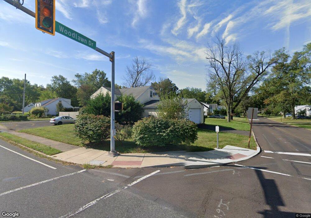
1214 Allentown Rd Lansdale, PA 19446
Estimated Value: $437,000 - $475,977
4
Beds
2
Baths
1,640
Sq Ft
$283/Sq Ft
Est. Value
About This Home
This home is located at 1214 Allentown Rd, Lansdale, PA 19446 and is currently estimated at $463,494, approximately $282 per square foot. 1214 Allentown Rd is a home located in Montgomery County with nearby schools including Inglewood Elementary School, Penndale Middle School, and North Penn Senior High School.
Ownership History
Date
Name
Owned For
Owner Type
Purchase Details
Closed on
May 15, 2006
Sold by
Orloski Daniel and Orloski Michele E
Bought by
Toussaint Carmelo and Toussaint Cherline
Current Estimated Value
Home Financials for this Owner
Home Financials are based on the most recent Mortgage that was taken out on this home.
Original Mortgage
$278,500
Outstanding Balance
$162,675
Interest Rate
6.55%
Estimated Equity
$300,819
Purchase Details
Closed on
Sep 29, 2004
Sold by
Not Provided
Bought by
Orloski Daniel and Orloski Michele E
Home Financials for this Owner
Home Financials are based on the most recent Mortgage that was taken out on this home.
Original Mortgage
$0
Interest Rate
5.81%
Purchase Details
Closed on
Sep 30, 1996
Sold by
Cameron Dorinda J and Owens Thomas J
Bought by
Kesslick Gabriel James and Kesslick Jody A
Create a Home Valuation Report for This Property
The Home Valuation Report is an in-depth analysis detailing your home's value as well as a comparison with similar homes in the area
Home Values in the Area
Average Home Value in this Area
Purchase History
| Date | Buyer | Sale Price | Title Company |
|---|---|---|---|
| Toussaint Carmelo | $295,000 | None Available | |
| Orloski Daniel | -- | -- | |
| Kesslick Gabriel James | $125,000 | -- |
Source: Public Records
Mortgage History
| Date | Status | Borrower | Loan Amount |
|---|---|---|---|
| Open | Toussaint Carmelo | $278,500 | |
| Previous Owner | Orloski Daniel | $0 | |
| Closed | Orloski Daniel | $0 |
Source: Public Records
Tax History Compared to Growth
Tax History
| Year | Tax Paid | Tax Assessment Tax Assessment Total Assessment is a certain percentage of the fair market value that is determined by local assessors to be the total taxable value of land and additions on the property. | Land | Improvement |
|---|---|---|---|---|
| 2025 | $5,259 | $129,810 | -- | -- |
| 2024 | $5,259 | $129,810 | -- | -- |
| 2023 | $5,036 | $129,810 | $0 | $0 |
| 2022 | $4,726 | $129,810 | $0 | $0 |
| 2021 | $4,745 | $134,210 | $49,980 | $84,230 |
| 2020 | $4,530 | $134,210 | $49,980 | $84,230 |
| 2019 | $4,451 | $134,210 | $49,980 | $84,230 |
| 2018 | $856 | $134,210 | $49,980 | $84,230 |
| 2017 | $4,274 | $134,210 | $49,980 | $84,230 |
| 2016 | $4,221 | $134,210 | $49,980 | $84,230 |
| 2015 | $4,045 | $134,210 | $49,980 | $84,230 |
| 2014 | $4,045 | $134,210 | $49,980 | $84,230 |
Source: Public Records
Map
Nearby Homes
- 340 Central Dr
- 545 Winding Rd
- 633 Conestoga Ln
- 1113 York Ave
- 515 Winding Rd
- 1131 Walnut Ln
- 1109 Walnut Ln Unit 59
- 920 Columbia Ave
- 750 Annes Ct
- 21 S Valley Forge Rd Unit 213
- 1035 Forest Ave
- 723 Columbia Ave
- 712 Derstine Ave
- 507 Delaware Ave
- 1222 Woodside Ave
- 39 N Mitchell Ave
- 1107 Jarvis Ln
- 521 Columbia Ave
- 1486 W Main St
- 1512 Tennis Cir
- 577 Woodlawn Dr
- 1210 Allentown Rd
- 264 Woodlawn Dr
- 581 Woodlawn Dr
- 572 Woodlawn Dr
- 704 Abbey Ln
- 700 Abbey Ln
- 578 Woodlawn Dr
- 260 Woodlawn Dr
- 724 Abbey Ln
- 582 Woodlawn Dr
- 1301 Allentown Rd
- 1207 Allentown Rd
- 586 Woodlawn Dr
- 256 Woodlawn Dr
- 261 Woodlawn Dr
- 1203 Allentown Rd
- 1305 Allentown Rd
- 590 Woodlawn Dr
- 701 Abbey Ln