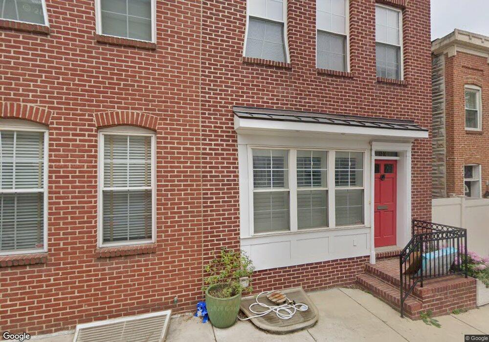
1214 Cooksie St Baltimore, MD 21230
Locust Point NeighborhoodEstimated Value: $341,569 - $391,000
3
Beds
3
Baths
1,404
Sq Ft
$261/Sq Ft
Est. Value
About This Home
This home is located at 1214 Cooksie St, Baltimore, MD 21230 and is currently estimated at $366,285, approximately $260 per square foot. 1214 Cooksie St is a home located in Baltimore City with nearby schools including Francis Scott Key Elementary/Middle School, Booker T. Washington Middle School, and Digital Harbor High School.
Ownership History
Date
Name
Owned For
Owner Type
Purchase Details
Closed on
May 22, 2006
Sold by
G Royal Homes Llc
Bought by
Hopkins Leslie and Hopkins Felicia
Current Estimated Value
Purchase Details
Closed on
Mar 11, 2005
Sold by
Peregoff Alex and Peregoff Ra L
Bought by
G Royal Homes Llc
Purchase Details
Closed on
Oct 31, 1997
Sold by
White Joseph
Bought by
Peregoff Alexandra L
Create a Home Valuation Report for This Property
The Home Valuation Report is an in-depth analysis detailing your home's value as well as a comparison with similar homes in the area
Home Values in the Area
Average Home Value in this Area
Purchase History
| Date | Buyer | Sale Price | Title Company |
|---|---|---|---|
| Hopkins Leslie | $262,500 | -- | |
| Christopulous Christopher | $262,500 | -- | |
| G Royal Homes Llc | $138,000 | -- | |
| Peregoff Alexandra L | $45,000 | -- |
Source: Public Records
Tax History
| Year | Tax Paid | Tax Assessment Tax Assessment Total Assessment is a certain percentage of the fair market value that is determined by local assessors to be the total taxable value of land and additions on the property. | Land | Improvement |
|---|---|---|---|---|
| 2025 | $4,224 | $239,133 | -- | -- |
| 2024 | $4,224 | $227,967 | -- | -- |
| 2023 | $4,118 | $216,800 | $80,000 | $136,800 |
| 2022 | $3,943 | $200,700 | $0 | $0 |
| 2021 | $4,357 | $184,600 | $0 | $0 |
| 2020 | $3,726 | $168,500 | $80,000 | $88,500 |
| 2019 | $3,700 | $168,167 | $0 | $0 |
| 2018 | $3,740 | $167,833 | $0 | $0 |
| 2017 | $3,762 | $167,500 | $0 | $0 |
| 2016 | $4,157 | $166,867 | $0 | $0 |
| 2015 | $4,157 | $166,233 | $0 | $0 |
| 2014 | $4,157 | $165,600 | $0 | $0 |
Source: Public Records
Map
Nearby Homes
- 1212 Towson St
- 1143 Hull St
- 1358 Towson St
- 1327 Richardson St
- 1337 Richardson St
- 1312 Haubert St
- 1314 Haubert St
- 1324 Haubert St
- 1200 Steuart St Unit 713
- 1200 Steuart St Unit 425
- 1200 Steuart St Unit 312
- 1200 Steuart St Unit 1913
- 1200 Steuart St
- 1413 Cooksie St
- 1425 E Clement St
- 1419 Andre St
- 1436 Andre St
- 1446 Andre St
- 1432 Haubert St
- 1500 Latrobe Park Terrace
- 1212 Cooksie St
- 1216 Cooksie St
- 1210 Cooksie St
- 1218 Cooksie St
- 1208 Cooksie St
- 1206 Cooksie St
- 1220 Cooksie St
- 1204 Cooksie St
- 1202 Cooksie St
- 1222 Cooksie St
- 1222 Cooksie St
- 1200 Cooksie St
- 1213 Hull St
- 1221 Cooksie St
- 1211 Hull St
- 1222 .5 Cooksie St
- 1209 Hull St
- 1217 Hull St
- 1223 Cooksie St
- 1207 Hull St
Your Personal Tour Guide
Ask me questions while you tour the home.