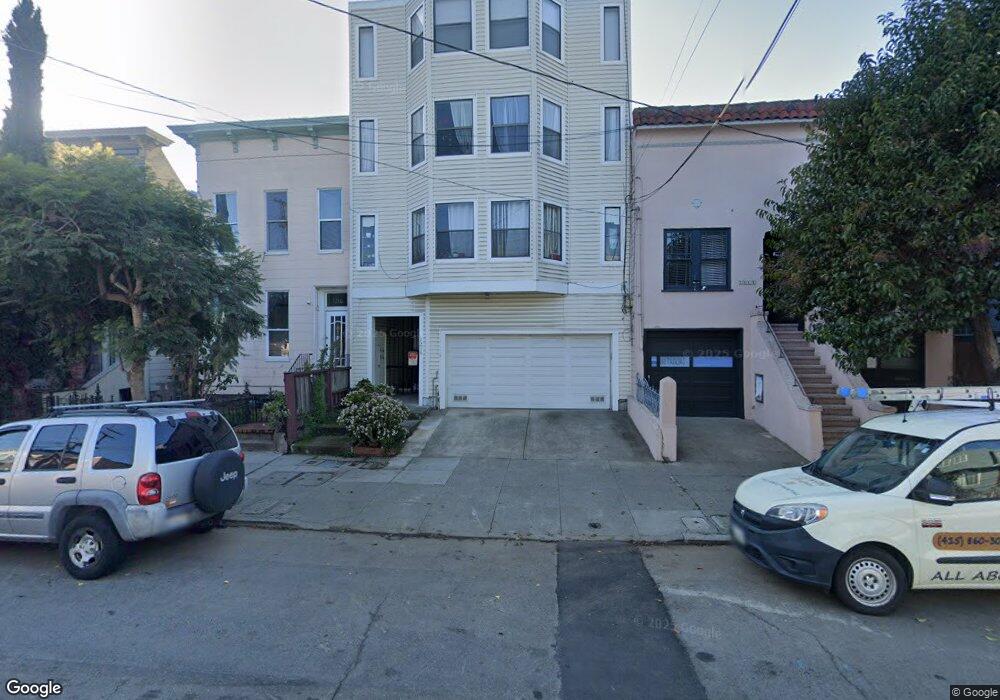
1214 Hampshire St Unit B San Francisco, CA 94110
Inner Mission NeighborhoodEstimated Value: $896,236 - $1,244,000
3
Beds
2
Baths
1,065
Sq Ft
$940/Sq Ft
Est. Value
About This Home
This home is located at 1214 Hampshire St Unit B, San Francisco, CA 94110 and is currently estimated at $1,001,309, approximately $940 per square foot. 1214 Hampshire St Unit B is a home located in San Francisco County with nearby schools including Bryant Elementary, Everett Middle School, and Mission Preparatory.
Ownership History
Date
Name
Owned For
Owner Type
Purchase Details
Closed on
Jul 15, 2022
Sold by
Teague Maass Adam
Bought by
Maass Nolan Family Living Trust
Current Estimated Value
Purchase Details
Closed on
Nov 7, 2001
Sold by
Stetland Harold and Stotland Nada L
Bought by
Maass Adam Teague
Home Financials for this Owner
Home Financials are based on the most recent Mortgage that was taken out on this home.
Original Mortgage
$308,000
Interest Rate
6.37%
Purchase Details
Closed on
Jul 23, 1999
Sold by
Klein Mary A and Klein Brett Mary
Bought by
Stotland Harold and Stotland Nada L
Home Financials for this Owner
Home Financials are based on the most recent Mortgage that was taken out on this home.
Original Mortgage
$210,000
Interest Rate
7.64%
Create a Home Valuation Report for This Property
The Home Valuation Report is an in-depth analysis detailing your home's value as well as a comparison with similar homes in the area
Home Values in the Area
Average Home Value in this Area
Purchase History
| Date | Buyer | Sale Price | Title Company |
|---|---|---|---|
| Maass Nolan Family Living Trust | -- | None Listed On Document | |
| Maass Adam Teague | $385,000 | First American Title Co | |
| Stotland Harold | $275,000 | First American Title Co |
Source: Public Records
Mortgage History
| Date | Status | Borrower | Loan Amount |
|---|---|---|---|
| Previous Owner | Maass Adam Teague | $308,000 | |
| Previous Owner | Stotland Harold | $210,000 | |
| Closed | Maass Adam Teague | $57,700 |
Source: Public Records
Tax History Compared to Growth
Tax History
| Year | Tax Paid | Tax Assessment Tax Assessment Total Assessment is a certain percentage of the fair market value that is determined by local assessors to be the total taxable value of land and additions on the property. | Land | Improvement |
|---|---|---|---|---|
| 2025 | $7,410 | $568,738 | $284,369 | $284,369 |
| 2024 | $7,410 | $557,588 | $278,794 | $278,794 |
| 2023 | $7,246 | $546,656 | $273,328 | $273,328 |
| 2022 | $7,081 | $535,938 | $267,969 | $267,969 |
| 2021 | $6,953 | $525,430 | $262,715 | $262,715 |
| 2020 | $6,997 | $520,044 | $260,022 | $260,022 |
| 2019 | $6,763 | $509,848 | $254,924 | $254,924 |
| 2018 | $6,539 | $499,852 | $249,926 | $249,926 |
| 2017 | $6,163 | $490,052 | $245,026 | $245,026 |
| 2016 | $6,044 | $480,444 | $240,222 | $240,222 |
| 2015 | $5,968 | $473,228 | $236,614 | $236,614 |
| 2014 | $5,813 | $463,960 | $231,980 | $231,980 |
Source: Public Records
Map
Nearby Homes
- 1222 York St Unit C
- 1222 York St Unit A
- 1258 York St
- 2920 25th St
- 2926 25th St
- 2922 25th St
- 2829 25th St Unit 3
- 2893 24th St
- 1102 York St
- 1339-1341 York St
- 2603 23rd St
- 1206-1208 Utah St
- 2758-2760 23rd St
- 2758 23rd St
- 2816 23rd St
- 1212 Alabama St
- 1310 Alabama St
- 3000-3006 26th St
- 3000 26th St
- 3002 26th St
- 1214 Hampshire St Unit C
- 1214 Hampshire St Unit A
- 1216 Hampshire St
- 1212 Hampshire St
- 1218 Hampshire St
- 1210 Hampshire St
- 1208 Hampshire St
- 1242 Hampshire St
- 1244 Hampshire St
- 1215A York St Unit 1215A
- 1215 York St
- 1217 York St
- 1219 York St
- 1209 York St
- 1221 York St
- 1264 Hampshire St Unit 1264
- 1262 Hampshire St
- 1260 Hampshire St Unit 1260
- 1223 York St
- 1225 York St