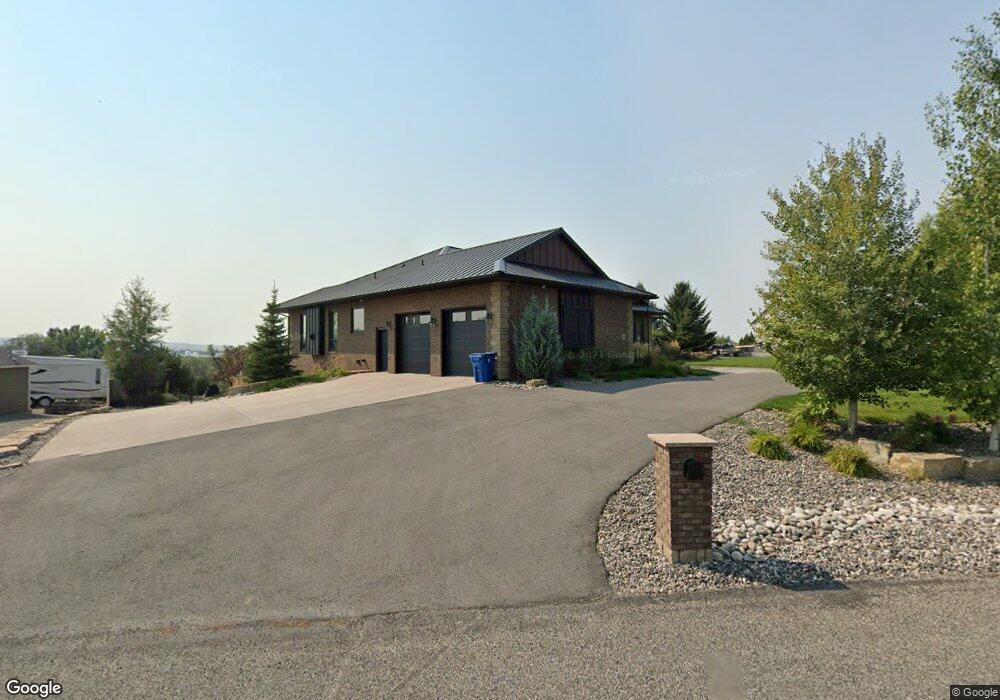
1214 Longview Rd Laurel, MT 59044
Estimated Value: $874,000 - $1,320,000
5
Beds
5
Baths
5,866
Sq Ft
$197/Sq Ft
Est. Value
About This Home
This home is located at 1214 Longview Rd, Laurel, MT 59044 and is currently estimated at $1,157,834, approximately $197 per square foot. 1214 Longview Rd is a home located in Yellowstone County with nearby schools including Fred W. Graff School, West School, and Laurel Middle School.
Ownership History
Date
Name
Owned For
Owner Type
Purchase Details
Closed on
Jun 29, 2021
Sold by
Kennedy Daniel L
Bought by
Sasankan Shenthol and Minner Sam
Current Estimated Value
Home Financials for this Owner
Home Financials are based on the most recent Mortgage that was taken out on this home.
Original Mortgage
$990,000
Outstanding Balance
$898,271
Interest Rate
2.9%
Mortgage Type
New Conventional
Estimated Equity
$259,563
Purchase Details
Closed on
Oct 21, 2014
Sold by
Lynch Teresa
Bought by
Kennedy Daniel L
Purchase Details
Closed on
May 2, 2012
Sold by
Lied Stephen Peter and Lied Karen Ruth
Bought by
Lynch Teresa
Create a Home Valuation Report for This Property
The Home Valuation Report is an in-depth analysis detailing your home's value as well as a comparison with similar homes in the area
Home Values in the Area
Average Home Value in this Area
Purchase History
| Date | Buyer | Sale Price | Title Company |
|---|---|---|---|
| Sasankan Shenthol | -- | First Montana Title Co | |
| Kennedy Daniel L | -- | Stewart Title | |
| Lynch Teresa | -- | Chicago Title |
Source: Public Records
Mortgage History
| Date | Status | Borrower | Loan Amount |
|---|---|---|---|
| Open | Sasankan Shenthol | $990,000 |
Source: Public Records
Tax History
| Year | Tax Paid | Tax Assessment Tax Assessment Total Assessment is a certain percentage of the fair market value that is determined by local assessors to be the total taxable value of land and additions on the property. | Land | Improvement |
|---|---|---|---|---|
| 2025 | $5,818 | $1,051,600 | $111,890 | $939,710 |
| 2024 | $5,818 | $853,300 | $85,499 | $767,801 |
| 2023 | $5,816 | $853,300 | $85,499 | $767,801 |
| 2022 | $5,456 | $785,300 | $0 | $0 |
| 2021 | $5,384 | $777,100 | $0 | $0 |
| 2020 | $5,787 | $813,200 | $0 | $0 |
| 2019 | $5,567 | $813,200 | $0 | $0 |
| 2018 | $6,021 | $760,300 | $0 | $0 |
| 2017 | $5,462 | $760,300 | $0 | $0 |
| 2016 | $736 | $71,990 | $0 | $0 |
| 2015 | $728 | $71,990 | $0 | $0 |
| 2014 | $695 | $36,106 | $0 | $0 |
Source: Public Records
Map
Nearby Homes
- 1031 Fir Ave
- 1108 E 8th St
- 1104 E 8th St
- 605 Date Ave
- 809 Pennsylvania Ave
- 717 E 5th, 506 Alder Ave
- 717 E 5th St
- 801 E 4th St
- 516 Pennsylvania Ave
- 414 Wyoming Ave
- 1665 Wild Lupine Ln
- 1319 Valley Dr
- 110 E 5th St
- 1321 E Railroad St
- 1631 Valley Dr
- 310 1st Ave
- 603 5th Ave
- 1216 W 12th Street Cir
- 1254 W Beartooth Dr
- 319 6th Ave
- 1224 Longview Rd
- 1225 Longview Rd
- 1200 Longview Rd
- 1232 Longview Rd
- 1239 Longview Rd
- 1150 Longview Rd
- 1207 Hillbrooke Ave
- 1205 Longview Rd
- 1215 Longview Rd
- 1123 Longview Rd
- 1112 Longview Rd
- 1131 Ridge Dr
- 1201 Ridge Dr
- 1310 Hill Crest Ave
- 1333 Hill Crest Ave
- 1190 Hillbrooke Ave
- 1337 Hill Crest Ave
- 1331 Ridge Dr
- 1202 Ridge Dr
- 1119 Longview Rd
Your Personal Tour Guide
Ask me questions while you tour the home.