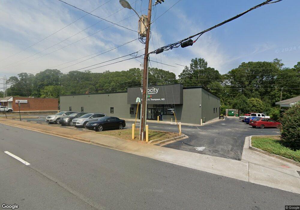
1214 N Fant St Anderson, SC 29621
Estimated Value: $1,554,649
--
Bed
--
Bath
8,671
Sq Ft
$179/Sq Ft
Est. Value
About This Home
This home is located at 1214 N Fant St, Anderson, SC 29621 and is currently estimated at $1,554,649, approximately $179 per square foot. 1214 N Fant St is a home located in Anderson County with nearby schools including Concord Elementary School, McCants Middle School, and T.L. Hanna High School.
Ownership History
Date
Name
Owned For
Owner Type
Purchase Details
Closed on
Oct 11, 2023
Sold by
Anderson Research Owners Group Llc
Bought by
Upstate Med Properties Llc
Current Estimated Value
Home Financials for this Owner
Home Financials are based on the most recent Mortgage that was taken out on this home.
Original Mortgage
$2,300,000
Outstanding Balance
$888,050
Interest Rate
7.18%
Mortgage Type
Construction
Estimated Equity
$666,599
Purchase Details
Closed on
Apr 5, 2021
Sold by
Khk Anderson Llc
Bought by
Anderson Research Owners Group Llc
Home Financials for this Owner
Home Financials are based on the most recent Mortgage that was taken out on this home.
Original Mortgage
$910,630
Interest Rate
3%
Mortgage Type
Construction
Purchase Details
Closed on
Jan 30, 2009
Sold by
Khk Inc
Bought by
Khk Anderson Llc
Create a Home Valuation Report for This Property
The Home Valuation Report is an in-depth analysis detailing your home's value as well as a comparison with similar homes in the area
Home Values in the Area
Average Home Value in this Area
Purchase History
| Date | Buyer | Sale Price | Title Company |
|---|---|---|---|
| Upstate Med Properties Llc | -- | None Listed On Document | |
| Anderson Research Owners Group Llc | $450,000 | None Available | |
| Khk Anderson Llc | -- | -- |
Source: Public Records
Mortgage History
| Date | Status | Borrower | Loan Amount |
|---|---|---|---|
| Open | Upstate Med Properties Llc | $2,300,000 | |
| Previous Owner | Anderson Research Owners Group Llc | $910,630 |
Source: Public Records
Tax History Compared to Growth
Tax History
| Year | Tax Paid | Tax Assessment Tax Assessment Total Assessment is a certain percentage of the fair market value that is determined by local assessors to be the total taxable value of land and additions on the property. | Land | Improvement |
|---|---|---|---|---|
| 2024 | $11,360 | $89,990 | $7,550 | $82,440 |
| 2023 | $11,360 | $27,170 | $7,550 | $19,620 |
| 2022 | $11,170 | $27,170 | $7,550 | $19,620 |
| 2021 | $12,643 | $29,300 | $6,930 | $22,370 |
| 2020 | $12,526 | $29,300 | $6,930 | $22,370 |
| 2019 | $12,526 | $29,300 | $6,930 | $22,370 |
| 2018 | $14,787 | $34,950 | $6,930 | $28,020 |
| 2017 | -- | $34,950 | $6,930 | $28,020 |
| 2016 | $14,076 | $33,610 | $6,930 | $26,680 |
| 2015 | $14,183 | $47,490 | $9,240 | $38,250 |
| 2014 | $18,174 | $47,490 | $9,240 | $38,250 |
Source: Public Records
Map
Nearby Homes
- 211 Cater St
- 705 E Mauldin St
- 0 High Shoals Rd
- 208 Cater St
- 401 Berkshire Hill
- 707 Windsor Dr
- 1102 Greenacres
- 406 Moultrie Square
- 1106 Greenacres
- 220 Moultrie Square
- 703 E Calhoun St
- 2010 Boulevard Heights
- 228 Santorini Way
- 2014 College Ave
- 510 Woodland Way
- 1014 Tribble St
- 119 Postelle Dr
- 1008 Tribble St
- 504 Piedmont Ave
- 110 Clinton Dr
- 1401 N Boulevard
- 1321 N Boulevard
- 1221 N Fant St
- 1321 North Blvd
- 1209 N Fant St Unit 1208 Ella Street
- 1205 N Fant St
- 1405 N Boulevard Unit P
- 1405 N Boulevard
- 1206 Ella St
- 1315 N Boulevard Unit P
- 1315 N Boulevard
- 1408 N Fant St
- 308 Broad St
- 1204 Ella St
- 1203 N Fant St Unit Lot 3-B
- 1203 N Fant St
- 1202 Ella St
- 307 Broad St
- 307 Broad St
- 1313 N Boulevard