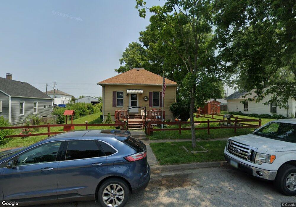
1214 Nebraska St Muscatine, IA 52761
Estimated Value: $93,000 - $104,129
2
Beds
1
Bath
864
Sq Ft
$115/Sq Ft
Est. Value
About This Home
This home is located at 1214 Nebraska St, Muscatine, IA 52761 and is currently estimated at $99,032, approximately $114 per square foot. 1214 Nebraska St is a home located in Muscatine County with nearby schools including Franklin Elementary School, Susan Clark Junior High School, and Muscatine High School.
Ownership History
Date
Name
Owned For
Owner Type
Purchase Details
Closed on
Jun 21, 2005
Sold by
Adams Everett W and Adams Alice M
Bought by
Moore Rocky J and Moore Kathleen D
Current Estimated Value
Home Financials for this Owner
Home Financials are based on the most recent Mortgage that was taken out on this home.
Original Mortgage
$51,000
Outstanding Balance
$26,796
Interest Rate
5.86%
Mortgage Type
Purchase Money Mortgage
Estimated Equity
$72,236
Create a Home Valuation Report for This Property
The Home Valuation Report is an in-depth analysis detailing your home's value as well as a comparison with similar homes in the area
Home Values in the Area
Average Home Value in this Area
Purchase History
| Date | Buyer | Sale Price | Title Company |
|---|---|---|---|
| Moore Rocky J | $59,500 | None Available |
Source: Public Records
Mortgage History
| Date | Status | Borrower | Loan Amount |
|---|---|---|---|
| Open | Moore Rocky J | $51,000 |
Source: Public Records
Tax History Compared to Growth
Tax History
| Year | Tax Paid | Tax Assessment Tax Assessment Total Assessment is a certain percentage of the fair market value that is determined by local assessors to be the total taxable value of land and additions on the property. | Land | Improvement |
|---|---|---|---|---|
| 2025 | $1,258 | $84,850 | $11,100 | $73,750 |
| 2024 | $1,258 | $79,560 | $11,100 | $68,460 |
| 2023 | $1,292 | $79,012 | $11,130 | $67,882 |
| 2022 | $1,114 | $73,130 | $10,500 | $62,630 |
| 2021 | $1,114 | $63,540 | $10,500 | $53,040 |
| 2020 | $1,034 | $58,050 | $9,000 | $49,050 |
| 2019 | $1,028 | $55,040 | $0 | $0 |
| 2018 | $1,004 | $54,810 | $0 | $0 |
| 2017 | $966 | $51,290 | $0 | $0 |
| 2016 | $962 | $51,290 | $0 | $0 |
| 2015 | $962 | $55,120 | $0 | $0 |
| 2014 | $1,056 | $54,940 | $0 | $0 |
Source: Public Records
Map
Nearby Homes
- 1708 Schley Ave
- 1908 Sampson St
- 1909 Wallace St
- 2108 Breese Ave
- 609 Liberty St
- 0 Towhead Island Unit 23-716
- LOTS 30-34 Evans St
- 111 Gilbert St
- 1903 Hershey Ave
- 1827 Hershey Ave
- LOT 5 Pine Ridge
- LOT 4 Pine Ridge
- LOT 6 Pine Ridge
- 900 W 3rd St
- 0 Parcel 1302108019 (Busch St)
- 701 W Mississippi Dr
- 1603 Lucas St
- 0 High Street Parcel
- 613 W 5th St
- 1143 Logan St
- 1208 Nebraska St
- 1216 1/2 Nebraska St
- 1216 Nebraska St
- 1712 Benham Ave
- 1222 Nebraska St
- 1215 Oregon St
- 1211 Oregon St
- 1201 Oregon St
- 1217 Oregon St
- 1203 Nebraska St
- 1211 Oregon St
- 1201 Nebraska St
- 1120 Nebraska St
- 1708 Dewey Ave
- 1205 Nebraska St
- 1807 Dewey Ave
- 1117 Oregon St
- 1119 Nebraska St
- 1114 Nebraska St
- 1301 Oregon St